

🇭🇲 Heard Island and McDonald Islands at a Glance
🌍 Overview
ℹ️ This is not a destination. Heard Island and McDonald Islands has no permanent population, no airstrip, no harbour, no accommodation and no scheduled transport of any kind. Every landing requires a written permit from the Australian Antarctic Division, and in most years nobody lands at all. This page is here because the territory exists, has a real and rather extraordinary history, and is one of the most scientifically valuable places on the planet — not because you can book it.
Heard Island and McDonald Islands — HIMI in Australian officialese — is an external territory of Australia in the southern Indian Ocean, roughly 4,100 km south-west of Perth and about 1,600 km north of the Antarctic continent. It sits at 53° south, in the belt of ocean that sailors have called the Furious Fifties for four hundred years, and the weather there is exactly as advertised.
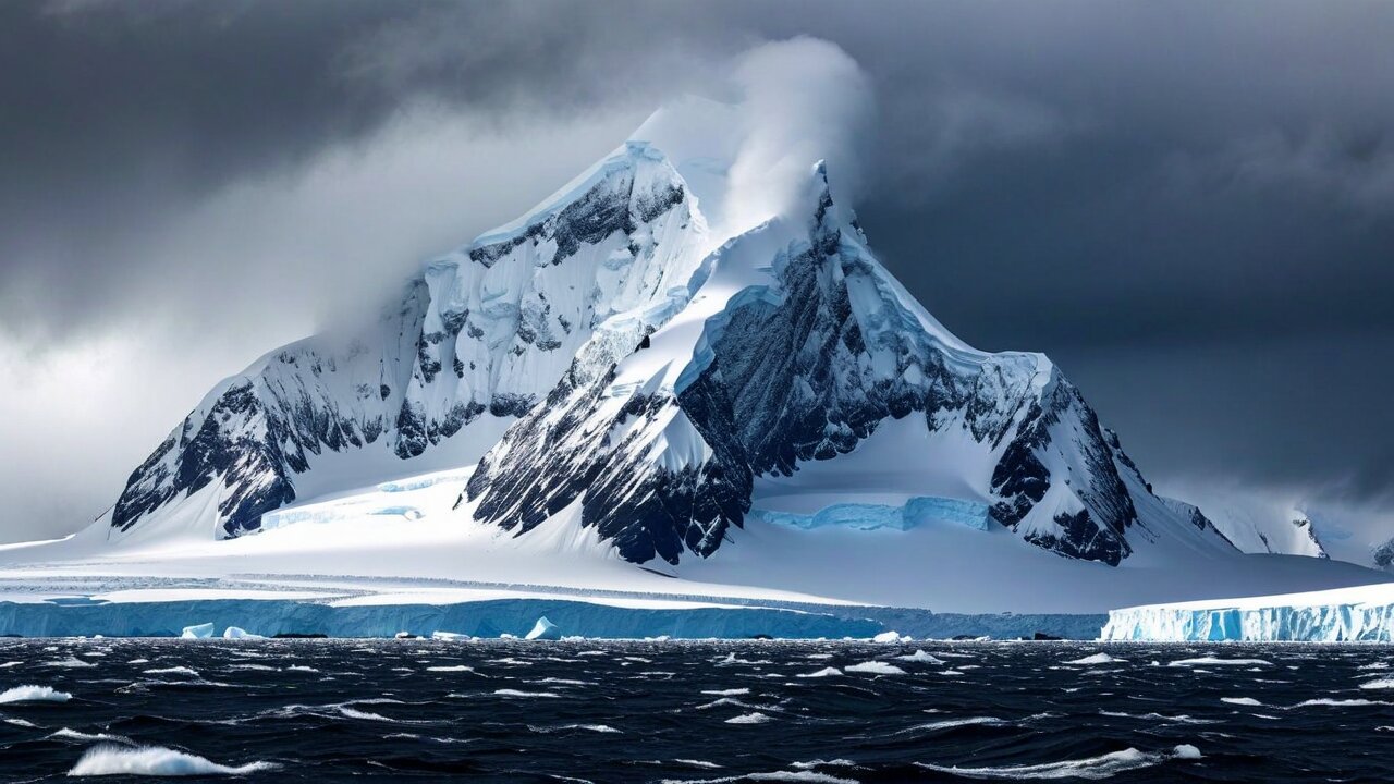
The territory is about 372 km² of land in total. Almost all of that is Heard Island itself, a single volcanic massif dominated by Big Ben, whose summit crater is called Mawson Peak and reaches 2,745 m. That makes it the highest mountain in Australian territory outside the Australian Antarctic claim — more than 500 m higher than Mount Kosciuszko, and higher than anything on the Australian mainland. It is also, along with McDonald Island 43 km to the west, one of Australia's only two active volcanoes.
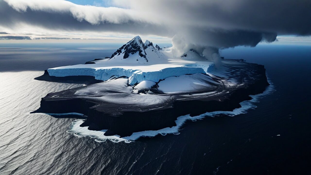
About 70% of Heard Island is under permanent ice, and roughly a dozen named glaciers run from the summit dome to the sea. The ice is retreating fast enough to be measured from one visit to the next, which is a large part of why the place matters: it is a set of glaciers with no local industry, no roads, no grazing and no people to confuse the signal.
It matters for a second reason, and this one is close to unique. HIMI has no introduced vertebrate species at all — no rats, no mice, no cats, no rabbits, no reindeer, none of the things that have wrecked every other sub-Antarctic island group from South Georgia to Kerguelen. Its ecosystems still run on their original terms. UNESCO inscribed the territory on the World Heritage List in 1997 for precisely that combination: an actively volcanic, actively glaciated island where nothing has been added.
🏷️ Names, Codes and the Absence of a Capital
The island is named after Captain John J. Heard, an American sailing the barque Oriental from Boston to Melbourne, who sighted it on 25 November 1853 and reported it. The neighbouring group is named after Captain William McDonald of the Samarang, who found it six weeks later, on 4 January 1854. Neither man landed. Neither ever went back. Between them they account for the entire naming of an Australian territory.
No capital, no settlement
There is nothing to have a capital of. The territory is administered from Kingston, Tasmania, by the Australian Antarctic Division — a suburb of Hobart roughly 4,500 km away. The nearest thing to a place-name on the ground is Atlas Cove, where a research station stood between 1947 and 1955 and where its wreckage still stands.
The codes
ISO 3166 gives it HM / HMD / 334. It has a flag emoji (🇭🇲) and a top-level domain (.hm) and a slot in every country dropdown menu on the internet, which is why a territory with no inhabitants appears in more databases than most small nations.
Language and money
By law, English and the Australian dollar. In practice neither is spoken or spent there, since nobody is present to do either. Australian law applies in full; the territory is treated as part of Australia for immigration, and any Australian who somehow got there would not have left the country.
Time
Officially UTC+5, which puts it four hours behind Perth and level with Kerguelen — a zone chosen for the ships and the science, not for anyone's working day. In the December–January window the sky never gets properly dark; in June it barely gets properly light.
One point of pedantry worth having straight: Heard Island is not in Antarctica and is not covered by the Antarctic Treaty. It lies well north of 60° south, it is undisputed sovereign Australian territory, and Australian domestic law — the Environment Protection and Biodiversity Conservation Act in particular — is what governs it. This is why permits there are issued by a Canberra department and not negotiated between treaty parties.
🗺️ Geography: One Volcano, Some Ice, and a Spit
Heard Island is roughly oval, about 43 km east–west and 20 km north–south, and essentially the exposed top of a single large volcano rising from the Kerguelen Plateau — a vast submarine igneous province, one of the largest on Earth, most of which lies a kilometre or more under water. Kerguelen itself is 450 km to the north-west; the two groups are the only substantial land on the plateau.
Big Ben
The main mass: a broad glaciated cone occupying most of the island, with Mawson Peak (2,745 m) at its summit inside an active crater. The slopes are consistently steep enough to be serious mountaineering and are almost entirely under ice, riven with crevasses and swept by avalanches.
Laurens Peninsula
The knob at the north-west end, joined to the main island by a low neck. It carries its own smaller volcanic centre — Mount Dixon (~700 m) and Anzac Peak — and its own ice cap, and it shelters Atlas Cove, the only anchorage on the island worth the name.
Elephant Spit
A long, low, entirely un-volcanic spit of black sand and gravel trailing about 10 km east from the island's eastern end, built and rebuilt by the swell. It is flat, it is bare, and it is where a very large share of the island's elephant seals and penguins actually haul out. It also changes shape year to year.
The McDonalds
43 km west: McDonald Island, Flat Island and Meyer Rock, a small cluster of steep-sided volcanic stacks with no ice cap and no safe landing. Nobody set foot on McDonald Island until 1971, and the island then rebuilt itself so thoroughly in the 1990s that the pre-1990 maps are useless.
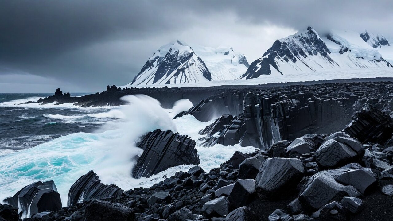
There are no rivers to speak of, a handful of meltwater lagoons that the retreating ice has opened up in the last few decades — Winston Lagoon and Compton Lagoon among them — and no natural harbour anywhere. Ships anchor off Atlas Cove in the north-west or Spit Bay in the east, both of them exposed, and everything and everyone that has ever landed came ashore in a small boat through surf.
🌋 Big Ben: An Active Volcano Under an Ice Cap
Big Ben is a stratovolcano that has been building itself for around a million years and has not finished. Its summit crater — Mawson Peak — has been seen glowing, steaming and throwing lava on and off since the first reliable report in 1910. Confirmed activity has been logged in 1910, the early 1950s, 1985, 1992, 1993, 2000, and then in a long run from roughly 2012 through 2016, when satellites repeatedly picked up hot lava flows spilling down the ice.
That combination — an active vent inside a glacier — is the geological point of the place. Lava meets ice, ice melts into the lava, and the resulting landforms are the kind of thing volcanologists otherwise study on Iceland with a road running past. Here there is no road, no monitoring station, and no local anything: what is known is known from ships, from satellites and from a very small number of people who have climbed it.
The highest Australian mountain
At 2,745 m, Mawson Peak beats Mount Kosciuszko (2,228 m) by more than five hundred metres and is the highest point under Australian sovereignty outside the Australian Antarctic Territory. Australians who want the country's true high point have to cross the Furious Fifties to get it, which is why so few have.
The first ascent
25 January 1965, by a five-man party from Warwick Deacock's expedition, which sailed from Australia in the 20-metre schooner Patanela. The summit party — Grahame Budd, Colin Putt, Warwick Deacock, Jon Stephenson and Philip Temple — went up through cloud and crevasses and came down again. It is one of the great small expeditions in Australian mountaineering and is barely known outside it.
How often it has been climbed
Fewer than a dozen times, in more than sixty years. Successful ascents are usually attached to a larger scientific or radio expedition that happened to have the weather and the people. Most attempts fail on the weather, not the terrain.
McDonald Island too
The second Australian volcano. It was thought dormant for around 75,000 years until it erupted in 1992 and kept going intermittently until about 2005 — in the process roughly doubling its area, from about 1 km² to around 2.5 km², and joining itself to the neighbouring Flat Island. A country's map is not often redrawn by geology within living memory.
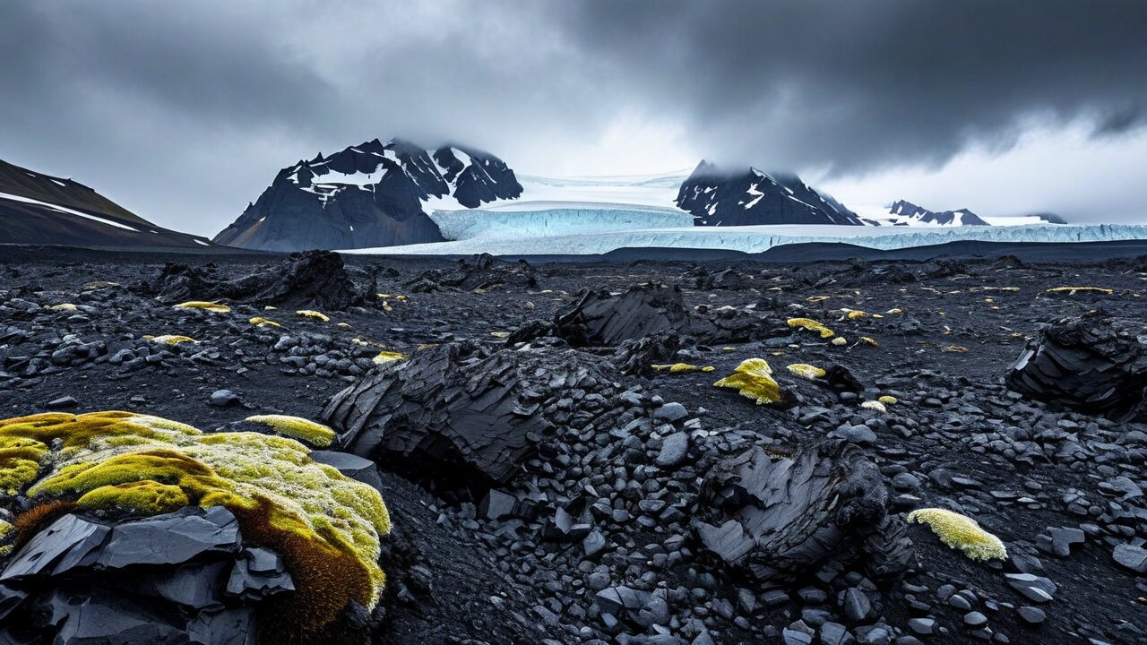
🧊 The Ice, and How Fast It Is Going
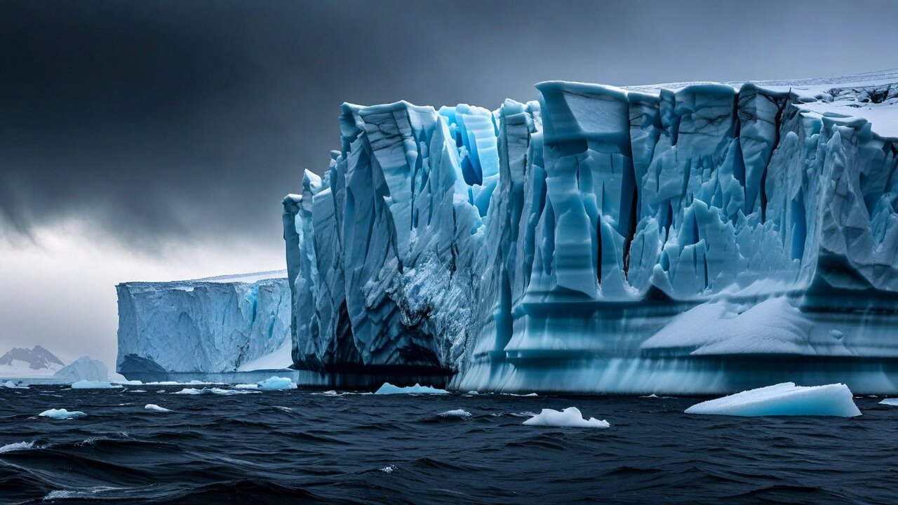
Roughly 70% of Heard Island is glaciated, with around a dozen named glaciers running radially off the Big Ben dome — Vahsel, Gotley, Baudissin, Challenger, Brown, Winston, Compton and others — several of which still reach tidewater and calve directly into the sea. There is no larger permanent ice mass anywhere between Antarctica and the tropics in this sector of the Indian Ocean.
The retreat is dramatic and it is well documented, because a small number of expeditions happened to map the ice carefully in 1947 and it has been re-measured by satellite ever since. Total ice cover has fallen by roughly a tenth since the late 1940s, and individual glaciers have done far worse: the Brown Glacier, the most-studied of them, has lost something on the order of a third of its area and retreated well over a kilometre. Glaciers that reached the sea in 1947 now end short of it, and lagoons have opened in the gaps.
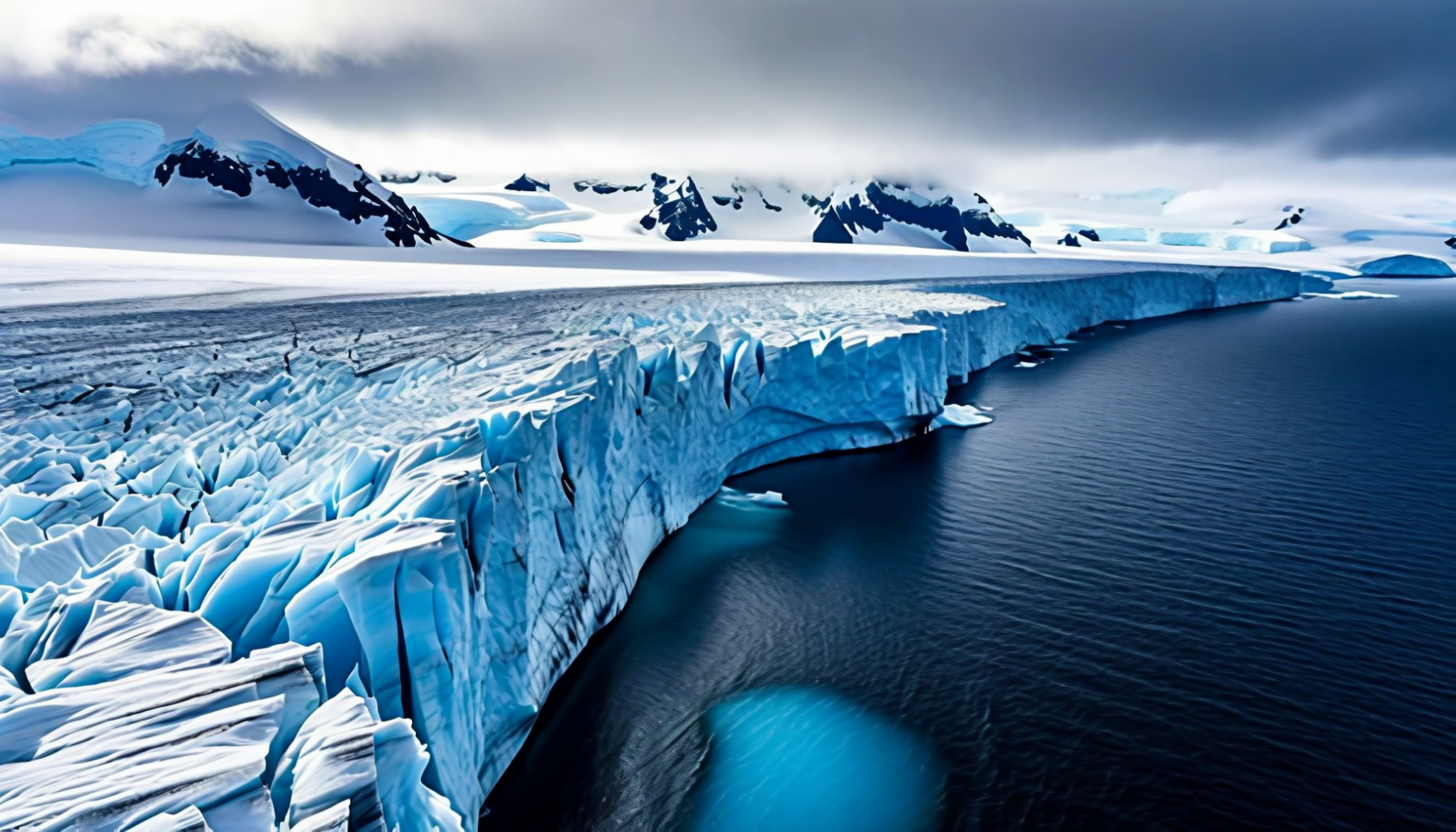
Why it is a good laboratory
No local pollution, no soot, no land-use change, no water extraction, no tourism traffic. Whatever the glaciers are doing, they are doing it in response to the ocean and the atmosphere and nothing else — which makes Heard a reference point against which messier glaciers elsewhere can be read.
What the retreat exposes
New ground. As the ice pulls back it uncovers fresh moraine that is immediately colonised — by mosses first, then cushion plants, then the seals and penguins that move into new beaches. Primary succession is happening here on a human timescale, in front of whoever turns up, which is rarer than it sounds.
Not simply warming
Sea-surface temperatures around Heard have risen, and so has the island's own mean temperature, but the southward shift of the westerly wind belt matters as well — it changes where the moisture that feeds the ice cap actually falls. The glaciers on the drier eastern side and the wetter western side have not retreated at the same rate.
The coastline moves
The island's shape is not fixed. Glacier snouts withdraw, lagoons form and drain, and Elephant Spit lengthens, shortens and bends with the swell. Charts of Heard Island carry dates for a reason.
🗺️ Map
Heard Island sits at about 53°06′ S, 73°31′ E. To put that in perspective: it is further south than the southern tip of South America's mainland, on the same latitude band as the Falklands and the Kerguelen group, and there is nothing at all between it and Antarctica except 1,600 km of the roughest water on the planet.
Perth
~4,100 km north-east. This is the practical departure point, and at expedition-ship speeds it is ten days to two weeks of open ocean each way — most of it in the Furious Fifties, all of it out of helicopter range of anywhere.
Kerguelen
~450 km north-west, French, permanently staffed, and the nearest human beings. There is no scheduled connection between the two territories; the fact that they are neighbours is a matter of geology, not of traffic.
Antarctica
~1,600 km south. Australia's Mawson, Davis and Casey stations are all considerably further away than that from Heard, since they sit on a different arc of the continent.
The nearest port
There isn't one. Fremantle or Hobart — both around two weeks away. Any medical emergency on Heard Island is a two-week medical emergency.
🧭 Discovery: Two Captains, Neither of Whom Landed
Heard Island has no indigenous history, because there is no plausible way anyone could have got there before ocean-going sailing ships and no reason to stay if they had. There are no artefacts, no middens, no oral tradition and no claim of prior discovery from anywhere. The human record of the island begins in the nineteenth century and is, from the start, entirely about extraction.
The first sighting may have been by the British sealer Peter Kemp in the brig Magnet in 1833, who marked land on his chart in roughly the right place, though the evidence is thin. The first sighting anybody acted on was by Captain John Heard of the American barque Oriental, running the clipper route from Boston to Melbourne, on 25 November 1853. He reported it, it entered the charts, and the sealers came.
Why nobody found it earlier
It is small, it is in a bad piece of ocean that ships crossed only because the Roaring Forties and Furious Fifties made it the fast way to Australia, and it is cloud-covered most of the time. Ships passed within tens of kilometres for decades without seeing it.
The McDonald Islands
Sighted 4 January 1854 by Captain William McDonald of the Samarang. He did not land either. Remarkably, nobody landed on McDonald Island until 1971 — 117 years later, and then only by helicopter, because there is nowhere to bring a boat ashore.
First landing on Heard
March 1855, by sealers from the American vessel Corinthian under Erasmus Darwin Rogers. They came for elephant-seal oil, they found a great deal of it, and within months there were rival gangs on the beaches.
The first survey
HMS Challenger passed the island on its great oceanographic voyage in February 1874 and made observations but could not land in the conditions. It is characteristic of Heard that the most famous scientific expedition of the century got as far as looking at it.
🛢️ The Sealers, 1855–1880
For about twenty-five years Heard Island was an industrial site. American sealing gangs, mostly out of New London, Connecticut, wintered on the beaches in huts made of barrels, stone and sailcloth, killing southern elephant seals for their blubber and boiling it down on the spot. The best estimate is that they took something in the order of 100,000 barrels of oil from the island in that period, which is a very large number of seals.
The conditions were as bad as anywhere in the history of the trade. Men were left ashore for a full year at a time with a stock of provisions and instructions to have the oil ready when the ship returned; sometimes the ship did not return on schedule. There are graves on the island. There is a place on the north coast still called Oil Barrel Point, and at Atlas Cove the ground is still littered with iron hoops and the staves of casks.
What they ate
Elephant seal — young ones, mostly, for the meat and the tongue — penguin eggs by the thousand, penguin breast, and Kerguelen cabbage (Pringlea antiscorbutica) for its vitamin C, which is written into its scientific name. Anything shipped in was flour, salt meat, sugar and tea, and it ran out.
Why it stopped
They ran out of seals. By the late 1870s the elephant seal population had been reduced to the point where a season no longer paid for itself, and the gangs went elsewhere. The last regular sealing voyage was around 1880; sporadic visits continued into the early 1900s.
What recovered
Almost everything, eventually, and this is the good news of the place. Southern elephant seals came back, Antarctic fur seals — hunted out even earlier and even harder — came back from near-nothing, and both now breed on the island in numbers. The recovery took the best part of a century and is still going on.
What is left
Scattered ironwork, cask hoops, try-pot fragments and a few graves, mostly around Atlas Cove and Corinthian Bay. It is protected as heritage and is not to be touched. The island's entire archaeological record is nineteenth-century industrial rubbish, and it is genuinely important.
🏴 The Claim, and the Handover of 1947
Sovereignty followed the oil at a distance. Britain formally claimed Heard Island and the McDonald Islands in 1910, when the sealing was already over and the islands were of no use to anybody, largely as part of the wider tidying-up of southern-ocean claims in the run-up to the Antarctic scramble.
The islands became Australian on 26 December 1947, when the British transferred them and an Australian party stepped ashore at Atlas Cove on the same voyage that established the station. The two things were deliberately simultaneous: the transfer of sovereignty and the physical act of occupation, in a decade when nobody wanted to leave a southern claim resting on paper alone.
ANARE
The Australian National Antarctic Research Expeditions, founded in 1947 and the vehicle for the whole southern effort. Heard Island was ANARE's first station — before Mawson, before Davis, before anything on the continent itself — and served as the training ground where Australia learned how to run a polar station at all.
Why Heard first
Because it was reachable. The continental coast was still largely unapproachable with the ships available in 1947, and Heard offered a sub-Antarctic environment, real glaciers, real weather and a landing beach, within reach of Australia. Everything learned there was applied on the continent five years later.
Undisputed
No other state has ever claimed HIMI, and no other state disputes the Australian claim. In a southern ocean full of overlapping and frozen claims, this is one of the very few pieces of territory whose status nobody argues about.
The maritime zone
The territory's real size is in the water. HIMI generates a full 200-nautical-mile exclusive economic zone — several hundred thousand square kilometres of ocean over the Kerguelen Plateau, containing a valuable fishery. The 372 km² of rock and ice is not what the territory is worth.
🏚️ Atlas Cove: The Station Years, 1947–1955
The Atlas Cove station operated continuously from December 1947 to March 1955. It was a cluster of prefabricated huts on the isthmus behind the cove, in the lee of the Laurens Peninsula, holding a party of usually ten to fourteen men who wintered over for a year at a time. They ran meteorology, geomagnetism, cosmic-ray physics, biology and survey, and in their spare time they attempted Big Ben and failed.
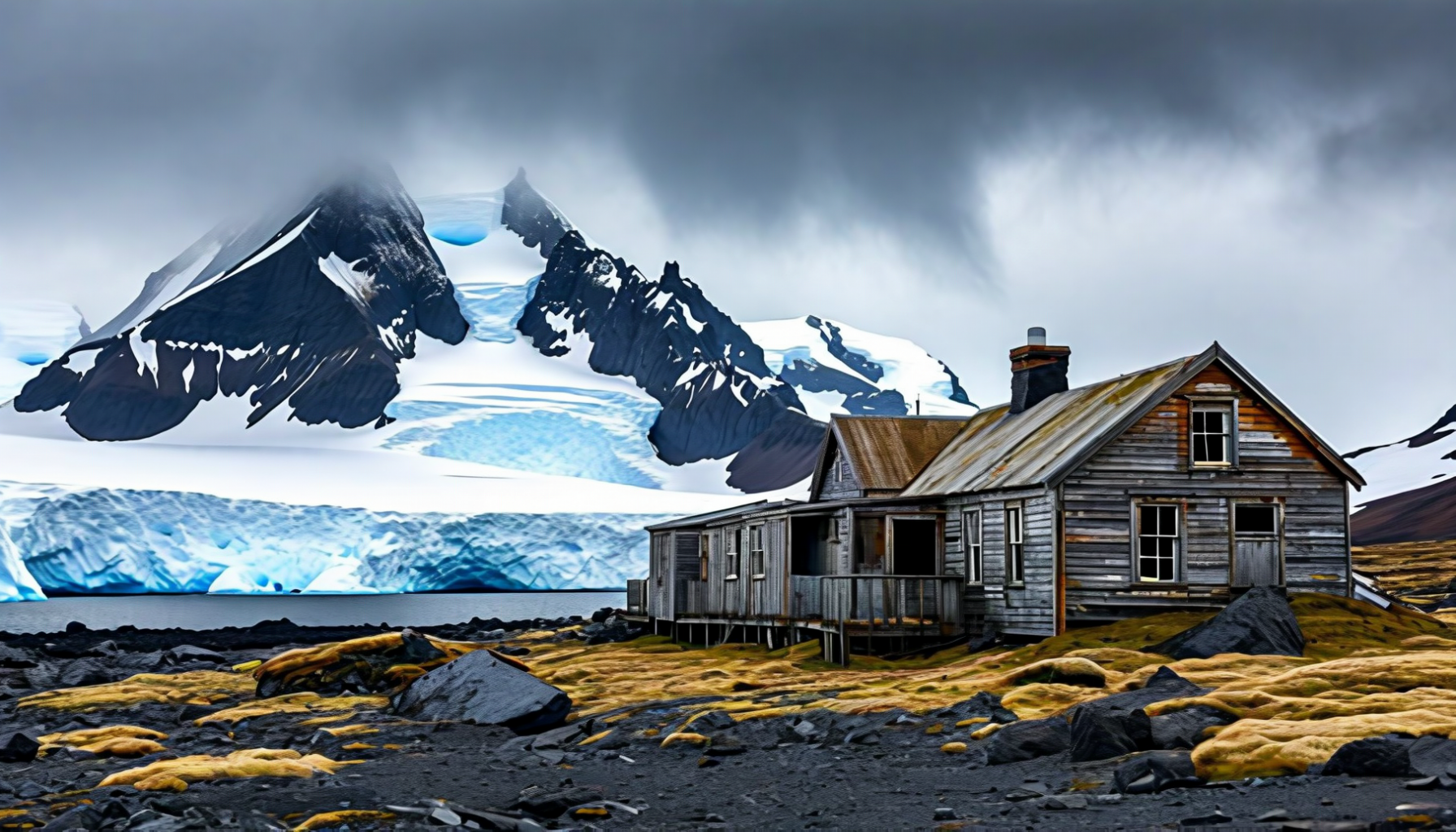
The station closed not because it failed but because it had done its job. In 1954 Australia opened Mawson station on the Antarctic continent — the first permanent station south of the Circle by any nation — and the ships, the money and the men went there instead. Heard was wound up the following autumn. The buildings were left standing.
Life there
Wind above all. Gusts over 180 km/h are recorded; the katabatic squalls that come off Big Ben — williwaws — arrive without warning and have flattened tents and moved buildings. Rain or snow on most days of the year, mean annual temperature around 1 °C, and no darkness worth the name in December, no daylight worth the name in June.
What they achieved
The first systematic mapping of the island, the first complete glacier survey (the 1947–48 baseline against which all subsequent retreat is measured), long meteorological and geomagnetic records, and the first serious biological survey of the seals and penguins. The 1947 glacier map is still cited in papers written seventy years later.
The failed climbs
Station parties tried Big Ben repeatedly through the early 1950s and never got up. The mountain was finally climbed a decade after the station closed, by a private expedition that arrived in a schooner.
What is there now
Ruins, and a clean-up problem. Fuel drums, asbestos-bearing building material and general debris from the station period have been progressively removed on later visits, but the site is not clear and is managed as both a heritage site and a contamination site, which is an awkward combination.
⛺ The Expedition Era, 1963 to Now
Since 1955 there has been no permanent presence. Instead there have been visits — a few dozen in seventy years, each of them a substantial undertaking. They fall into three kinds: scientific parties under the Australian Antarctic Division, private mountaineering and radio expeditions, and, very occasionally, an expedition cruise ship that has secured a permit and then usually cannot land because of the weather.
1963 and 1965
A 1963 party reconnoitred the island; on 25 January 1965 Warwick Deacock's expedition, arriving in the schooner Patanela, put five men on the summit of Mawson Peak. The voyage south from Australia in a 20-metre wooden boat is the more impressive half of the story.
1983 and 1992
Australian scientific expeditions re-established the survey and glacier record. It was the 1992 season that turned up the great surprise of the modern era: McDonald Island, silent for tens of thousands of years, was erupting.
1997: VK0IR
The Heard Island DXpedition — a team of radio amateurs who chartered a ship, spent two weeks on the island and made over 80,000 contacts. Heard is one of the most sought-after entities in amateur radio precisely because almost nobody is ever transmitting from it. A second major expedition, VK0EK, followed in 2016 and combined radio with a full scientific programme.
Cruise ships
A very small number of expedition vessels have obtained permits since the 1990s. Landings are rare, brief and heavily conditioned; most passengers who pay to go to Heard Island see it from the ship through rain and leave without setting foot on it, and the operators say so in advance.
The pattern is consistent: the island grants access on its own terms. A great many well-funded expeditions have arrived off Atlas Cove, sat there for a week unable to launch a boat, and gone home. That is not a failure of planning — it is simply what 53° south does.
🎣 Toothfish, Poachers and the Long Chases
The one genuine economy attached to this territory is in the water. The Kerguelen Plateau around HIMI holds commercially valuable stocks of Patagonian toothfish (Dissostichus eleginoides) — sold worldwide as Chilean sea bass — and mackerel icefish. Australia licenses a small, tightly controlled fishery in the HIMI zone, managed under the rules of CCAMLR, the Antarctic marine living resources convention, and it is generally held up as one of the better-run deep-ocean fisheries anywhere.
It got that way the hard way. Through the late 1990s and early 2000s the zone was worked by illegal, unreported and unregulated vessels — flag-of-convenience longliners that would fish the plateau and run for the far side of the world when a patrol ship appeared. Australia responded with armed fisheries patrols and, on several occasions, with pursuit.
The South Tomi, 2001
Spotted fishing illegally in the HIMI zone and pursued by the Australian patrol vessel Southern Supporter for 14 days and roughly 6,100 km, ending off South Africa with South African special forces boarding her. At the time it was one of the longest hot pursuits in maritime history.
The Viarsa 1, 2003
It did not hold the record long. The Viarsa 1 was chased for 21 days across nearly 4,000 nautical miles of the Southern Ocean through pack ice, in an operation that eventually involved Australian, South African and British vessels before she was boarded near South Africa. The subsequent trial in Perth ended in acquittal, which is its own commentary.
What changed
Sustained patrolling, satellite vessel monitoring, catch documentation schemes and port-state measures largely closed the plateau to IUU fishing by the late 2000s. Toothfish stocks in the Australian zone have recovered to the point where the fishery is certified as sustainable, which is not a sentence that can be written about many deep-water fisheries.
The marine reserve
The HIMI Marine Reserve was declared in 2002, extended in 2014 and extended again substantially in 2023, taking the fully and highly protected area into the hundreds of thousands of square kilometres. Fishing is excluded from the core zones entirely; the licensed fishery operates outside them.
🐧 Penguins: Four Species, Very Large Numbers
Four penguin species breed on Heard Island, and between them they account for a good deal of the island's biomass. The ground around the colonies is worked black and the noise carries a long way — a large king penguin colony is audible before it is visible, which given the visibility on Heard is a useful property.
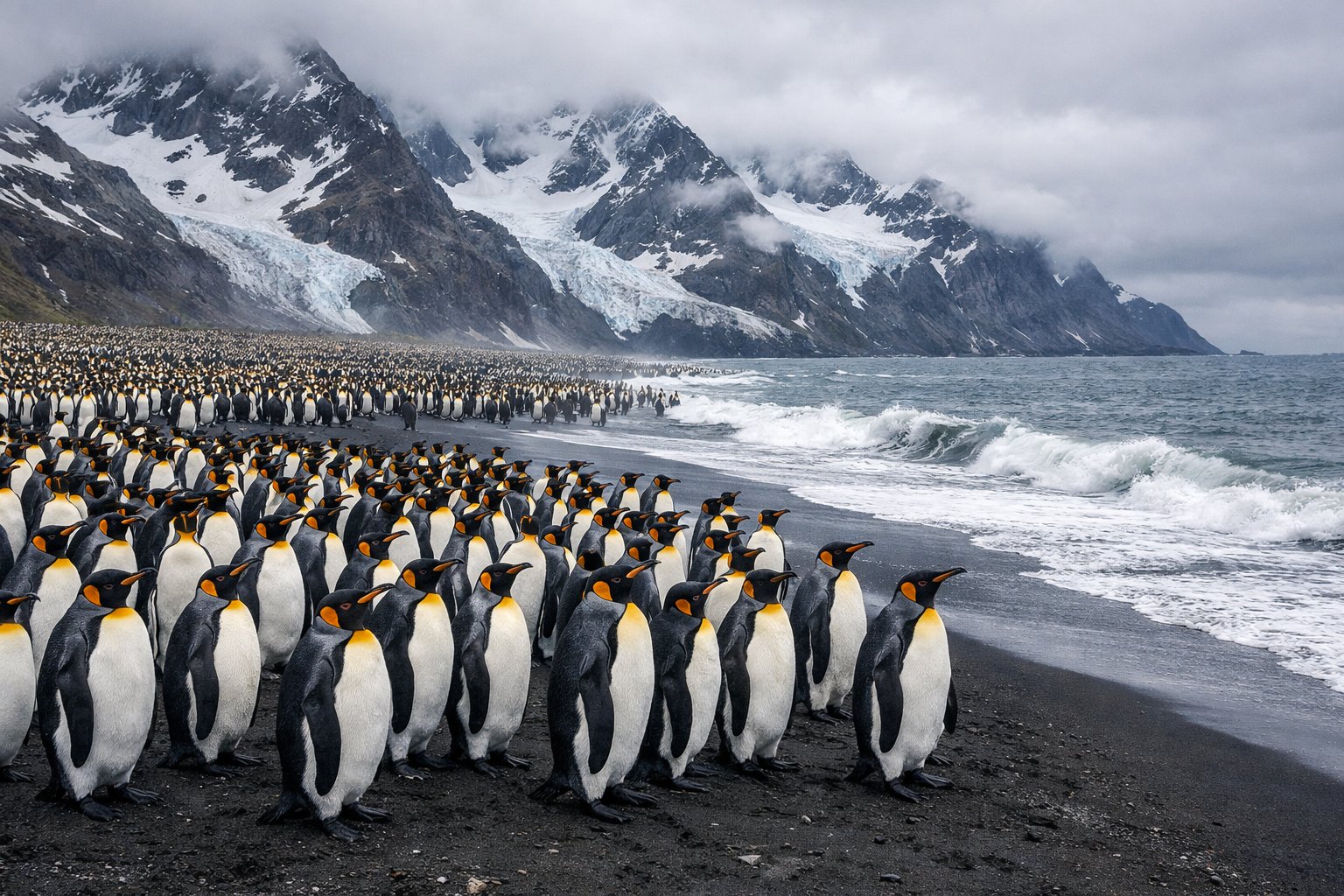
King penguin
The great success story. Almost gone by the 1940s, now numbering in the tens of thousands of breeding pairs on the eastern beaches and Elephant Spit. King penguins breed on a fourteen-month cycle, which means a colony always contains eggs, small chicks and enormous brown woolly chicks at the same time — the brown ones were mistaken for a separate species in the nineteenth century.
Macaroni penguin
Historically the most numerous penguin on the island by a wide margin, in colonies of many tens of thousands on the steeper coastal slopes. Small, loud, and crested with a spray of orange-yellow plumes that meet across the forehead. Macaroni numbers on Heard, like macaroni numbers across the whole sub-Antarctic, have been falling for decades — a decline that is not fully explained.
Gentoo penguin
The stay-at-home. Gentoos breed in smaller, looser colonies close to the shore and remain in the area year-round rather than heading out to sea in winter. They are the species most likely to be seen wandering about on their own, and their colonies shift location between seasons far more than the others'.
Eastern rockhopper
The smallest of the four and the least numerous on Heard, in scattered colonies on rocky ground. Rockhoppers are declining sharply across their whole sub-Antarctic range, and Heard is no exception. Yellow eyebrow plumes, red eyes, and a way of moving up cliffs that the name describes exactly.
A note on the pictures. There is no honest photograph of a macaroni penguin in this page's image set. One of the images supplied under that name shows king penguins with macaroni-style crests added — a chimera of two species that does not exist — and it has been left out rather than published with a caption pretending otherwise. If you want to know what a macaroni penguin looks like, the short version is: knee-high, thick orange bill, and golden plumes that start between the eyes and sweep back over the head.
🦭 Seals: Elephants, Fur Seals and Leopards
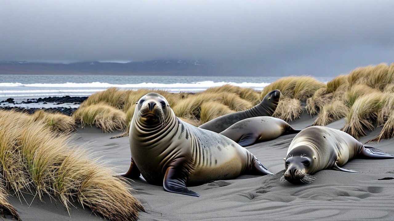
Heard Island's beaches were the reason anybody came here in the first place, and after a century of recovery they are again among the more important seal breeding grounds in the Indian Ocean sector of the Southern Ocean. Three species breed; a fourth turns up to eat the others.
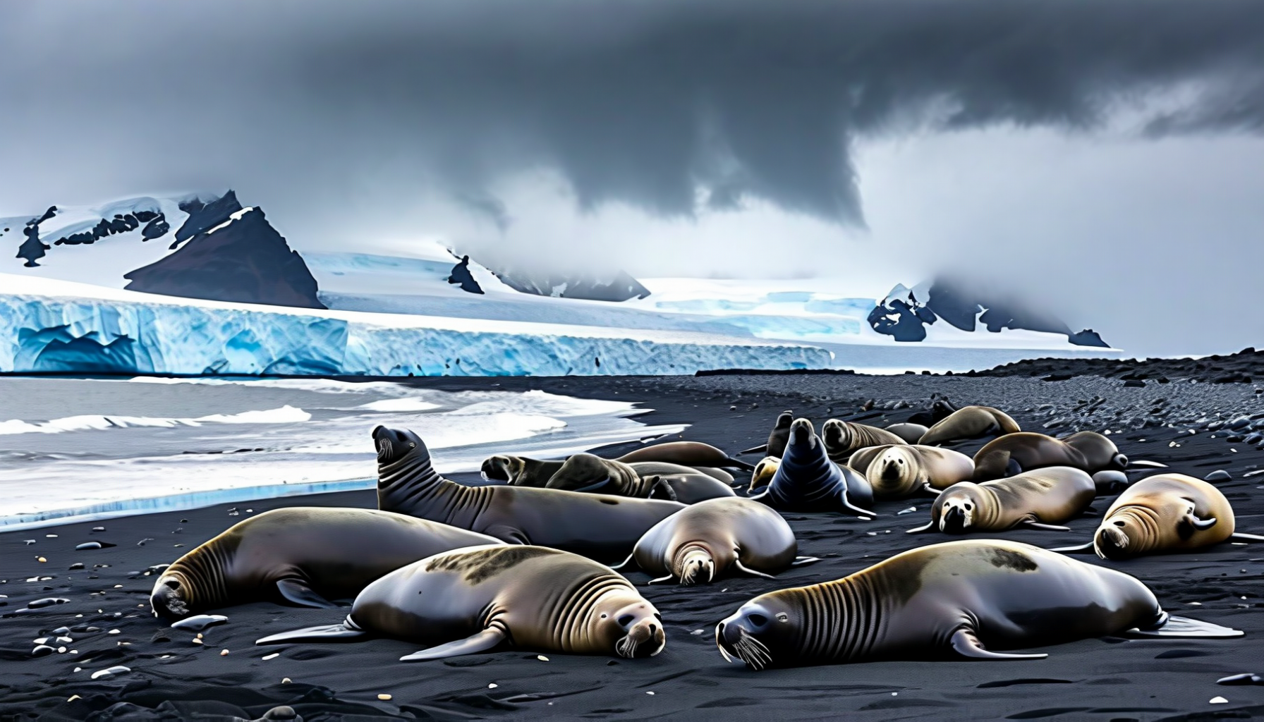
Southern elephant seal
The species the sealers came for, and the largest seal on Earth: bulls reach four tonnes and five metres, with the inflatable nose that gives the animal its name. Heard's population was reduced to a remnant by 1880, recovered strongly through the twentieth century, and has since been roughly stable or slightly declining — a pattern seen across the whole Indian Ocean sector and thought to relate to food availability rather than hunting.
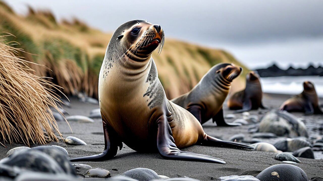
Antarctic fur seal
Hunted out even earlier and even harder than the elephant seals — reduced to a handful of animals across the entire Southern Ocean by the mid-1800s. Their return is one of the great wildlife recoveries: from near-extinction to millions. On Heard, breeding numbers have grown steadily since the 1950s. Bulls are territorial and genuinely dangerous on a beach; they move much faster than they look.
Subantarctic fur seal
Present in smaller numbers and interbreeding with the Antarctic fur seal where the two overlap, which they do on Heard. Slightly smaller, with a creamier chest and a blunter face. Heard is one of the few places where both species are found on the same beach.
Leopard seal
Not a breeder here — a visitor, hauling out on the beaches in winter and working the penguin colonies from the water. Three metres, reptilian head, and no particular fear of anything. Leopard seals are among the very few animals in the Southern Ocean that have injured people, and expedition parties give them a very wide berth.
🕊️ Seabirds and the Endemic Cormorant
Somewhere around twenty species of bird breed on Heard Island and its neighbours, almost all of them seabirds, and the island's remoteness means several are present in globally significant numbers. It also holds the territory's only endemic vertebrate.
Heard Island cormorant
Leucocarbo nivalis — the territory's only endemic vertebrate, found nowhere else on Earth and numbering only a few hundred pairs. A blue-eyed shag of the sub-Antarctic type, black above and white below with bright blue eye-rings and a yellow caruncle above the bill. Its entire world population lives on one island's coast.
Albatrosses
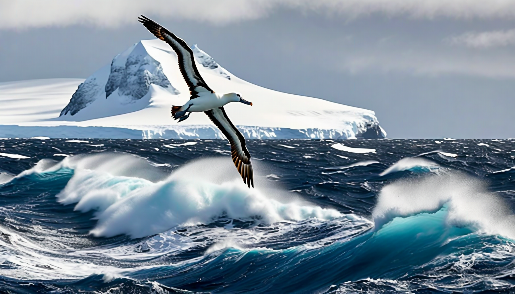
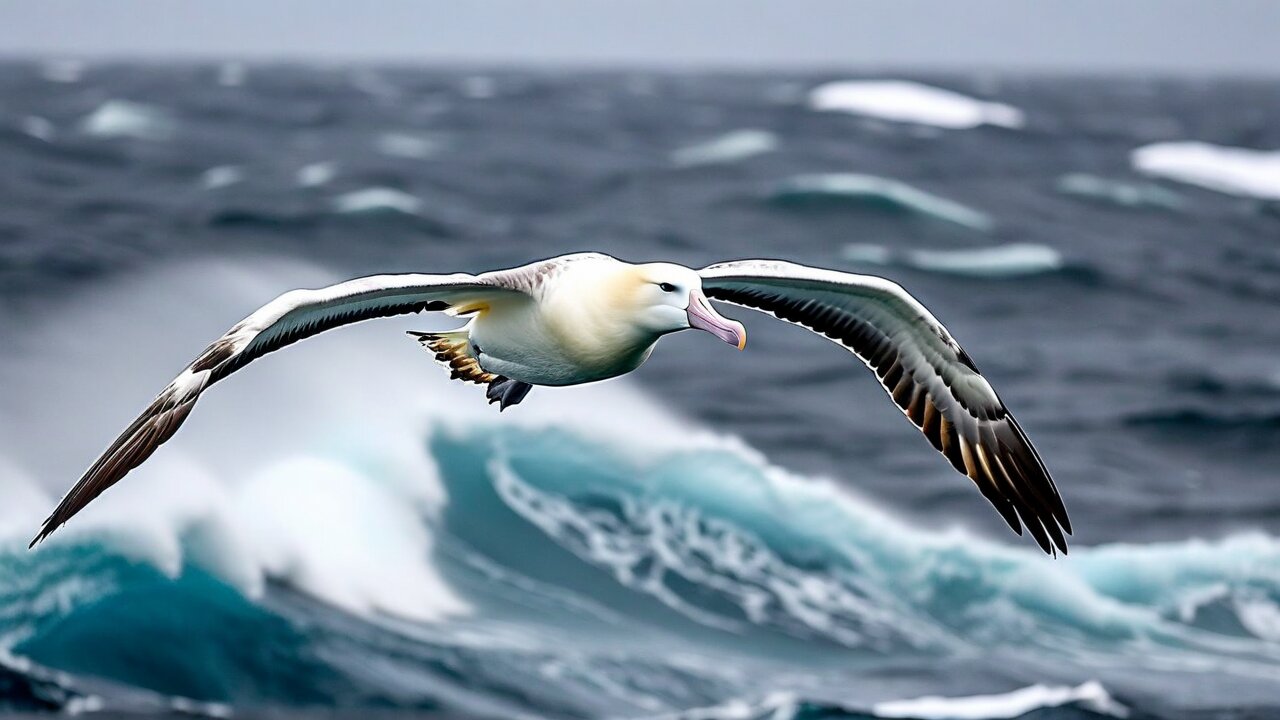
Black-browed albatross and light-mantled albatross both breed here. The light-mantled is the more beautiful of the two by common consent — smoky grey-brown with a white crescent behind the eye — and nests on cliff ledges in pairs that display in synchronised flight.
Giant petrels
Both southern and northern giant petrel breed on Heard. Enormous, with a wingspan approaching two metres and a heavy tube-nosed bill, they are the Southern Ocean's principal scavengers and will strip a seal carcass on the beach. Sailors called them stinkers, for good reason.
The sheathbill
The Heard Island sheathbill is a distinct subspecies of the black-faced sheathbill, and it is the only bird in the Southern Ocean with no webbing on its feet — a shorebird that walks everywhere, lives entirely on the beach, and makes a living out of penguin colonies by stealing food, eggs and anything left unguarded. It is a pigeon-shaped scavenger with an excellent character.
Also present: Antarctic and Kerguelen terns, brown skuas working the penguin colonies from above as the sheathbills work them from below, kelp gulls, cape petrels, and enormous numbers of small burrowing petrels and prions whose colonies would be a great deal easier to survey if they did not nest underground and come ashore only at night.
🌿 Twelve Plants and Not One Tree
There are no trees, no shrubs and no woody plants of any kind on Heard Island. The entire vascular flora runs to somewhere around a dozen species — grasses, cushion plants and a few herbs — supplemented by mosses, liverworts, lichens and algae that between them do most of the actual covering of the ground. Everything grows low, everything grows slowly, and nothing grows above about 200 m.
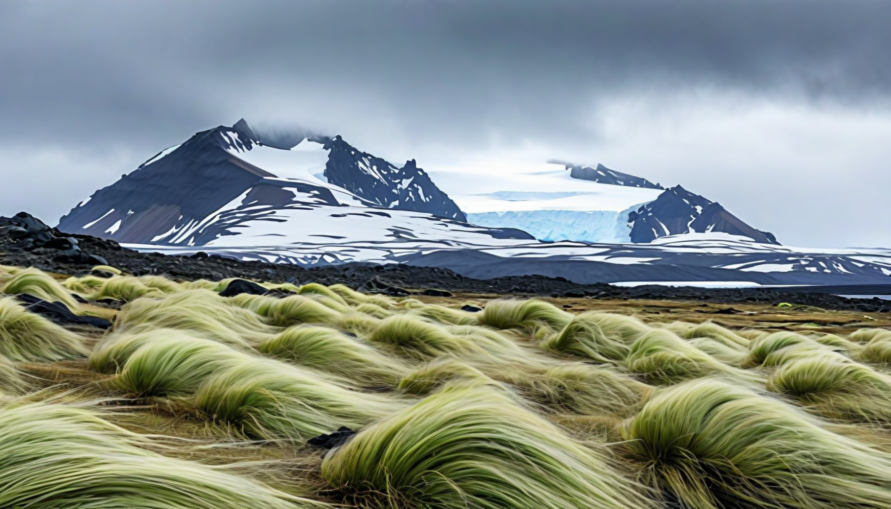
Azorella selago
The cushion plant, and the defining vegetation of the sub-Antarctic. It grows as a dense hemispherical mound, sometimes a metre or more across and decades or centuries old, packed so tightly that it creates its own warm, sheltered microclimate inside — which is where a large part of the island's invertebrate life lives. Standing on one does real damage that takes many years to undo.
Kerguelen cabbage
Pringlea antiscorbutica — a cabbage relative found only on the sub-Antarctic islands of the southern Indian Ocean, with a species name that means "against scurvy". Sealers and early expeditions ate it for exactly that reason, and it very probably saved lives. It has no insect pollinator on Heard and is instead pollinated by the wind, which on this island is not a limiting factor.
The grasses
Poa cookii forms the tall tussock around seal wallows and seabird colonies where there is nitrogen to be had; Poa kerguelensis and Deschampsia antarctica — the Antarctic hair grass, one of only two flowering plants native to Antarctica itself — hold the drier and more exposed ground.
Colonising new ground
The retreating glaciers uncover fresh moraine every year, and the sequence that follows — algae and lichens, then mosses, then Azorella, then grasses — is textbook primary succession happening in real time on ground whose exposure date is precisely known. Very few places on Earth offer that, and none of the others is free of human interference.
🛡️ The Thing That Makes It World Heritage: Nothing Was Added
Every other significant sub-Antarctic island group has been wrecked, at least partly, by species people brought with them. South Georgia had rats and reindeer. Kerguelen has rabbits, cats, mice, rats, reindeer and mouflon. Macquarie had rabbits, rats, mice and cats, and spent decades and tens of millions of dollars getting rid of them. Marion Island is still fighting mice that have learned to eat albatross chicks alive.
Heard Island and the McDonald Islands have none. No introduced mammals, no introduced birds, no introduced reptiles — nothing vertebrate that was not there before 1853. It is one of the very few sub-Antarctic island groups on Earth of which that can be said, and it is the single most important fact about the territory. The 1997 World Heritage inscription rests on it as much as on the volcano.
Why it survived
Luck and inhospitality in roughly equal measure. Nobody ever settled permanently; nobody farmed; nobody released food animals as a larder for future castaways, as they did on dozens of other southern islands. The sealers were on the beaches, not the interior, and their ships called for a few decades rather than a few centuries.
It is not perfectly pristine
A small number of introduced invertebrates and plants have made it ashore — the grass Poa annua was first recorded on the island in the late 1980s and is being monitored, and a handful of introduced insects and mites are established. Nothing vertebrate. The distinction matters: it is introduced predators and grazers that collapse island ecosystems, and there are none.
What biosecurity means here
This is why the permit conditions are severe. Boots scrubbed and inspected, velcro cleaned out, bags vacuumed, no fresh food ashore, clothing that has been used on another sub-Antarctic island effectively barred. A single pregnant rat coming off a ship would end a two-million-year experiment inside a decade.
A natural laboratory
Because nothing was added, the population changes on Heard mean something. When king penguins increase a hundredfold and macaroni penguins decline, that is the ocean and the climate talking, not rats. Nowhere else in the sub-Antarctic can that sentence be written without a long list of caveats.
🌊 The Ocean: A Plateau, a Front and a Great Deal of Krill
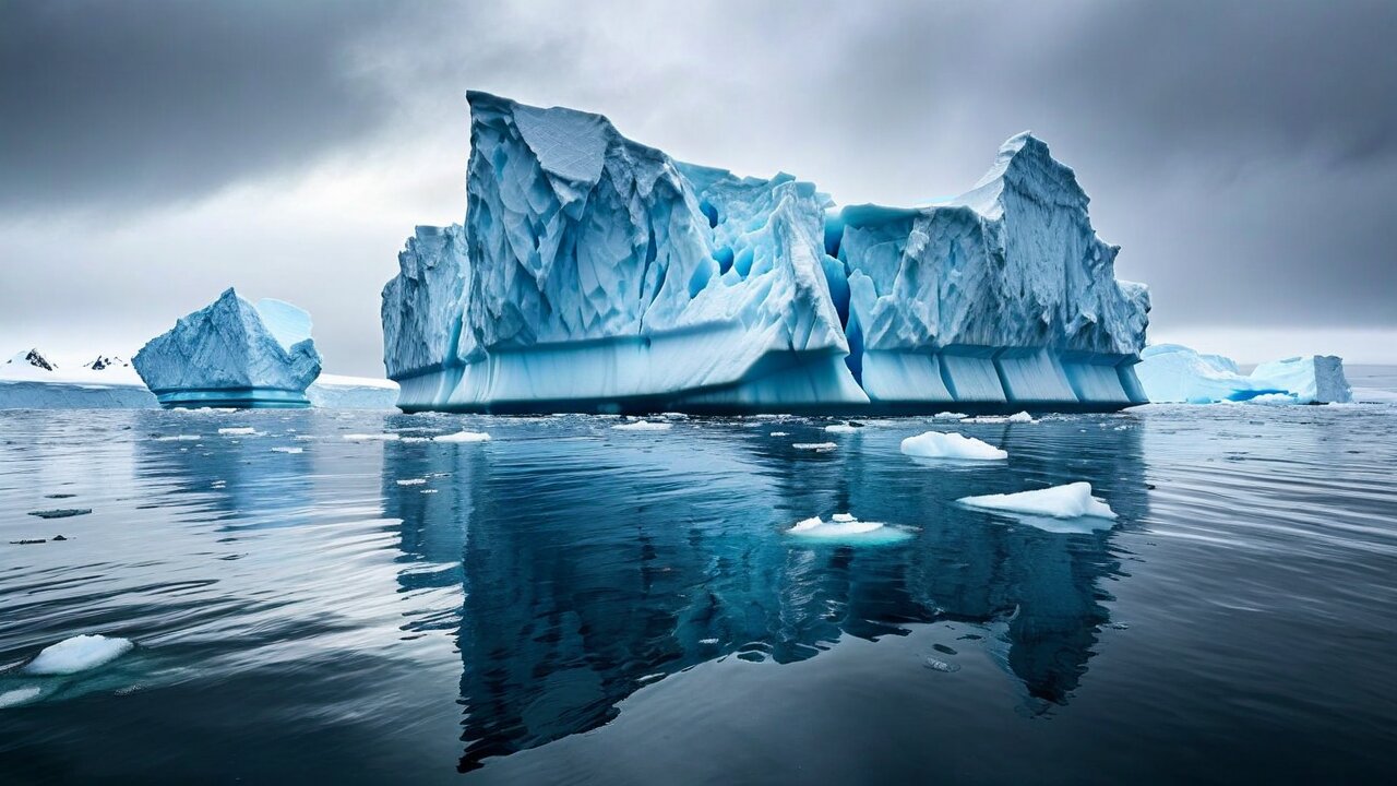
The territory's ecological significance does not stop at the shore. Heard sits on the Kerguelen Plateau, a shallow submarine platform in an ocean that is otherwise very deep, and it sits near the Antarctic Polar Front — the boundary where cold Antarctic surface water sinks beneath warmer sub-Antarctic water. Shallow water plus a frontal zone plus deep upwelling produces one of the more productive stretches of the Southern Ocean.
What lives in it
Antarctic krill and other euphausiids at the base; myctophid lanternfish, squid, icefish and Patagonian toothfish above them; and on top, every seal, penguin and albatross on the island. The whole terrestrial spectacle of Heard Island is a by-product of the marine food web — nothing on the island eats anything that grew on the island.
Whales
Southern right, humpback, fin, sei, blue and minke whales all use these waters, and sperm whales work the deeper edges of the plateau. All of them were hunted to a fraction of their former numbers in the twentieth century; humpbacks in the Indian Ocean sector are recovering strongly, blue whales far more slowly.
Benthic life
The plateau floor supports cold-water corals, sponge gardens, brittle stars and a great deal that has not been properly described. Much of it is slow-growing and easily destroyed by bottom trawling, which is a principal reason the marine reserve's core zones are drawn where they are.
Fishing rules
The licensed fishery uses longlines and midwater trawl rather than bottom trawl in most areas, carries independent observers on every trip, and operates under CCAMLR catch limits set from stock assessments. Seabird bycatch — once the great killer of southern albatrosses — has been reduced to near zero in this fishery by streamer lines, night setting and weighted gear.
🏕️ What Being There Is Actually Like
Nobody lives on Heard Island, but between 1947 and 1955 around a hundred men did, a year at a time, and since then a few hundred more have camped there for weeks at a stretch. Their accounts agree closely enough that the picture is clear, and it is not a romantic one.
The dominant fact is wind. The island sits in an unbroken westerly airstream that has crossed thousands of kilometres of open ocean, and Big Ben adds its own violence on top: cold air pouring off the ice cap accelerates down the slopes and arrives at sea level as a williwaw — a sudden, near-vertical squall that can go from calm to well over 150 km/h in under a minute. Tents have been shredded and a station building was once moved bodily off its footings.
The numbers
Mean annual temperature at sea level around 1 °C, with very little seasonal swing — roughly 0 °C in winter, 4 °C in summer. Precipitation on three days out of four, as rain, sleet, snow or all three in an hour. Sunshine averaging under two hours a day. Cloud almost permanently on Big Ben; the summit is visible from sea level on a small number of days per year.
The ground
Volcanic gravel, moraine, wet moss and bog. Crossing the island on foot means glacier travel with ropes, because the route to anywhere goes over ice, and the crevasse fields on Big Ben are extensive. The coastal walking is easier and much shorter than the map suggests, because the ice comes down to the shore in several places and blocks the way entirely.
The company
Seals, which are territorial, heavy and faster than they look; skuas, which dive at anything near their nests; and penguin colonies whose smell arrives well before the birds do. There are no predators dangerous to people on land, and the animals have very little fear of people — which is a hazard in itself, since a fur seal that will not move is a fur seal you have to walk around.
Communications
Satellite, and nothing else. There is no infrastructure of any kind — no power, no water supply, no shelter, no cache, no medical facility, no landing strip and no permanent radio. Everything a party needs it brings, and everything it brings it takes away again, including its waste.
🍽️ Food: There Is No Cuisine, So Here Is What People Ate
Heard Island has no cuisine, because a cuisine requires people to have lived somewhere long enough to argue about it. What it has instead is a documented food history in two chapters — the sealers, and the ANARE station — and both are worth recording, because in each case what people ate was determined entirely by what could survive the voyage south.
Chapter one: the sealers, 1855–1880
Gangs left ashore for a full year lived largely off the island. Elephant seal was the staple — the tongue and the flippers were considered the best of it, and the young animals were eaten in preference to the bulls. Penguin eggs were collected in the thousands in season and preserved in grease; penguin breast meat was eaten when nothing else offered. And they ate Kerguelen cabbage, deliberately and in quantity, because it worked: the plant is genuinely high in vitamin C and its scientific name, antiscorbutica, commemorates the fact. From the ship came flour, salt beef, sugar, tea and rum, in quantities that assumed the ship would come back on time. Sometimes it did not.
Chapter two: the station, 1947–1955
The ANARE men ate an Australian ration of the period: tinned meat and vegetables, dried egg, powdered milk, an enormous quantity of flour, and a Sunday roast whenever the frozen meat held out. A station cook was a serious appointment and a bad one was a serious problem, since there was nowhere else to eat for a year. Three things from that ration have survived as the island's honorary dishes, and they are all Australian rather than Heard Island — damper, ANZAC biscuits and a roast leg of lamb. Nobody pretends otherwise, and the recipes below are given in that spirit.
Why damper
Because it needs no yeast, no proving and no oven that works properly. A station or a sealer's camp could produce bread from flour, water, salt and whatever raising agent was to hand, in a camp oven buried in the ashes. It is the single most useful thing anybody can bake a long way from a shop.
Why ANZAC biscuits
Because they keep. The recipe contains no egg, which is precisely why it was developed — biscuits that would survive a sea voyage to the other side of the world without spoiling. That property recommended them to every Australian expedition south for the next fifty years.
Why a roast
Morale. Every polar station in history has had a fixed weekly ritual meal, because a year is a long time and the calendar has to be marked somehow. On the Australian stations that meal was Sunday roast lamb, and it still is.
Today
Modern parties eat freeze-dried expedition rations, and take nothing fresh ashore at all — the biosecurity rules forbid it. Nobody has eaten a penguin egg on Heard Island in a very long time, and it would now be a criminal offence to try.
🥖 Recipe: Camp Damper
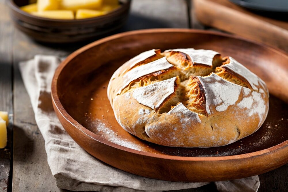
Damper
Australian camp bread · serves 6 · 15 min prep + 30 min baking
Ingredients: 500 g self-raising flour (or 500 g plain flour plus 4 tsp baking powder); 1 tsp salt; 60 g cold butter, cubed; about 300 ml milk, or water and 3 tbsp powdered milk; a little extra flour for dusting.
Method: Heat the oven to 200 °C. Rub the butter into the flour and salt with your fingertips until it looks like coarse breadcrumbs. Make a well, pour in most of the milk and bring it together quickly with a knife — add the rest only if it is dry. Do not knead it properly; a dozen turns on a floured board is enough, and overworking it makes it tough. Shape into a round about 18 cm across, put it on a floured tray, cut a deep cross most of the way through, and dust the top with flour. Bake 25–30 minutes, until it is well browned and sounds hollow underneath. Tear it apart rather than slicing it, and eat it hot with butter and golden syrup.
💡 In a camp oven: put the dough in the cast-iron pot, lid on, sit it in the coals and shovel more coals onto the lid. Roughly 30 minutes, and you check it by smell. The version made in ashes is the real one; the oven version is a good imitation.
🍪 Recipe: ANZAC Biscuits
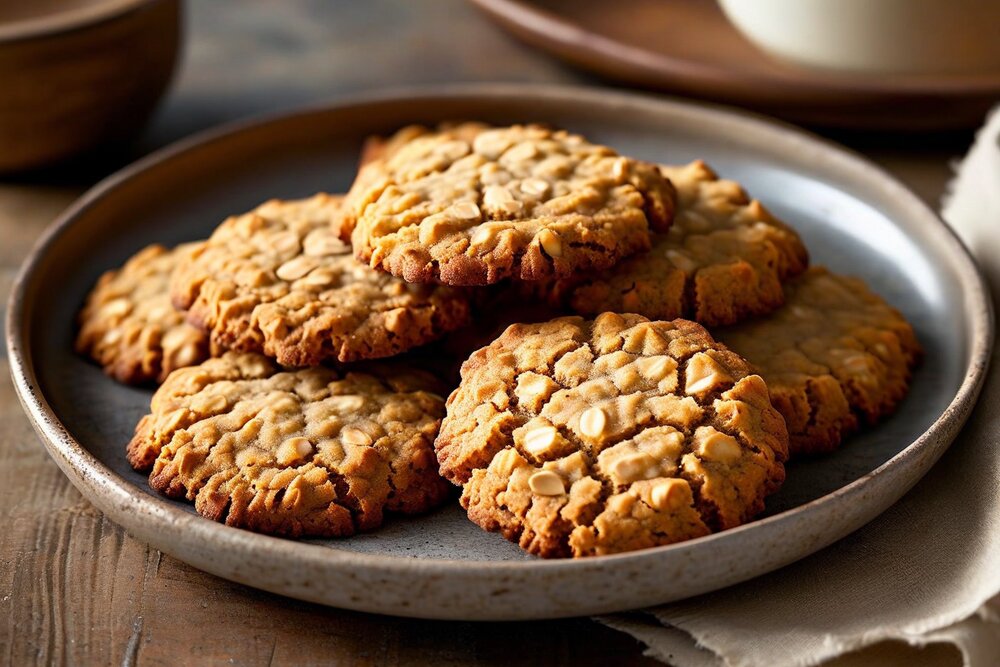
ANZAC Biscuits
Australian expedition biscuit · makes about 24 · 15 min prep + 15 min baking
Ingredients: 100 g rolled oats; 150 g plain flour; 100 g desiccated coconut; 150 g caster sugar; 125 g butter; 2 tbsp golden syrup; 1 tsp bicarbonate of soda; 2 tbsp boiling water.
Method: Heat the oven to 160 °C and line two trays. Mix the oats, flour, coconut and sugar in a large bowl. Melt the butter with the golden syrup in a small pan over a low heat. Dissolve the bicarbonate of soda in the boiling water and stir it into the melted butter — it will foam up considerably, which is what you want. Pour the lot into the dry ingredients and mix to a stiff, sticky dough. Roll walnut-sized balls, space them well apart on the trays and flatten each one slightly; they spread. Bake 12–15 minutes for chewy, 18 for crisp. Let them firm up on the tray for five minutes before moving them, or they will fall apart.
💡 No egg — that is the whole design. It is why they last for months in a tin and why they went south on every Australian expedition from Mawson's onwards.
🍖 Recipe: Station Sunday Roast Lamb
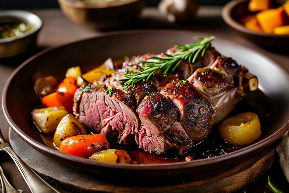
Roast Leg of Lamb with Root Vegetables
Australian station Sunday dinner · serves 6 · 20 min prep + 1½–2 h roasting
Ingredients: 1 leg of lamb, about 2 kg; 4 garlic cloves, slivered; several sprigs of rosemary; 2 tbsp oil; salt and coarse black pepper; 1 kg potatoes, halved; 4 carrots, in chunks; 2 onions, quartered; 250 ml stock or water; 1 tbsp flour for the gravy.
Method: Heat the oven to 220 °C. Make small deep cuts all over the lamb with the point of a knife and push a sliver of garlic and a few rosemary needles into each. Rub with oil, salt and plenty of pepper. Put it on a rack over a roasting tin and give it 20 minutes at 220 °C. Drop the oven to 180 °C, tip the potatoes, carrots and onions into the tin underneath so they cook in the fat, and roast a further 60–75 minutes for pink in the middle, 90 for well done. Rest the meat under foil for at least 15 minutes — this is not optional. Meanwhile pour off most of the fat, stir the flour into what is left in the tin, cook it for a minute, add the stock and any resting juices, and scrape everything off the bottom for the gravy.
💡 Frozen leg was what actually came ashore in 1948, and a frozen leg roasts perfectly well provided it is fully thawed first — an overnight job that station cooks learned to plan around.
🚢 Can You Actually Go?
Technically yes. Practically, almost certainly not, and it is worth being precise about why, because the internet is full of pages that treat Heard Island as a bucket-list tick rather than as what it is.
Entering the territory — including its territorial sea, and including simply anchoring off it — requires a written permit from the Australian Antarctic Division under the Environment Protection and Biodiversity Conservation Act 1999 and the HIMI Marine Reserve Management Plan. Permits are assessed case by case against the reserve's conservation objectives. They are granted routinely to Australian government science, occasionally to serious private scientific and mountaineering expeditions, and rarely to tourism.
Who gets permits
Australian Antarctic Division programmes, licensed fishing vessels operating in the zone, and a small number of private expeditions with a credible scientific, conservation or historical justification — the major amateur-radio expeditions have been permitted on that basis. A general-interest visit with no purpose beyond being there is not a strong application.
The commercial option
A very small number of expedition cruise operators have run voyages to HIMI, usually as part of a longer sub-Antarctic itinerary out of Australia. They are infrequent — not annual — very expensive, and honest operators tell you in the brochure that landings are conditional on weather and permit terms and frequently do not happen.
Private yachts
Some do sail there, and permits have been issued to well-prepared voyages. This is not casual cruising: it is a passage of 4,000 km across the Furious Fifties to an anchorage with no shelter, no rescue and no shore facilities, in a boat that has to be entirely self-sufficient both ways.
What you are allowed to do ashore
Very little, and only what your permit says. Designated landing areas, no camping outside approved sites, minimum approach distances to wildlife, no entering the historic sites without specific authorisation, no removing anything at all — rock, bone, feather or artefact — and no leaving anything, including human waste.
🧭 Getting There: Fourteen Days, Each Way
There is no airport, no airstrip and no flat ground long enough to build one, and no helicopter has the range from anywhere. Everything arrives by sea, and the sea route is the whole problem.
From Fremantle / Perth
The usual departure. Roughly 4,100 km, which at a working expedition ship's 10–12 knots is ten days to two weeks, almost all of it beam-on to the westerly swell. Add the same coming back, plus the time on station, and a realistic voyage is four to five weeks door to door for perhaps two or three days of actual landing opportunity.
From Hobart or Cape Town
Both have been used. Hobart is the home of the Australian Antarctic Division and its ships; Cape Town is the departure point for some southern-Indian-Ocean charters. Neither is meaningfully closer than Perth once you account for the route.
The anchorages
Atlas Cove in the north-west, in the lee of the Laurens Peninsula, and Spit Bay in the east. Both are open roadsteads — the ship anchors in the open and can be forced to weigh and stand off at any hour. Landings are by inflatable through surf onto a gravel beach.
The odds
Multiple full-scale expeditions have reached the island and been unable to land at all. Plan for the possibility of arriving, waiting a week in a gale, and leaving. Expedition accounts describe this outcome often enough that it should be considered normal rather than bad luck.
💰 What It Costs
There is nothing to spend money on once you arrive, which is the only economical thing about the place. The cost is entirely in getting there, and it is at the extreme end of what travel costs anywhere on Earth.
A berth on an expedition voyage
When such a voyage is offered at all, expect it to run into the tens of thousands of euros per person for a sub-Antarctic itinerary of three to four weeks including HIMI, before flights to Australia. In Czech terms that is comfortably into the hundreds of thousands of crowns, and the landing is not guaranteed.
A chartered expedition
The 1997 and 2016 radio expeditions each cost in the region of hundreds of thousands of US dollars to mount, funded by clubs, sponsors and the participants themselves. Chartering an ice-capable vessel for a month is the dominant line item and it is not negotiable downwards.
On the island
Nothing. There is no shop, no fee, no accommodation, no guide, no tax and no currency in circulation. Everything you consume you carried from Australia, and the marginal cost of a day ashore is zero — which does not remotely compensate for the rest.
Insurance
Specialist expedition cover only, and read the evacuation clause carefully. There is no evacuation from Heard Island other than the ship you came on. Standard travel policies exclude the region outright, and any policy that appears to cover it cheaply almost certainly does not.
🪨 The McDonald Islands: Even Less Reachable
Forty-three kilometres west of Heard lies the other half of the territory's name: McDonald Island, Flat Island and the sea-stack of Meyer Rock. Together they amount to a couple of square kilometres of steep, cliff-bound volcanic rock with no ice cap, no beach and no anchorage.
They are, in a real sense, the least-visited land on Earth outside Antarctica. Sighted in 1854, they were not set foot on until 1971, and then by helicopter. There have been only a handful of landings since. Nobody has stayed overnight.
The eruption
McDonald Island was believed dormant for around 75,000 years when, in 1992, it started erupting. Activity continued intermittently until about 2005. In that time the island roughly doubled in area — from about 1 km² to around 2.5 km² — its summit height changed, and it grew across the gap to join Flat Island. Maps drawn before 1990 no longer describe the place.
How that was found out
Largely from a passing ship and then from satellites. There was no monitoring equipment, nobody within 4,000 km, and no way to observe the eruption directly. A country's territory changed shape substantially and it was noticed after the fact.
The wildlife
Very large seabird and penguin colonies — macaroni penguins in particular — and fur seals on what shoreline there is. Because landings are so nearly impossible, the McDonalds are the least-disturbed vertebrate breeding ground in the territory, which is a high bar in a territory like this one.
Landing
In practice: no. The islands are cliff-girt with no boat landing, the seas around them are unsurveyed in places, and the permit conditions for them are stricter still than for Heard. A helicopter from a ship, in perfect weather, with a scientific permit, is the only route that has ever worked.
🧼 Biosecurity and the Rules Ashore
Because the territory's whole conservation value rests on nothing having been introduced, the rules governing what may go ashore are among the strictest applied anywhere in the world — stricter than the Antarctic Treaty area's, and enforced by Australian statute rather than by convention.
Before landing
Every item of clothing, footwear and equipment is inspected and cleaned. Boot soles are scrubbed and disinfected; velcro, seams, pockets and camera bags are vacuumed out; walking poles and tripods are stripped. Clothing previously worn on Kerguelen, Macquarie or South Georgia is a particular concern and is usually excluded outright.
No food, no soil
No fresh food of any kind goes ashore — no fruit, no vegetables, no sandwiches. No soil, no untreated timber, no packaging that has been in a warehouse where rodents might have been. Ship stores are inspected before departure and vessels are rodent-baited.
Wildlife distances
Minimum approach distances apply to every species and are larger than the ones tourists are used to elsewhere: several metres from most birds, considerably more from seals and from any nesting albatross or giant petrel. Cushion plants are not to be walked on at all — a boot print in Azorella takes decades to grow out.
Take everything out
All waste, including human waste, leaves with the party. Nothing is buried, nothing is burned, nothing is cached for a future visit. Nothing is collected — not a stone, not a feather, not a fragment of a sealer's barrel, all of which are protected either as natural values or as heritage.
None of this is bureaucratic theatre. Macquarie Island's rabbit and rodent eradication took seven years and cost around AU$25 million, and it was undertaken because a small number of animals arrived on ships in the nineteenth century. The cheapest possible moment to stop that happening on Heard is on the deck of the ship, and everybody involved knows it.
⚠️ Hazards
Heard Island has no crime, no disease, no corrupt officials and no scams, and it substitutes for all of them a set of physical hazards that have killed people in comparable places and would have no difficulty doing so here.
Weather
The primary hazard, and the cause of most incidents. Williwaws off the ice cap can go from calm to over 150 km/h with no warning; a party caught in the open has no shelter to reach. Whiteouts are frequent, and the combination of wind, wet and 1 °C produces hypothermia far faster than the temperature alone suggests.
Crevasses and the mountain
Any route onto Big Ben is glacier travel over heavily crevassed ice, in poor visibility, with no rescue available. The mountain has been climbed fewer than a dozen times in sixty years and most attempts have been turned back. It is a serious mountaineering objective in an environment with no margin.
Surf and cold water
Every landing goes through breaking surf onto gravel, in an inflatable, with sea temperatures of 1–4 °C. Immersion incapacitates in minutes. The ship's boat is also the only way back, and if the weather closes in while a party is ashore, the party stays ashore.
Volcanic activity
Big Ben has erupted repeatedly in living memory and is not monitored. There is no seismic network, no warning system and no way to know what the mountain is doing before you are on it. It is a small risk relative to the weather, but it is not zero and it is entirely unmanaged.
The overriding point: there is no rescue. No helicopter can reach the island from anywhere. No aircraft can land. The nearest permanently staffed place is a French base 450 km away with no obligation and limited capacity to help. Any medical emergency is treated with what the expedition brought, on the ship it came on, ten days from a hospital. Expeditions plan on that basis, and so must anyone who goes.
🏛️ World Heritage, 1997
Heard Island and McDonald Islands were inscribed on the UNESCO World Heritage List in 1997 as a natural site, under the criteria covering outstanding examples of ongoing geological processes and of ongoing ecological and biological evolution. It is one of the smaller and less-visited World Heritage properties on the list, and one of the very few that almost nobody has ever seen.
The citation rests on the pairing that runs through this whole page: an active volcano under an active ice cap, in an ecosystem free of introduced species. Either alone would be notable. Together, on an island nobody has settled, they make a control sample — a place where geological and biological processes can be watched running without any human variable to subtract first.
The geology
Volcanism and glaciation interacting continuously: lava into ice, ice over lava, and landforms produced by the collision that are difficult to study anywhere else without a road, a town and a century of quarrying in the frame.
The biology
Sub-Antarctic terrestrial and near-shore ecosystems with their original species composition intact, and colonisation of freshly deglaciated ground happening on a timescale that can be watched between expeditions.
Management
By the Australian Antarctic Division from Kingston, Tasmania, under a management plan for the marine reserve and the EPBC Act for the land. Enforcement is by permit conditions, by fisheries patrol vessels and, in practice, by the fact that getting there is nearly impossible.
The pressures
Not visitors, of whom there are close to none. Climate change — the glaciers, the ocean temperature, the shifting westerlies — and the ever-present risk of a biosecurity failure. The listing is not threatened by people going there; it is threatened by what people do everywhere else.
💻 The .hm Domain, and Why It Is Everywhere
Every ISO country code gets a top-level internet domain, whether or not anyone lives there to use it. Heard Island and McDonald Islands got .hm, and it is by a very wide margin the most widely encountered thing about the territory — an uninhabited volcano's initials, sitting in the address bars of people who have never heard of it.
The domain is operated privately rather than by any Australian government body, and it has been unusually permissive: for long stretches of its history .hm registrations have been free or nearly free, with no residency requirement and no connection to the territory required. That combination — a short, free, two-letter TLD with no rules — produced exactly what you would expect.
What it gets used for
Domain hacks and short URLs, mostly, where hm completes a word. Vanity redirects. Link shorteners. A certain amount of throwaway hosting that a paid registry would have made uneconomic. Very little of it has anything to do with the Southern Ocean.
The .cx comparison
Christmas Island's .cx went the same way, and rather more infamously. Small Australian external territories have supplied a disproportionate share of the internet's novelty domains simply because they have codes and no population to allocate them to.
Is any of it official?
No. The Australian Antarctic Division does not use .hm; official material about the territory lives on antarctica.gov.au and on the Department of Climate Change, Energy, the Environment and Water's own domains. A .hm address is not evidence of anything at all.
The flag emoji
🇭🇲 exists for the same reason — Unicode's regional-indicator scheme generates a flag for every valid ISO alpha-2 code. Since the territory has no flag of its own, most systems render it as the Australian flag, and some render nothing at all.
📈 Why Scientists Keep Going Back
For a place with no people, Heard Island produces a disproportionate quantity of science, and the reason is the absence itself. Almost every environmental measurement made anywhere on Earth has to be corrected for local human effects before it means anything. Here there are none to correct for.
The glacier record
A precisely dated 1947–48 baseline survey, then satellite coverage from the 1970s, on glaciers with no local soot, no dust from agriculture and no meltwater extraction. Heard's glacier retreat is one of the cleanest long records available anywhere in the Southern Hemisphere and is used as a reference against which dirtier records are read.
The penguin record
King penguins up more than a hundredfold since 1947; macaroni penguins down substantially over the same period. On any other sub-Antarctic island those numbers would be entangled with rats, cats and rabbits. Here they are a signal about the ocean, and they are treated as one.
Volcano–ice interaction
One of a very small number of places on Earth where an active vent sits inside a temperate glacier system and can be watched over decades. What is learned here applies to the far more consequential ice-covered volcanoes of Iceland and the Andes.
Baseline chemistry
Air, snow and water sampled thousands of kilometres from any industrial source. Heard Island values are used as a Southern Hemisphere background against which pollution elsewhere is measured — a role the place can only play for as long as nobody moves in.
👤 The Names on the Map
Nobody was born here and nobody is from here, so the territory's roll of names is a list of the people who arrived, worked and left — and they are attached to almost every feature on the chart.
John Heard and William McDonald
Two merchant captains, neither of whom landed, six weeks apart in the summer of 1853–54. Between them they named an Australian external territory, a UNESCO World Heritage site and an internet domain, and then sailed on and are otherwise unremembered.
Douglas Mawson
Australia's great Antarctic figure, whose BANZARE expedition landed at Atlas Cove in 1929 and whose name the summit of Big Ben carries. Mawson Peak is named for him, as is Australia's first continental Antarctic station — the one whose opening in 1954 caused the Heard Island station to close.
Erasmus Darwin Rogers
The American sealing captain of the Corinthian who put the first party ashore in March 1855 and effectively founded the island's twenty-five-year industry. The two things Heard Island produced for the world economy — seal oil and, much later, toothfish — both begin with someone like him.
Warwick Deacock and the Patanela party
The 1964–65 expedition that sailed a 20-metre schooner from Australia and put Grahame Budd, Colin Putt, Warwick Deacock, Jon Stephenson and Philip Temple on the summit of Mawson Peak on 25 January 1965. Budd went on to spend a scientific career on the island's biology and is probably the person who has spent most of his life thinking about Heard Island.
❓ Misconceptions
"It's in Antarctica."
No. It is at 53° south, more than 1,600 km north of the continent, well outside the Antarctic Treaty area, and it is undisputed sovereign Australian territory governed by ordinary Australian law. The confusion is understandable from the pictures and wrong in every legal and geographical sense that matters.
"Nobody has ever been there."
People have been there since 1855, roughly a hundred men wintered there between 1947 and 1955, and expeditions have visited regularly since. What is true is that nobody lives there and that landings are rare. McDonald Island is the genuinely extreme case — first landing in 1971, a handful since.
"Australia's highest mountain is Kosciuszko."
Only if you restrict yourself to the mainland. Mawson Peak (2,745 m) on Heard Island beats Kosciuszko's 2,228 m by over five hundred metres and is the highest point under Australian sovereignty outside the Antarctic claim — where, if you count the claim, higher peaks again exist.
"Australia has no active volcanoes."
It has two, and both are in this territory: Big Ben on Heard and McDonald Island, the latter having doubled its own size by erupting in the 1990s after tens of thousands of years of silence. Nothing on the Australian mainland has erupted for several thousand years.
"The .hm domain is run by the territory."
There is no territory to run it — no residents, no administration on the ground. It is operated privately, has been free for long periods, and its registrations have essentially nothing to do with the islands.
"It's pristine and always was."
The ecosystem is exceptional because no vertebrate species was ever introduced. The island was nonetheless the site of a hard industrial slaughter for twenty-five years that took roughly 100,000 barrels of seal oil, and there is a contaminated station site at Atlas Cove still being cleaned up. Pristine is the outcome, not the history.
✍️ Author's Note
This page is an outlier in a travel factbook, and it is worth saying why it is here at all. Heard Island and McDonald Islands has a country code, a flag emoji, a domain and an entry in every dropdown menu on the internet, which means people look it up. Almost everything they find is either a stub or a piece of aggregated filler that treats an uninhabited volcano as a holiday option and pads the page out with an invented capital city and a list of restaurants. That seemed worth correcting properly.
So the honest summary: you are not going. Fewer people have stood on Heard Island than have stood on the summit of Everest — by a very large margin — and the ones who have got there did so on scientific expeditions, on chartered ships, after years of preparation, and half of them never got off the boat. Treating it as a destination is the one thing this page will not do.
What it is instead is a place worth knowing about: a mountain higher than anything in Australia, erupting under its own ice cap, on an island where the seals and the penguins have spent a century recovering from what people did to them and where — uniquely in the sub-Antarctic — nothing was ever introduced to stop them. The measurements taken there are the reference points against which glaciers and seabird colonies everywhere else are read. There is real value in a place that stays empty, and this is the clearest example of it anywhere under an ISO code.
On the images
The photographs on this page are illustrative reconstructions, not documentary photographs of Heard Island — genuine imagery of the place is extremely scarce, and none of it belongs to this site. Where an image diverges from reality in a way that matters, the caption says so and corrects it: Big Ben's real shape, the coast image filed under a penguin's name, the albatross that is not one of the island's species. One image supplied for this page — king penguins with macaroni crests grafted on, a bird that does not exist — was left out entirely rather than published with a caption explaining it away. Everything factual on this page stands on its own regardless of the pictures.
Support This Project 🌍
This World Travel Factbook is a labor of love – free to use for all travelers. If you find it helpful, consider supporting its continued development.