


🛢️ The Strait of Hormuz at a Glance
🛢️ The World's Most Important 33 Kilometres of Water
⚠️ This page describes an active war. The Strait of Hormuz has been effectively closed to normal commercial traffic since 28 February 2026. Nothing here is a substitute for a real-time source: for anything operational — shipping, insurance, energy trading, or a decision about travel — use UKMTO, your national foreign ministry, and specialist maritime risk services. The account below was checked on 6 September 2026 and is dated by design.
The Strait of Hormuz is a narrow channel between the southern coast of Iran and the Musandam peninsula of Oman, joining the Persian Gulf to the Gulf of Oman and, through it, the Indian Ocean. At its narrowest it is about 33 km wide, and the usable shipping lanes within that are much narrower still: roughly 3 km inbound and 3 km outbound, separated by a 3 km buffer, in a traffic separation scheme that runs through Omani territorial water.
Through that single gap normally passes something close to a fifth of the world's oil — around 20 million barrels a day — and about a fifth of its liquefied natural gas. Crude from Saudi Arabia, Iraq, Kuwait, the UAE and Iran itself; LNG from Qatar, one of the two or three largest exporters on Earth. Up to 30% of internationally traded fertiliser goes the same way, along with a large share of the world's aluminium and, less famously, most of its helium.
Why it matters more than other chokepoints
Because there is genuinely no way around it. Suez has the Cape route; Panama has a longer Pacific crossing; Malacca has Lombok and Sunda. Hormuz has pipelines that carry a small fraction of the volume and nothing else. A ship loaded at Ras Tanura or Ras Laffan either sails through the strait or does not sail. That single fact is what has made this stretch of water a permanent item in every serious energy and defence assessment for fifty years.
The pre-crisis rhythm
Depending on how you count — all traffic, or laden tankers only — somewhere between 85 and 130 vessels a day made the transit, one every ten or fifteen minutes around the clock, in lanes policed by nothing more than the traffic separation scheme and habit. Warships, dhows, container feeders, car carriers and a near-continuous file of VLCCs shared the same six kilometres of usable water.
Whose water is it
Both shores are territorial sea, so the lanes themselves lie inside Iranian and Omani waters. Ships pass under the regime of transit passage in the UN Convention on the Law of the Sea, which cannot lawfully be suspended. Iran signed UNCLOS but never ratified it and has long argued the transit-passage regime does not bind it — an argument nobody else accepts, and the legal heart of the present dispute.
What this page is
A reference on the waterway itself: its geography and geology, what moves through it, its history from the kingdom of Ormus to the Tanker War, the islands in it — and a documented, dated account of the 2026 crisis. It is not a war blog and does not take a position on the conflict's causes or justification.
🗺️ The Geography of a Chokepoint
The strait is roughly 160 km long and shaped like a bent funnel. Coming out of the Persian Gulf a ship passes north of the Iranian islands of Qeshm, Hormuz and Larak, turns east-south-east through the narrows against the tip of Musandam, and emerges into the Gulf of Oman. The whole passage takes a laden VLCC about eight hours.
The narrows
The pinch is between Larak Island on the Iranian side and the Quoin Islands off Musandam: about 33 km (21 miles, or 18 nautical miles). Because both coasts claim 12-nautical-mile territorial seas and 12 + 12 is more than 18, there is no strip of high seas anywhere in the narrows. Every ship that transits is in somebody's territorial water for the whole passage.
The traffic separation scheme
Adopted through the IMO and in force since 1979. Inbound and outbound lanes about 2 nautical miles wide each, with a 2-mile separation zone between them, and both lanes sit within Omani territorial waters off Musandam — a detail that has mattered enormously in 2026, because it means the shipping lanes are not Iranian water and Oman is a party to anything that happens in them.
Depth and the seabed
The strait is shallow by ocean standards — mostly 50 to 80 m, with a deepest point around 90 m. Shallow water is why mining it is practical and why clearing mines is slow: a bottom mine in 60 m of warm, silty, high-salinity water is difficult to find and dangerous to approach. It is also why the Gulf side, which is shallower still, heats to over 33 °C in summer.
Musandam
The tip of the funnel is an exclave of Oman, cut off from the rest of the country by the UAE and reached by road only through Emirati territory or by sea from Khasab. It is a landscape of drowned fjord-like inlets — the khors — where the Arabian plate is tilting and sinking beneath Asia, so the mountains run straight into deep water. It is also, on a clear day, close enough to Iran to see it.
🧂 Salt Domes, and Why the Islands Are There
The islands in the strait are not ordinary islands. Hormuz, Qeshm, Larak and Hengam are the tops of salt domes: plugs of Precambrian evaporite — the Hormuz Salt Formation, laid down some 550 million years ago — which are less dense than the rock above them and have been rising through it ever since, like slow bubbles in tar.
What a salt diapir does
Salt under pressure flows. Buried under kilometres of younger sediment it becomes buoyant, finds a weakness, and pushes upward at a few millimetres a year, dragging and folding everything above it. Where the plug reaches the surface in an arid climate it stands as a hill, and rain dissolves channels into it — occasionally producing a salt glacier, a genuine tongue of salt flowing downhill. Iran has the best examples on Earth.
Why the soil is red
The Hormuz Formation carries the salt up together with everything trapped in it: iron oxides, hematite, potash, gypsum, volcanic material. On Hormuz Island this produces around seventy distinguishable mineral colours in the surface — ochre, rust, violet, yellow, white, black — and a red iron-oxide ore called gelak that has been quarried and exported for centuries as pigment.
The same rock, the same oil
The Hormuz salt is not a curiosity: it is the reason the Persian Gulf is the Persian Gulf. Rising salt domes folded the overlying strata into exactly the kind of closed anticlinal traps that hold hydrocarbons, and the salt itself is an impermeable seal. The geology that made the islands is the geology that made the oilfields, which is a tidy irony given what has happened between them.
Qeshm's version
Qeshm is the largest island in the Persian Gulf — about 1,500 km², bigger than Bahrain — and is also salt-cored. It holds the Namakdan salt cave system, at over 6 km one of the longest salt caves in the world, and an eroded badland of pale sedimentary pillars known as the Valley of Stars. It was Iran's first UNESCO Global Geopark.
🚢 What Actually Goes Through
The figures below are the normal, pre-2026 baseline. They are what the world was built around and what the crisis removed; the current numbers are in the energy-shock section further down.
Crude and products
About 20 million barrels a day in the years before the crisis — roughly a fifth of global consumption and closer to a quarter of all seaborne oil trade. Saudi Arabia is the largest single shipper, followed by Iraq, the UAE, Kuwait and Iran. The overwhelming majority goes east: China takes about a third of its crude through this strait, and Japan, South Korea and India are all heavily exposed.
LNG
Around a fifth of the world's liquefied natural gas, almost all of it Qatari, loaded at Ras Laffan. Europe has typically drawn 12–14% of its LNG from Qatar, which is why a closure at Hormuz shows up on a Czech gas bill within weeks even though no molecule of that cargo was ever destined for Czechia — the European gas price is set on one market and Qatari volume is part of it.
The unglamorous cargoes
Up to 30% of internationally traded fertiliser — Gulf urea and ammonia — which links this waterway directly to the price of food. A large share of the world's aluminium, smelted in the Gulf because the power is cheap. And most of the world's helium, a by-product of Qatari gas processing, which is why MRI scanners and semiconductor fabs are on the list of things a naval crisis can disrupt.
The ships
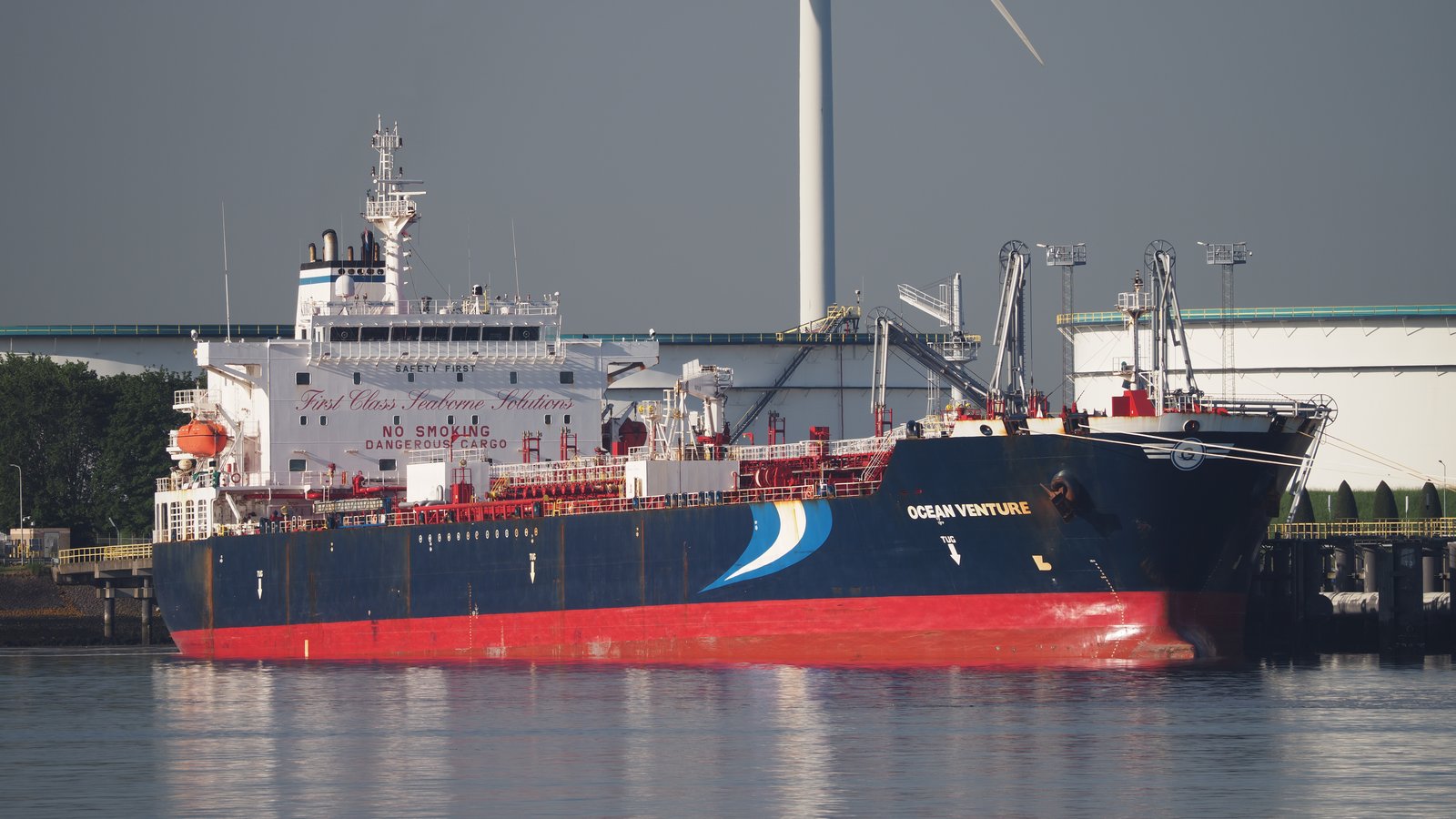
Predominantly VLCCs — Very Large Crude Carriers of around 300,000 tonnes deadweight, 330 m long, drawing 22 m loaded — plus Q-Max and Q-Flex LNG carriers, product and chemical tankers, and ordinary container and bulk traffic serving Dubai and the Gulf ports. Crews are overwhelmingly Filipino, Indian, Bangladeshi and Ukrainian, a fact worth holding on to when casualty figures appear.
🛤️ The Pipelines That Do Not Bypass Enough
Everyone who has ever looked at this map has asked the same question: why not build a pipeline around it? Several have been built. Together they cover a fraction of the traffic, and the arithmetic is the whole story of why the strait is a chokepoint rather than an inconvenience.
Saudi Arabia — the East–West line
The Petroline, running 1,200 km from Abqaiq on the Gulf coast to Yanbu on the Red Sea, with a nameplate capacity of around 5 million barrels a day. It is the single biggest bypass by a wide margin. It is also not spare capacity: much of it is in normal use, and Yanbu then feeds a Red Sea route that has its own security problem at Bab el-Mandeb.
UAE — Fujairah
The ADCOP line carries roughly 1.5–1.8 million barrels a day from Habshan across the country to Fujairah on the Gulf of Oman, outside the strait. Fujairah has become the region's bunkering and storage hub precisely because of where it is. It is genuinely useful and it moves less than a tenth of the strait's volume.
Iran — Goreh–Jask
Iran's own bypass, opened in 2021, running to Jask on the Gulf of Oman with a design capacity of around 300,000 barrels a day and, in practice, considerably less throughput than that. It exists so that Iran can export without transiting a strait it may want to close — a point that has not been lost on anyone.
The arithmetic
Total practical spare bypass capacity is usually put at around 2.5 to 3.5 million barrels a day against roughly 20 million going through the strait. That is 15% or less. And no pipeline carries LNG at all: Qatari gas is liquefied at Ras Laffan and can only leave by ship, through the strait. For LNG the bypass capacity is exactly zero.
🗺️ Map
The strait lies at roughly 26.6° N, 56.3° E. North of the water is the Iranian province of Hormozgan and the port of Bandar Abbas; south of it is the Musandam exclave of Oman. Dubai is 200 km west, Muscat 300 km south-east, and the Iranian city of Bandar Abbas sits directly on the northern shore.
The Iranian shore
Bandar Abbas is the main port and the headquarters of the Iranian navy; Bandar-e Lengeh lies to the west and Jask to the east, outside the strait. Offshore are Qeshm, Hormuz, Larak and Hengam, and further west the disputed Abu Musa and the Greater and Lesser Tunbs, held by Iran since 1971 and claimed by the UAE.
The Omani shore
Musandam, with Khasab as its small port and airfield. Oman has historically been the quiet party here: it maintains relations with Iran, hosted the back channel that produced the 2015 nuclear agreement, and its territorial water contains the shipping lanes. Its position in 2026 has been extraordinarily uncomfortable.
The Emirati flank
The UAE coast west of Musandam holds Dubai, Abu Dhabi and the huge container port of Jebel Ali, all of them inside the Gulf and therefore behind the chokepoint. Fujairah, on the eastern side of the peninsula, is the exception and the reason it has grown so fast.
Distances that surprise people
The narrows are only about 90 km from Ras al-Khaimah in the UAE and around 130 km from central Dubai. From the Iranian shore to the Omani shore is less than the distance from Prague to Plzeň. This is a very small piece of water to have this much of the world economy running through it.
👑 The Kingdom of Ormus
Long before oil, the same geography concentrated a different kind of wealth. The strait was a key link in the maritime Silk Road — the sea route by which Persian, Arab, Indian and Chinese goods moved between the Indian Ocean and the Gulf — and whoever controlled the narrows taxed all of it.
From roughly the eleventh century a princedom based at Old Hormuz on the Iranian mainland, and from about 1300 on the island itself, grew into one of the richest trading states in the Indian Ocean. Ormus at its height controlled the mouth of the Gulf, took a cut of the trade in horses, pearls, spices and silk, and became a byword in Europe for opulence.
Why on an island with no water
Because it was defensible and it was in the right place. Hormuz island has essentially no fresh water and no agriculture — everything, including drinking water, was shipped in from the mainland. A city of tens of thousands lived there anyway, entirely on the proceeds of the strait. It is possibly the purest example in history of a settlement that existed solely because of a chokepoint.
What the visitors said
Marco Polo passed through in the 1270s and was unimpressed by the ships (sewn with coir rather than nailed, which he thought unsafe — he was right). Two centuries later the Persian saying had it that "if the world were a ring, Ormus would be the jewel in it", and Milton put it in Paradise Lost alongside the wealth of India.
The pearls
Before oil, the Gulf's export was pearls. The banks off Bahrain, Qatar and the Trucial Coast supported an entire economy of diving fleets, and Ormus and later Bandar Abbas were where the trade was financed and taxed. It collapsed in the 1930s — destroyed not by war but by the Japanese cultured pearl, arriving at exactly the moment the Depression removed the customers.
What survives
On Hormuz island, the great Portuguese fortress of 1507 and the earthworks and cisterns of the old city; on Qeshm, the ruins of Portuguese Castle at the eastern end. The medieval city itself is largely gone. The population of Hormuz island today is a few thousand people in one village, on an island that once ran the mouth of the Gulf.
⚓ Albuquerque, 1507
In 1507 the Portuguese commander Afonso de Albuquerque arrived off Hormuz with six ships and about 500 men, bombarded the harbour, and forced the young king into vassalage. It was one of the founding acts of the first global seaborne empire, and its logic was the logic of this page: Albuquerque's strategy was to seize the chokepoints — Hormuz, Goa, Malacca, and, unsuccessfully, Aden — and thereby control the whole Indian Ocean trade without controlling any of the land behind it.
The fort
Building it began immediately; Albuquerque's own men mutinied over it and he had to withdraw and return. The Fort of Our Lady of the Conception was finished in 1515 and Portugal then held the island for a hundred and seven years, taxing every ship that entered or left the Gulf. Its red stone walls still stand on the northern shore of the island and can be walked around.
The end of it
In 1622 Shah Abbas I of Safavid Persia took Hormuz back with the help of the ships and guns of the English East India Company — an alliance of convenience that gave the English their foothold in the Gulf and Persia its port. The trade was moved to the mainland at Gombroon, renamed Bandar Abbas, "Abbas's port", which is the city on the northern shore of the strait today.
Why it is remembered here
Because the strategic idea has never changed. Albuquerque understood in 1507 that a narrow water can be worth more than a province, and every actor in this strait since — Persian, Ottoman, Dutch, English, Omani, American, Iranian — has been operating on the same insight. The technology is different. The map is not.
The Omani afterword
Oman drove the Portuguese out of Muscat in 1650 and went on to build a maritime empire of its own that reached Zanzibar and the East African coast, ruled from Muscat and for a time from Zanzibar itself. The Musandam side of the strait has been Omani ever since, and Oman's careful neutrality in Gulf quarrels is a habit of several centuries, not a recent policy.
🇬🇧 The British Century
From the early nineteenth century until 1971 the Gulf was, in practice, a British lake. It began as anti-piracy and ended as oil, and the political map it left behind — the borders, the emirates, the disputed islands — is the map the strait is fought over today.
The Trucial States
A series of maritime truces imposed by Britain from 1820 onwards on the sheikhdoms of the lower Gulf, suppressing raiding and, incidentally, freezing the ruling families in place. The Trucial States became, in 1971, the United Arab Emirates. Qatar and Bahrain went their own way in the same year. Britain guaranteed all of their external security for a century and a half.
Oil changes the stakes
The first Middle Eastern oil was struck in Persia in 1908 at Masjed Soleyman, and the Anglo-Persian Oil Company followed. In 1914 Churchill, as First Lord of the Admiralty, converted the Royal Navy from coal to oil and bought the British government a controlling share in the company — which made the Gulf, and therefore this strait, a permanent British strategic interest in a way it had never been before.
1953
The Anglo-Iranian Oil Company's refusal to renegotiate terms led Prime Minister Mohammad Mosaddegh to nationalise it in 1951. In 1953 a coup organised by the British and American intelligence services removed him and restored the Shah's personal rule. It is impossible to understand modern Iranian views of Western involvement in the Gulf without this, and it is invoked in Tehran to this day.
1971 — the handover and the islands
Britain withdrew from east of Suez in 1971. In the days around the handover, Iranian forces occupied Abu Musa and the Greater and Lesser Tunbs, small islands near the western approach to the strait claimed by Ras al-Khaimah and Sharjah. Iran has held them since; the UAE claims them still, every Gulf communiqué mentions them, and they sit directly on the shipping approach.
💥 The Tanker War, 1984–1988
Until 2026, the benchmark for how bad the Strait of Hormuz could get was the Tanker War: the maritime phase of the Iran–Iraq war, in which both sides attacked the other's oil exports and, before long, everybody else's shipping as well.
It began in earnest in 1984 when Iraq, unable to export through the Gulf itself, began striking tankers loading at Iran's Kharg Island terminal with French-supplied Exocet missiles. Iran retaliated against the shipping of Iraq's financial backers — Kuwait and Saudi Arabia — with mines, gunboats and, from 1987, Silkworm missiles fired from the coast.
The numbers
Over four years roughly 450 to 550 ships were attacked and something over 400 merchant seafarers were killed. Insurance rates rose sharply and traffic fell — but, and this is the important comparison, the strait never actually closed. Oil exports from the Gulf fell by perhaps a quarter at the worst; ships kept sailing because the money was good enough to cover the risk.
Operation Earnest Will
In 1987 Kuwait asked both superpowers for protection and got it: eleven Kuwaiti tankers were reflagged as American and escorted by the US Navy in convoys. It was the largest naval convoy operation since the Second World War and the precedent that every subsequent Gulf escort scheme, including the one in 2026, has been built on.
Mines and Praying Mantis
In April 1988 the frigate USS Samuel B. Roberts struck an Iranian mine and was nearly lost. The American response, Operation Praying Mantis on 18 April 1988, destroyed two Iranian oil platforms and sank or crippled roughly half the operational Iranian navy in a single day. It remains the largest US naval surface engagement since 1945, and it is the reason Iranian naval doctrine since has been asymmetric — mines, small fast craft, coastal missiles — rather than fleet-on-fleet.
Why the comparison matters
Analysts spent forty years treating the Tanker War as the worst case: a shooting war in the Gulf in which the strait stayed open. 2026 has been worse on every measure — traffic did not fall by a quarter, it fell by more than ninety per cent — and the comfortable assumption that the strait cannot really be closed because closing it would hurt Iran too has not survived contact with events.
✈️ Iran Air 655
On 3 July 1988, in the last weeks of the Tanker War, the American cruiser USS Vincennes — inside Iranian territorial waters, in a running gunfight with Iranian speedboats — fired two missiles at an aircraft climbing out of Bandar Abbas. It was Iran Air flight 655, an Airbus A300 on a scheduled twenty-eight-minute run to Dubai, and all 290 people aboard were killed, including 66 children.
What went wrong
The aircraft was on a published civil route, squawking a civil transponder code and climbing. The Vincennes' crew, in a stressful engagement and with a combat information centre that later inquiries criticised sharply, believed it to be a descending F-14. The identification was simply wrong, and the ship's own recorded data contradicted the crew's account of the aircraft's altitude trend.
What followed
The United States expressed regret and in 1996 paid $61.8 million in compensation as part of a settlement at the International Court of Justice, without an admission of liability or a formal apology. The commanding officer received the Legion of Merit for his tour. Both facts are cited in Iran constantly and have done lasting damage that no amount of subsequent diplomacy has undone.
Why it belongs on this page
Because it is the clearest illustration of the specific danger of this waterway: a very small space, full of civil traffic, in which armed forces on hair-trigger alert have minutes to identify contacts. Everything that made 655 possible in 1988 — the compression of time and distance, the mixing of civil and military traffic, the asymmetry of a superpower navy against small fast boats — is still true, and in 2026 it is true in a hotter war.
And the mirror case
Iranian air defences shot down Ukraine International Airlines flight 752 over Tehran on 8 January 2020, killing all 176 aboard, in the hours after Iranian missile strikes on US bases in Iraq. Iran initially denied it and admitted it three days later. The two disasters are not equivalent in every respect, but the mechanism — jumpy air defence, civil airliner, minutes — is the same one, and this region has now produced it twice.
🎯 Threats and Near-Misses, 1988–2025
For thirty-seven years after the Tanker War the strait stayed open, and the pattern was a recurring cycle: an Iranian threat to close it, usually in response to sanctions; a period of harassment and seizures; a de-escalation. The threats were routine enough that markets largely stopped pricing them.
The recurring threat
Senior Iranian officials threatened to close the strait in 2008, 2011–12, 2018 and 2019, generally in response to oil-export sanctions, with the standing formula that if Iran cannot export oil, nobody will. Each time, analysts pointed out that closure would cut Iran's own exports and antagonise China, its main customer — and each time, the strait stayed open. That track record is precisely why the 2026 closure was so widely under-predicted.
2019 — the tanker attacks
In May and June 2019 six tankers were damaged by limpet mines in the Gulf of Oman near Fujairah; the United States attributed the attacks to Iran, which denied them. In June Iran shot down an American RQ-4 Global Hawk drone, and in July it seized the British-flagged Stena Impero after Britain detained an Iranian tanker off Gibraltar. Insurance rates rose; traffic did not stop.
Seizures as policy
Iran has used tanker seizure as a bargaining instrument for years — the Advantage Sweet, the Niovi, the St Nikolas and others — usually in retaliation for a cargo confiscated elsewhere under sanctions. The ships are taken to Bandar Abbas, the crews are held for weeks or months, and the vessel is eventually released. It is coercion with a well-understood ceiling, and until 2026 it stayed under that ceiling.
The escort coalitions
Successive multinational operations have patrolled these waters: the Combined Maritime Forces at Bahrain, the American-led IMSC/Sentinel from 2019, and the European EMASOH/Agénor mission based in Abu Dhabi, which several EU states preferred to the American framework. All of them were designed for deterrence and reassurance against harassment — not for a war.
⚠️ 28 February 2026
How to read this section. Everything below is dated, attributed where the claim is contested, and reflects the public record as of 6 September 2026. In an active war the first account of any single incident is often wrong; casualty figures move for months and both governments contest each other's numbers. Where the parties disagree, that is said rather than resolved.
On 28 February 2026 the United States and Israel began a campaign of air and missile strikes against Iran, aimed at its nuclear and ballistic-missile programmes. Among those killed in the opening strikes was Iran's Supreme Leader, Ali Khamenei — an event without precedent in the history of the Islamic Republic. Iran subsequently named his son as successor and launched counter-strikes against Israel, American bases across the region, and targets in Arab states.
Within hours of the first strikes the Islamic Revolutionary Guard Corps issued warnings prohibiting vessel passage through the strait. Commercial traffic did not decline; it stopped. Ship-tracking data showed an initial fall of about 70%, and by 2 March tanker AIS signals in the strait were close to zero. Maersk, MSC and Hapag-Lloyd suspended transits entirely.
What made this different
Every previous Iranian threat to close the strait had been read as leverage rather than intent, on the reasoning that closure would strangle Iran's own exports and antagonise China. That reasoning held for thirty-seven years and then stopped applying, because the calculation changes when the state making it believes it is fighting for survival. The single most widely held assumption about this waterway turned out to be conditional.
The trapped fleet
The strait is a door, and when it shut it shut with people inside. On 21 April the International Maritime Organization reported roughly 20,000 mariners and 2,000 ships stranded inside the Persian Gulf — crews on ships that could not leave, many far past the end of their contracts, in a war zone, on vessels whose insurance had lapsed. It is the largest such entrapment since the ships stuck in the Great Bitter Lake in 1967.
The Tanker War comparison
Analysts had used the 1984–88 Tanker War as the worst case for four decades. That benchmark fell in the first week: the Tanker War reduced Gulf oil exports by roughly a quarter over four years, while the 2026 closure removed more than ninety per cent of traffic in a matter of days. This is the largest disruption to world energy supply since the 1970s.
What is not established
The internal Iranian decision-making, the precise sequence of the opening strikes, and the true casualty totals on all sides are not reliably known and will not be for years. Several widely reported individual incidents have been revised. Anyone claiming certainty about intentions — on any side — is going beyond the public record.
⛓️ How the Strait Was Closed
Iran did not close the strait with a fleet, because it does not have one that could survive contact with the United States Navy — that lesson was administered in 1988. It closed it with the tools of asymmetric naval warfare, and the striking thing is how few of them were needed. A waterway six kilometres wide does not have to be blocked; it only has to be made uninsurable.
Mines
US intelligence confirmed mine-laying from around 10 March. The American military said it had destroyed 16 Iranian minelayers; by August, more than 100 suspected mines had been identified in the traffic separation scheme alone. In 50–80 m of warm, silty, high-salinity water, bottom mines are hard to detect and slow to clear — a hundred mines is a season of work, not a weekend.
Small craft, missiles and drones
More than 67 documented attacks on vessels, using swarms of fast attack craft — of which the IRGC navy operates hundreds — together with anti-ship missiles and one-way drones. Ships were holed, set on fire, abandoned and in several cases sunk. The tug Mussafah 2 went down on 6 March with four crew; the tanker Safesea Vishnu burned on 11 March.
Electronic warfare
GNSS jamming and satellite spoofing on a large scale, feeding false positions to ships' navigation systems in the most confined and mine-threatened water in the world. This is the least visible of the tools and arguably the most effective: it degrades the ability to navigate a swept channel accurately, which is the entire premise of mine clearance.
Insurance — the actual mechanism
The strait was not closed by physics but by underwriting. War-risk premiums went from about 0.125% of hull value per transit to 0.2–0.4%, which on a $100 million VLCC turns a routine passage into a several-hundred-thousand-dollar line item — before anyone prices the cargo, the crew or the possibility of total loss. At that point most owners simply stop, and no navy can order them to start.
🛡️ The Naval Response
The American objective through 2026 has been to reopen the strait rather than to hold it, and the campaign has moved through several distinct phases — bombardment, blockade, escort, mine clearance — with a diplomatic track running alongside and repeatedly collapsing.
The campaign, from 19 March
The United States began a sustained aerial campaign against Iranian naval, missile and coastal-radar targets on 19 March, with the declared aim of reopening the waterway. The UAE conducted strikes on Lavan Island. Retaliatory exchanges have continued in cycles ever since, most recently in the first days of September.
Blockade and counter-blockade
From 13 April to 29 May the United States blockaded Iranian ports — a mirror-image measure whose legality was disputed and which foreclosed the diplomatic track it was meant to force. Iran for its part proposed toll systems and pre-approved routes for shipping, which the United States and international maritime bodies rejected as incompatible with freedom of navigation.
Escorted convoys
Operation Project Freedom, the merchant escort scheme, began on 4 May and was paused two days later for ceasefire talks. On 27 June the US announced a widened transit route hugging the Omani side. The result is neither closure nor free passage but a third thing: escorted, rationed transit, at a fraction of the old volume and at a cost most cargoes cannot bear.
Mine clearance
On 25 August US Central Command said it had cleared over 100 mines from the traffic separation scheme. This is genuine progress and it is not the same as reopening: clearance has to be verified, re-verified against re-seeding, and accepted by underwriters before commercial traffic returns. Mine clearance is measured in months and the confidence of insurers is measured in quiet weeks.
The diplomatic track, briefly. A temporary ceasefire on 8 April collapsed when the Islamabad talks failed. On 17 April Iran said it would allow commercial shipping; the American blockade continued and Iran reimposed restrictions. On 17 June the US president and President Masoud Pezeshkian signed the Islamabad Memorandum, the most substantial agreement of the war — and on 20 June Iran declared the strait closed again, citing violations that the US military denied. The interim truce collapsed on 8 July after further attacks on commercial ships. The memorandum is technically still in effect.
📉 The Energy Shock
March 2026 produced the largest monthly increase in oil prices ever recorded. Brent crossed $100 a barrel on 8 March for the first time in four years and peaked at about $126. In early September it was trading around $95, and the US Energy Information Administration's third-quarter forecast has been revised repeatedly upward through the year.
The volumes, quarter by quarter
Crude and petroleum liquids through the strait averaged 20.4–21.6 million barrels a day before the conflict. They fell to 14.6 mbd in the first quarter of 2026 and to 4.9 mbd in the second — a collapse of roughly three quarters against the baseline. The daily ship count tells the same story: 6 transits on 30 August against a normal 85 or more.
Rerouting, and what it cannot fix
Cargoes that can go another way do: around the Cape of Good Hope, at 10–14 extra days per voyage and the fuel to match, which absorbs tanker capacity globally and raises freight rates on routes that have nothing to do with the Gulf. But rerouting only helps a ship that has already loaded. For oil still inside the Gulf there is no other exit except the pipelines, and for Qatari LNG there is none at all.
Beyond oil
The shock has spread to every cargo the strait carries: fertiliser, and behind it the cost of the next harvest in importing countries; aluminium, smelted in the Gulf for its cheap power; and helium, most of the world's supply being a by-product of Qatari gas — with consequences for medical imaging and semiconductor fabrication that few people connected to a naval crisis in advance.
What it means in Czechia
No Czech cargo transits Hormuz and it does not matter. Diesel and petrol prices follow Brent with a lag of a couple of weeks, and European gas is priced on a single market in which Qatari LNG is a substantial share — so the closure of a strait 4,500 km away is visible on a Czech household's energy costs and on the input costs of every Czech manufacturer. Fertiliser prices feed through to food with a longer lag.
🕯️ Seafarers and Spills
The people who have paid for this crisis are, overwhelmingly, merchant seafarers — Filipino, Indian, Bangladeshi, Ukrainian and Chinese crews on ships flagged in Panama, Liberia and the Marshall Islands, who had no part in the quarrel and no way out of the Gulf.
The human toll
At least 20 seafarers killed, around 35 injured, and one port worker killed in the attack on the Stena Imperative on 2 March. Two crew on the Skylight, three on the Mayuree Naree, four on the Mussafah 2, two on the Sidr, and single deaths on several others. Multiple ships have been seized — among them the MSC Epaminondas, MSC Francesca, Ocean Koi, Hui Chuan and Kavomaleas — with their crews held.
Abandonment
Beyond the deaths is the slower harm: crews stranded for months past the end of their contracts on ships nobody will insure, in a war zone, with wages unpaid and no mechanism for relief. Maritime labour organisations have described it as the worst crew-welfare emergency in decades, and it is the part of this crisis with no headline attached to it.
Oil in the water
Multiple spills, several serious. The Sonangol Namibe on 4 March; the Parimal on 18 March; the Minoan Pioneer on 3 August, whose slick ran more than 10 km and had reached Qeshm Island by 10 August. Reports of a much larger spill from a stranded tanker, on the order of hundreds of square miles reaching the Omani coast, have circulated widely; the extent is contested and no independent survey has been published.
What the Gulf can absorb
Very little. The Persian Gulf is shallow, enclosed, and slow to flush — water exchange with the Indian Ocean takes years, and it does so through this same strait. It is already among the most heavily industrialised and hypersaline seas on Earth. Its coral, its mangroves and its dugong population were under severe pressure before 2026, and oil in a basin like this does not disperse and does not leave.
📡 Where It Stands — 6 September 2026
📅 Last checked: 6 September 2026. This section goes out of date faster than anything else on this site. If you are reading it long after that date, treat it as history and go to UKMTO, the IMO, and your national foreign ministry for the present state.
The honest summary is that the strait is neither closed nor open. It is not the total blockade of March and it is nothing like normal traffic: a handful of escorted transits a day against a normal eighty-five or more, under a memorandum that both sides accuse the other of violating, with mine clearance incomplete and war-risk premiums still at levels that price out most commercial cargo.
The traffic
Six ships transited on 30 August. As of 1 September, US forces reported having redirected 84 commercial vessels attempting to run the blockade, disabled three that did not comply, and boarded two. Iran continues to attack shipping it deems non-compliant with its own approval regime. Neither side's account of who controls the water is accepted by the other.
The first week of September
The heaviest exchange in more than a month. The US said it struck dozens of military targets along Iran's southern coast; Iran said an American bomb hit a wedding at Kuhestak, killing at least four and wounding dozens — a claim the United States has not accepted. Iran fired missiles at targets in Kuwait, Bahrain, Jordan and Iraq. On 1 September US forces struck two Iranian government tankers at anchor, described as retaliation for attacks on the Sidr and the Senegal Prosperity.
The spillover
This has never been contained to the strait. Iranian strikes have hit targets in Oman, the UAE, Kuwait, Bahrain, Jordan and Iraq; Qatari-owned vessels including the LNG carrier Al Rekayat have been attacked. Houthi forces in Yemen have threatened to widen the maritime conflict into the Red Sea, which would remove the Suez alternative as well. China and Russia vetoed a Security Council resolution on the strait on 7 April.
What would count as reopening
Three things together, and only together: verified mine clearance of the traffic separation scheme; a ceasefire that holds for weeks rather than days; and war-risk premiums falling back toward pre-crisis levels. The third is the real test, because it is the one that cannot be announced — it happens only when underwriters believe the first two. Nothing about the position in early September suggests that is imminent.
🏝️ Hormuz Island
The island that gave the strait its name is small — about 42 km², an hour by ferry from Bandar Abbas — and is one of the strangest-looking places in Asia. It is a salt dome that has pushed seventy different minerals to the surface, so the ground is genuinely red, ochre, violet, yellow and white, and the sea at the shoreline runs pink where the runoff meets it.
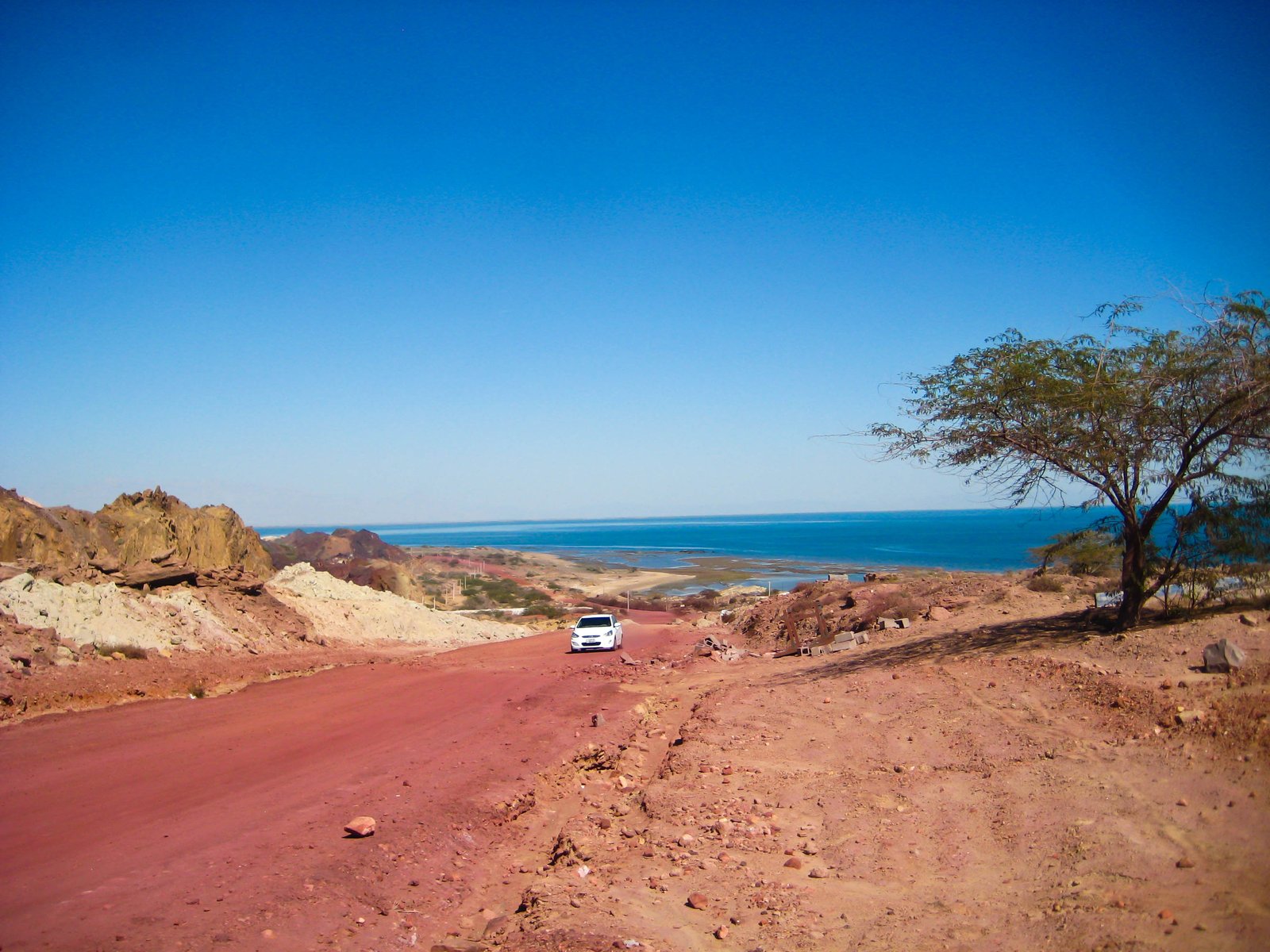
Gelak — the edible earth
The red ochre is called gelak, and it is exported as pigment and, locally, eaten: it goes into a bread-and-sauce dish called suragh, and into fish sauces. This is not folklore for tourists — it is ordinary island cooking, and the mineral is high enough in iron oxide that it has been quarried commercially for paint and cosmetics. Extraction is now regulated because it was outrunning the island.
Rainbow Valley and the salt goddess
The interior is a badland of banded hills — the Rainbow Valley, the Silver Beach where salt crystals glitter along the tideline, and the Valley of Statues where erosion has left shapes people name after animals. The island is small enough to circle by motorbike or tuk-tuk in a few hours, which is how nearly everyone sees it.
The Portuguese fort
The Fort of Our Lady of the Conception, begun by Albuquerque in 1507 and completed in 1515, stands on the northern shore in red stone quarried from the island itself. It held the mouth of the Gulf for over a century. The medieval city of Ormus around it is essentially gone — cisterns, foundations and earthworks.
The art on it
Two projects put Hormuz on the Iranian domestic tourist map. The environmental artist Ahmad Nadalian has for years made enormous sand carpets on the shore from the island's own coloured soils, laid out like Persian rugs and left to the tide. And in 2020 ZAV Architects completed the Majara residence — a cluster of small coloured domes built by islanders using the SuperAdobe earthbag technique developed by the Iranian-American architect Nader Khalili — which has been widely published and is the image most people now have of the island.
🪨 Qeshm
Qeshm is the largest island in the Persian Gulf — around 1,500 km², longer than Luxembourg is wide, with about 150,000 people — and it lies along the northern side of the strait like a breakwater. It is a free-trade zone, a naval area, a UNESCO Global Geopark and, geologically, one of the most interesting islands in the region.
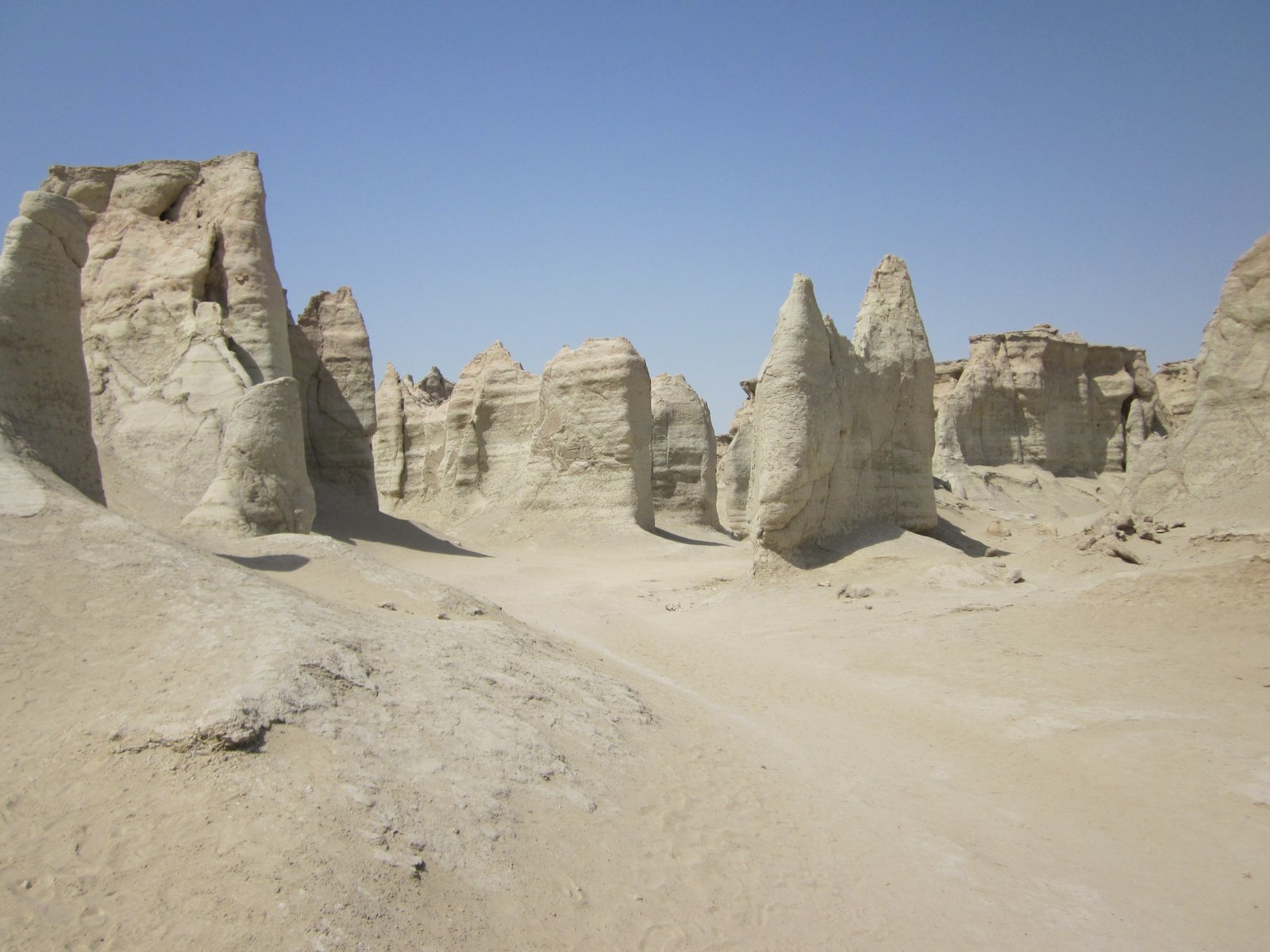
The geopark
Iran's first UNESCO Global Geopark, designated for the salt dome, the caves and the erosion landforms. The Namakdan salt cave is over 6 km long — among the longest salt caves in the world — with salt stalactites and a stream running through it. Chahkooh is a slot canyon cut into pale rock, and the Valley of Stars is the photogenic one.
Hara — the mangroves
The Hara Protected Area between Qeshm and the mainland is one of the largest Avicennia marina mangrove forests in the region, a Ramsar site, and a nursery for the whole northern Gulf's fish stocks as well as a wintering ground for herons, flamingos and waders. You go through it by boat at high tide. Oil in the water here would be an ecological event of the first order.
The lenj
Qeshm and the Hormozgan coast build lenj — traditional wooden dhows — and the knowledge of building and sailing them, including a body of navigational lore and sea shanties, is on UNESCO's list of intangible heritage in need of urgent safeguarding. The same boats have carried a brisk informal trade to Dubai for as long as anyone can remember.
Salakh and the shipyards
Village life on Qeshm is fishing, boatbuilding and, increasingly, the free-zone economy at Qeshm town. The island also holds Iranian naval and missile facilities, which is why parts of it are closed and why photography near the coast is a bad idea in normal times and an extremely bad idea now.
⚓ Bandar Abbas and the Northern Shore
Bandar Abbas — "Abbas's port", named for the shah who took Hormuz back from Portugal in 1622 — is the city on the strait: about 650,000 people, the capital of Hormozgan province, Iran's main container port at Shahid Rajaee, and the headquarters of the Iranian navy. It is also brutally hot and humid, with summer conditions that regularly reach the limits of what is survivable outdoors.
The port
Shahid Rajaee handles the large majority of Iran's container throughput and a great deal of its oil products. It has been sanctioned, expanded, sanctioned again, and in 2025 suffered a catastrophic explosion at a chemical storage area that killed dozens. It is the economic reason Bandar Abbas exists and the strategic reason it is a target.
The people
Hormozgan is not culturally central Iran. The coast is Bandari — Persian Gulf coastal culture with deep African, Arab and Indian threads from centuries of trade and from the slave trade that ran up this coast. Bandari music, with its distinctive rhythm and the ney anban bagpipe, is the region's best-known export, and the coastal dialect is not readily intelligible to a Tehrani.
The burqa
Women in parts of Hormozgan and on the islands wear the boregheh, a stiff gold-and-black mask covering the upper face, unlike anything worn elsewhere in Iran and closely related to masks worn across the Gulf in Oman and the UAE. It is a coastal, not a national, tradition and is worn less by younger women than it was.
The heat
The strait sits at the intersection of a very hot land mass and a shallow sea that reaches over 33 °C in summer. The combination produces some of the highest wet-bulb temperatures ever recorded on Earth — conditions in which sweat no longer cools the body — measured on this coast and across the water at Dhahran. Climate models put the Gulf coast among the first inhabited places to cross that threshold routinely.
🐋 What Lives in the Water
It is easy to forget that the most industrialised strategic waterway in the world is also a sea. The Persian Gulf is shallow, enclosed, extremely saline and extremely hot, and the life in it is correspondingly specialised — including corals that survive summer temperatures that would kill reefs anywhere else on the planet.
The heat-proof corals
Gulf corals routinely endure 35 °C water — several degrees above the bleaching threshold for the same species elsewhere — through a combination of heat-adapted symbiotic algae and the corals' own physiology. They are studied intensively as a natural laboratory for what reefs elsewhere may have to do to survive this century. They are also already stressed, and an enclosed basin absorbs oil the way a bathtub does.
Dugongs and turtles
The Gulf holds the second-largest dugong population in the world after Australia — several thousand animals grazing seagrass beds in shallow water — and nesting beaches for hawksbill and green turtles on the Iranian islands and along the Arabian coast. Both are exactly the shallow-water, coastal species that an oil slick harms most.
Whale sharks and the strait
The strait is a migratory funnel as much for animals as for cargo. Whale sharks aggregate seasonally off Qatar and move through; humpback whales of the isolated Arabian Sea population — perhaps a hundred animals, the world's most endangered and the only non-migratory humpbacks — live just outside it. Underwater noise from naval activity is a documented problem for all of them.
Birds
The mangroves and mudflats of Qeshm and the Iranian coast are a major staging post on the Central Asian flyway: flamingos, crab plovers, herons, and enormous numbers of waders wintering on the intertidal flats. The Hara forest is a Ramsar site precisely for this. Very little of this is monitored at present, for obvious reasons.
📋 Practical Information — and the Short Version Is Don't
⚠️ Do not travel to the Strait of Hormuz, its islands, or the Iranian Gulf coast. This is an active war zone with ongoing air strikes, naval combat and missile exchanges reaching neighbouring states. There is no version of this trip that is responsible in September 2026. The section below exists to say that clearly, to point at the sources that will tell you when it changes, and to describe what visiting was like when it was possible.
For Czech travellers
The MZV ČR travel advisory for Iran is at the highest level and covers the whole country; the Gulf states have their own current warnings and several have been struck. The Czech Embassy in Tehran is the responsible mission and its capacity in wartime is limited — an embassy cannot extract you from a closed airspace. Register in DROZD if you are anywhere in the region for any reason, and note the mzv.cz emergency line before you go rather than after.
Insurance
Standard Czech travel insurance excludes war and civil unrest as a matter of course, so a policy bought for a Gulf trip today is very likely worth nothing in the circumstances that would make you need it. Specialist war-risk cover for individuals exists, costs a great deal, and requires you to have a reason. Read the exclusions rather than the brochure.
If you have an operational interest
Shipping, insurance, chartering or energy trading: use UKMTO (UK Maritime Trade Operations, Dubai) for reporting and advisories, the IMO circulars, your P&I club and flag state, and a specialist maritime risk service. Do not use a travel page — this one included — as an input to a routing or underwriting decision.
What it was like before
For the record, because it will be true again: Hormuz and Qeshm were cheap, easy and startlingly beautiful. Ferries ran from Bandar Abbas several times a day, the islands were done by tuk-tuk or motorbike, the guesthouses were family homes, the food was fish and rice and dates, and Iranian hospitality on that coast was on the level that makes people book a second trip before they leave. Winter — November to March — was the season; the summer is genuinely dangerous heat.
✍️ Author's Note
This page had to be rewritten rather than merely reformatted, because the previous version described the situation as understood in August 2026 and events have moved. That is going to keep happening. A page about an active war is a snapshot with a date on it, and the most useful thing it can do is say so loudly and point at sources that update faster than it does.
Two editorial rules were applied throughout. First, every claim about the war is dated, and where the two sides give different accounts — the strike at Kuhestak, who controls the water, the size of the largest oil spill — the disagreement is stated rather than resolved in favour of whichever version reads better. Second, the page takes no position on the war's causes or justification. It is a reference on a waterway, and there are better places to argue about the rest.
The one editorial judgement worth flagging: the section on the Tanker War is longer than a purely current-events page would need, because the forty-year habit of treating 1984–88 as the worst case is exactly the assumption that failed in March. It seemed worth showing the benchmark that broke rather than just asserting that it did.
On the images
There is no image folder for this page at all — every photograph here is borrowed from the Iran country set, and only three of that set have anything to do with the strait. The two used at full size are genuine and accurate: the red soil of Hormuz Island, which really is that colour and really is iron oxide from the salt dome, and the Valley of Stars on Qeshm, which is exactly what it looks like. Both are inside the strait.
The third, the tanker, is the honest problem. It is a real photograph of a real ship, but it was taken in a northern European port — the wind turbine and the grey light give it away — and the vessel is a mid-sized product tanker rather than the VLCC that dominates Hormuz traffic. It is kept because a page about a waterway should show a ship, and the caption says plainly what it is and is not. There is no photograph of the strait itself on this site, and given the circumstances there is not going to be one soon.
Support This Project 🌍
This World Travel Factbook is a labor of love – free to use for all travelers. If you find it helpful, consider supporting its continued development.