

🇰🇮 Kiribati at a Glance
🌍 Overview
Kiribati — pronounced KIRR-i-bass, because in Gilbertese the letters ti make an s sound — is 33 coral islands with a combined land area of 811 km², roughly the size of Prague and its outer suburbs, spread across 3.5 million km² of ocean. It is the only country on Earth located in all four hemispheres, and it straddles the international date line so completely that it had to bend the line to keep one calendar.
About 136,000 people live there, over half of them crammed onto the thin ribbon of South Tarawa at densities comparable to Tokyo. The average elevation is around two metres. Nothing about how this country works can be understood without holding those two numbers together.
The state
A republic with a directly elected president, the Beretitenti, who must be nominated from among elected members of the Maneaba ni Maungatabu, the 45-seat parliament, and is limited to three four-year terms. Taneti Maamau has been president since 2016 and won a third and final term in November 2024. Independence from Britain came on 12 July 1979. See the politics section.
The people
Almost entirely I-Kiribati, a Micronesian people with strong Polynesian admixture in the south, speaking Gilbertese (te taetae ni Kiribati) with English as the second official language. It is a young population and a rapidly urbanising one: the drift from the outer islands to South Tarawa is the country's largest internal social problem after the sea itself.
The economy
One of the least diversified in the world. Fishing licences sold to foreign fleets — mostly for skipjack tuna — have provided over 70% of government revenue in recent years. Beyond that: copra, a sovereign wealth fund built from phosphate money that ran out in 1979, remittances from I-Kiribati seafarers, and aid. There is almost no manufacturing, almost no arable soil, and a trade deficit that is structural rather than cyclical.
What visiting is like
Genuinely difficult, genuinely rewarding, and not a beach holiday. Flights are few and cancel. Accommodation on Tarawa is basic and not cheap. There is very little to buy, almost no tourism infrastructure outside Kiritimati's fishing lodges, and the water and sanitation situation on South Tarawa is poor. What you get in exchange is one of the least-visited countries on the planet and a culture that has not been reshaped for visitors, because there are hardly any.
🏷️ The Name, the Sound and the Date Line
Kiribati is the Gilbertese rendering of "Gilberts" — the islands were named after Thomas Gilbert, a British captain who sighted them in 1788. Gilbertese has no l, no g and no s, so Gilberts became Kiribati, and the ti combination is pronounced s. Saying "kirri-BAH-tee" is the single most reliable way to mark yourself as someone who has never met an I-Kiribati.
The date line bend
At independence, Kiribati's eastern islands were a full day behind the west — the date line ran through the middle of the country, so Tarawa and Kiritimati kept different calendars and had only four shared working days a week. On 1 January 1995 the government moved the line east around the whole country. The Line Islands went to UTC+14, the furthest-forward time zone on Earth, which is how a nation of 136,000 people came to own the first sunrise of every day, and of every millennium.
Caroline Island, renamed
Ahead of the year 2000, Kiribati renamed Caroline Island — an uninhabited atoll at the eastern edge of the country — Millennium Island, and it did indeed see the first sunrise of the new millennium, on 1 January 2000. Tonga and New Zealand objected on various grounds. It remains uninhabited and is one of the most pristine atolls in the Pacific, precisely because nobody lives there.
Three island groups
Kiribati is really three countries that share a passport. The Gilbert Islands in the west hold almost the entire population and the capital. The Phoenix Islands in the middle are essentially uninhabited — one settlement, on Kanton, with a couple of dozen people. The Line Islands in the east, over 3,000 km from Tarawa, hold Kiritimati and a few thousand people. Flying from one end of the country to the other is harder than flying to Australia.
The flag
A rising golden sun over three white and blue wavy bands, with a golden frigatebird in flight above it. The sun is the equator and the first sunrise, the seventeen rays are the sixteen Gilbert Islands plus Banaba, the three waves are the three island groups, and the frigatebird — te eitei — is command of the sea and freedom. It was designed in 1932 by Sir Arthur Grimble, a colonial administrator whose memoir A Pattern of Islands is still the best-known book about the place.
🗺️ What an Atoll Actually Is
To understand Kiribati you have to understand the atoll, because almost the entire country is one — and an atoll is not an island in any ordinary sense. It is a rim of coral sand sitting on the drowned summit of a volcano, holding a lagoon, and it exists only because a living reef keeps building faster than the sea rises.
How they form
Darwin worked it out in the 1830s and was proved right by drilling a century later. A volcano rises from the seabed; a fringing reef grows around it in the warm shallow water; the volcano cools, subsides and eventually vanishes below the surface — but the reef keeps growing upward toward the light. What is left is a ring of reef enclosing a lagoon where the mountain used to be. The land on top is broken coral and shell, ground fine by waves and heaped up by storms.
The dimensions
A typical Kiribati islet is a few hundred metres wide and two to three metres above sea level at its highest natural point. Tarawa's lagoon is roughly 500 km²; its land is about 31 km². Kiritimati is the exception and the outlier — at 388 km² it is the largest coral atoll in the world by land area and holds nearly half of all Kiribati's land in a single island.
The freshwater lens
The thing that makes atolls habitable and that almost nobody outside them knows about. Rainwater soaking into the porous coral does not mix immediately with the seawater below; it floats on it as a lens of fresh water, held in place by density. That lens is the entire water supply of an atoll community. It is thin, it shrinks in drought, and it is contaminated from above by sanitation and from below and the sides by saltwater intrusion when the sea rises or storms wash over. Kiribati's water crisis is a lens crisis.
What grows there
Almost nothing, and everything the culture is built on. There is no soil worth the name — just coral sand with very low nutrients and no capacity to hold water. What survives: the coconut palm, which supplies food, drink, oil, fibre, thatch and timber; pandanus, whose fruit is the traditional preserved staple; breadfruit; and babai, giant swamp taro, grown by digging pits down to the freshwater lens and feeding the plants for years with compost and leaf mulch. Everything else is imported.
Banaba, the odd one out
Banaba (Ocean Island), 400 km west of the Gilberts, is not an atoll but a raised limestone island — an uplifted reef, 81 m high, the highest point in the country. That geology made it a solid mass of high-grade phosphate rock, which is why it was mined nearly to destruction and its people relocated to Fiji. See the Banaba section.
Climate
Equatorial and, crucially, outside the main cyclone belt, which is the one piece of geographical luck Kiribati has. The Gilberts get around 2,000 mm of rain a year in the north and far less in the south, where droughts of a year or more happen. Everything is dominated by ENSO: El Niño brings rain and higher sea levels to the Line Islands and can be catastrophic for coral; La Niña brings drought to the Gilberts. Temperatures sit near 28–32 °C year round with almost no seasonal variation.
🌊 Sea Level — the Real Story
📅 Checked 6 September 2026. This is the section most people come to this page for, and it is also the one most often reported badly in both directions — as either an imminent disappearance or an overblown scare. Neither is right.
The physical facts
Global mean sea level is rising and the western Pacific is rising faster than average. Kiribati's inhabited islets average two metres of elevation. The IPCC's central projections put global rise at roughly 0.44–0.76 m by 2100, with high-emission and ice-sheet-collapse scenarios substantially worse. Over half of South Tarawa's land is exposed under mid-century high-water scenarios, and something over 60% of the island's population lives on it.
What is already happening
Not future tense. King tides flood roads, houses and graveyards in Betio and Bairiki several times a year. Saltwater intrusion has killed babai pits and coconut stands and is degrading the freshwater lens. Coastal erosion has taken land in living memory and villages have been moved. The 2015–16 El Niño produced flooding and then a severe drought. None of this requires a projection to observe.
The complication nobody mentions
Atolls are not concrete: they are made of sand and rubble that the reef continually produces and waves continually rearrange. Studies of atoll shorelines across the Pacific have found that many islets have been stable or have grown in area over recent decades, moving and reshaping rather than drowning. This is real and it is misused in both directions. It does not mean Kiribati is safe: an islet that keeps its area while migrating across the reef and losing its freshwater lens is uninhabitable long before it is underwater. Habitability fails first.
The 2026 research
A study published in January 2026 on wave events at Tarawa found that extreme waves cluster during El Niño, when water levels are already elevated. It projected that wave height on the lagoon-facing shore during El Niño westerly wind bursts could rise by up to 89%, with wave energy more than tripling, by 2100 under high sea-level rise. The lagoon shore is where the people, the roads and the causeway are. Wave energy, not slow inundation, is the mechanism that will do the damage.
What Kiribati is doing
Three tracks at once. Adaptation: seawalls, mangrove planting, water security, and a long-discussed plan to raise and reclaim land on Tarawa with dredged material, for which China is a prospective funder. Migration with dignity: the policy under President Anote Tong of training I-Kiribati so that if they must leave, they leave as skilled migrants rather than as refugees. And in 2014 Kiribati bought roughly 2,200 hectares of land on Vanua Levu in Fiji — officially for food security, and openly discussed as a fallback.
The legal question
If a state's territory becomes uninhabitable, does the state cease to exist — and what happens to its 3.5 million km² of ocean, which is the source of nearly all its income? Kiribati and its neighbours have pushed hard, with some success, for the international principle that maritime boundaries once declared should be permanent regardless of shifting coastlines. There is no established category of climate refugee in international law; a New Zealand case brought by an I-Kiribati man failed on exactly that point in 2015.
🛶 Settlement, Navigation and the Maneaba
Getting there at all
The Gilberts were settled by Austronesian voyagers around 3,000 years ago, in an act of navigation that remains one of the great human achievements: finding a two-metre-high sand ridge in an empty ocean, deliberately, and doing it repeatedly. Later contact with Samoa, Tonga and Fiji brought Polynesian influence, particularly in the southern Gilberts, and produced the culture, language and social order that exists today.
Navigation without instruments
I-Kiribati navigators worked by star paths, swell patterns, cloud formations, bird behaviour and the phosphorescence in the water, and taught it through a stick-and-shell star compass and long memorised chants. Crucially they read the interference patterns of ocean swells refracting around islands — the way to detect land far beyond the horizon. Almost all of this knowledge is now held by a small and ageing number of people, and its documentation is a live cultural project.
The maneaba
The maneaba is a huge open-sided meeting house with a low sweeping thatched roof, and it is the central institution of I-Kiribati life. Every village has one. Inside, each family has an inherited seating place, the boti, and decisions are made by discussion to consensus under the authority of the unimwane, the old men. The national parliament is called the Maneaba ni Maungatabu and is built as one. Enter barefoot, keep your head lower than the elders', and wait to be told where to sit.
The traditional order
Land was and largely remains held by extended families, with rights recorded in memory and now in courts that spend much of their time on land cases. Society in the north was more egalitarian; the southern islands had strong chiefly lines, particularly on Abemama, Butaritari and Tabiteuea. Fighting was real — shark-tooth swords and armour woven from coconut fibre, some of the most distinctive material culture in the Pacific, and now in museums in Europe rather than in Kiribati.
Contact
Whalers from the 1820s, then traders after coconut oil and copra, then blackbirders — labour recruiters who took several thousand I-Kiribati to plantations in Fiji, Samoa, Hawaii and Peru, sometimes by contract and sometimes by force. Missionaries arrived from the 1850s, dividing the group between Protestant north and Catholic south along lines still visible today. Introduced disease did what it did everywhere.
The colony
Britain declared a protectorate over the Gilbert and Ellice Islands in 1892, largely to regulate the trade and the labour recruiting, and annexed the group as a colony in 1916, adding Banaba, the Line Islands and the Phoenix Islands. It was administered lightly and cheaply from Ocean Island and later Tarawa, and its most lasting colonial legacy is the phosphate hole where Banaba used to be.
⛏️ Banaba — a Country Sold for Fertiliser
The single most consequential thing Britain did in Kiribati was to dig up an entire island and ship it to New Zealand and Australia as fertiliser, and then move the people who lived on it 2,600 km away. It is not a footnote; it is the reason Kiribati has a sovereign wealth fund and the reason it has a permanent open wound.
The discovery
In 1900 a prospector named Albert Ellis identified a lump of rock being used as a doorstop in a Sydney office as high-grade phosphate — and traced it to Banaba and to Nauru. Banaba turned out to be almost entirely phosphate: millennia of seabird guano on an uplifted limestone island. A licence was obtained from Banaban leaders who did not read English, for £50 a year.
The mining
Over roughly seventy years the British Phosphate Commissioners removed around 22 million tonnes of rock, stripping about 90% of the island's surface down to bare limestone pinnacles. The phosphate went to the farms of Australia and New Zealand and is a real part of why their agriculture became productive. Royalties to the Banabans were a fraction of the value; much of what was paid was held in trust and administered elsewhere.
The removal
During the Japanese occupation in the Second World War the Banabans were deported to Nauru, Tarawa and Kosrae, and many died. After the war, rather than returning them home, the colonial authorities bought Rabi Island in Fiji with Banaban trust money and resettled the entire population there in 1945 — 2,000 km away, in a completely different climate, on a volcanic island where nothing they knew about food or fishing applied. Their descendants are still there, about 5,000 of them, holding Fijian citizenship and a Kiribati seat.
The court case
In 1975–76 the Banabans sued the British Crown in the High Court in London — Tito v Waddell — in one of the longest trials in English legal history. They largely lost on the legal points. The judge's finding that the Crown's conduct had been less than admirable was cold comfort. An ex gratia payment of A$10 million was eventually made by Australia, New Zealand and Britain into a Banaban trust fund.
What is left
About 300 people live on Banaba today, on the unmined coastal strip, dependent on shipped water and irregular supply vessels, among rusting mining plant and a moonscape of limestone pinnacles. It has its own guaranteed seat in the Kiribati parliament and a special constitutional status. Getting there is extremely difficult and requires permission. It is, by some distance, the most sobering place in the country.
The money
Kiribati's phosphate royalties were placed in the Revenue Equalisation Reserve Fund, established in 1956 and one of the world's oldest sovereign wealth funds. Mining ended in 1979, the year of independence, taking with it the great majority of national revenue overnight. The RERF still exists, is worth several times GDP, and is the reason the state did not simply collapse — a rare case of colonial extraction money actually being saved.
💣 The Battle of Tarawa
For seventy-six hours in November 1943, a coral islet of about two square kilometres at the western end of Tarawa atoll was the most violent place on Earth. Betio is now the most densely populated part of Kiribati, and people live on top of it.
Why Betio
Japan occupied the Gilberts days after Pearl Harbor and fortified Betio heavily, building an airfield and a defensive system of concrete bunkers, coconut-log seawalls and interlocking fields of fire under Rear Admiral Keiji Shibasaki, who is supposed to have said that a million men could not take it in a hundred years. The United States needed the airfield to open the drive across the central Pacific, and Operation Galvanic was the first American amphibious assault against a heavily defended beach.
The tide
The disaster of the first day came down to water depth. Planners were warned that a neap tide might leave insufficient water over the fringing reef; the landing went ahead anyway. Landing craft grounded on the reef hundreds of metres out and Marines had to wade in across open shallows under machine-gun fire from the seawall. Only the tracked amphibious tractors got across, and there were not enough of them.
The cost
In seventy-six hours, roughly 1,000 US Marines and sailors were killed and over 2,000 wounded. Of about 4,700 Japanese and Korean defenders and labourers, seventeen Japanese soldiers and 129 Korean labourers survived. The photographs and film that came back — the first American combat dead shown to the US public — caused a political shock and directly changed how subsequent landings were planned.
The I-Kiribati in it
Largely written out of the accounts. Islanders were on Betio and the neighbouring islets throughout, were used as forced labour by the Japanese garrison, and were killed by both sides' fire. On Butaritari and Abemama, I-Kiribati and a handful of Europeans who stayed behind as coastwatchers were executed by the Japanese; twenty-two of them, including seventeen New Zealanders, were beheaded on Betio in October 1942 after an American raid.
What is there now
Betio today is a working port, a fuel depot, a causeway terminus and a dense town of tens of thousands of people, with the war lying openly around and under it. Japanese 8-inch coastal guns still stand on their mountings, concrete bunkers are used as shelter and storage, the sunken hulks are dive sites, and rusting amphibious tractors sit on the reef. Human remains are still recovered — an American recovery organisation has found and repatriated hundreds of Marines from Betio in the past decade, and construction work regularly turns up more.
Visiting it decently
The sites are unmarked, unfenced and lived in. Do not climb on the guns, do not enter bunkers people are using, do not remove anything — souvenir-hunting on Betio is taking objects from what is functionally a mass grave, and unexploded ordnance is a real hazard. Ask locally; there are guides in Betio who know exactly what is where and whose fathers and grandfathers were there.
☢️ Nuclear Tests and Independence
Kiritimati and the bombs
Between 1957 and 1958 Britain detonated its first megaton-range hydrogen bombs in Operation Grapple at and near Kiritimati and Malden Island. The United States followed with Operation Dominic in 1962, running some two dozen further atmospheric tests from Kiritimati. Between them, more than thirty nuclear devices were exploded in Kiribati's sky.
Who was standing there
British servicemen were ordered to sit on the beach with their backs to the blast, in shorts, with their hands over their eyes. I-Kiribati islanders were not evacuated for much of the testing programme; accounts describe people watching from Kiritimati and from Fanning Island, and being told to look away. The subsequent history of cancers, blood disorders and birth defects among both veterans and islanders has been fought over for sixty years, and British nuclear test veterans only won limited recognition after decades of campaigning. Kiribati has never been compensated.
The road to independence
The colony moved slowly toward self-government through the 1960s and 70s. The Ellice Islands, whose Polynesian population feared domination by the more numerous Micronesian Gilbertese, voted overwhelmingly in a 1974 referendum to separate and became Tuvalu in 1978. The Gilbert Islands became the independent Republic of Kiribati on 12 July 1979, with Ieremia Tabai, aged 29, as the world's youngest head of state.
The timing
Independence arrived in the same year that phosphate mining on Banaba ended. A country of 60,000 people took on sovereignty at the precise moment its only significant export ceased. That it did not collapse is down to the RERF, to fishing licences, and to a great deal of aid — and it explains why Kiribati's foreign policy has always been, of necessity, about extracting value from things other countries want.
The Treaty of Tarawa
In 1979 the United States, which had claimed fourteen islands in the Phoenix and Line groups under the nineteenth-century Guano Islands Act, signed a treaty relinquishing all of them to Kiribati. The treaty also gave the US a say in any third-country military use of those islands — a clause that reads very differently now that the Pacific is contested again.
The Kiribati diaspora
There is a long tradition of I-Kiribati men serving as merchant seafarers, trained at the marine school on Tarawa, and their remittances have been a significant part of the economy. There are also seasonal-worker schemes with New Zealand and Australia, and communities in Fiji, New Zealand and the Solomon Islands. For a country with almost no domestic labour market, working abroad is not a lifestyle choice but the plan.
🏛️ Politics Now — 6 September 2026
📅 Checked 6 September 2026. Kiribati is midway through a presidential term that constitutionally cannot be extended, which makes the succession the live question.
The system
Unusual and worth understanding. Voters elect the 45-member Maneaba ni Maungatabu; the members then nominate three or four of their own number as presidential candidates, and only those nominees go to a national popular vote. The Beretitenti is head of state and government and serves a maximum of three four-year terms. If parliament passes a vote of no confidence, the government falls and a Council of State runs the country until fresh elections — which has happened.
Taneti Maamau
President since 2016, re-elected in 2020 and again in November 2024 with about 55% against Kaotitaake Kokoria's 42%, on his third and final term. His Tobwaan Kiribati Party government has been defined by the pivot to China, the KV20 twenty-year development vision, and a willingness to break with regional orthodoxy. The 2024 result was widely read as a popular endorsement of the China relationship.
The switch to Beijing
In September 2019 Kiribati severed relations with Taiwan and recognised the People's Republic of China, days after Solomon Islands did the same. Kiribati had recognised Taiwan since 2003, and the switch split Maamau's own party and drew sharp criticism at home. Since then Chinese engagement has covered agriculture, fisheries, and a much-discussed proposal to upgrade the Second World War airstrip on Kanton in the Phoenix Islands — an airfield 3,000 km from Hawaii, which is why that particular runway is the subject of a great deal of attention in Washington and Canberra.
The Pacific Islands Forum
Kiribati announced its withdrawal from the Forum in 2022 alongside other Micronesian states over the appointment of the secretary-general, then returned in 2023 after the Suva Agreement. The episode showed both the region's fault lines and Kiribati's willingness to walk out of a room, which is a small state's most reliable form of leverage.
What actually dominates domestic politics
Not geopolitics. It is the cost of imported food and fuel, water and sanitation on South Tarawa, overcrowding, the state of the inter-island shipping and air services, land disputes, and outer-island neglect. A member of parliament from Butaritari is judged on whether the ship came. The judiciary has also been in open crisis: in 2022 the government suspended the Chief Justice and then the entire Court of Appeal bench, all foreign judges, in a dispute that drew formal concern from Australia, New Zealand and the international legal community.
The 2026 position
Maamau cannot stand again in 2028, so the manoeuvring over who succeeds him — and whether the China alignment survives him — is under way. Former president Anote Tong, internationally the best-known I-Kiribati figure for his climate advocacy, remains an influential critic. For a country of 136,000 people, Kiribati is subject to an extraordinary amount of great-power attention, and its politicians are entirely aware of what that is worth.
💰 An Economy Made of Fish Licences
The tuna
Kiribati's 3.5 million km² exclusive economic zone — one of the largest in the world — sits over the richest skipjack tuna grounds on the planet. Kiribati does not fish it at industrial scale; it sells the right to, to Chinese, Taiwanese, Korean, Japanese, American and European fleets. Between 2018 and 2022 those licences consistently supplied over 70% of total government revenue. It is, in effect, rent on an ocean.
The Vessel Day Scheme
The mechanism that made this work. Kiribati and seven neighbours in the Parties to the Nauru Agreement stopped selling licences by the tonne and started auctioning fishing days, with a collectively agreed cap and a minimum price. It is one of the most effective cartels a group of small states has ever run, and it multiplied the region's revenue several times over. It is also the reason Kiribati's budget rises and falls with ENSO, which moves the tuna east and west across the Pacific.
PIPA, and the reversal
In 2008 Kiribati established the Phoenix Islands Protected Area, at 408,250 km² one of the largest marine protected areas on Earth and a UNESCO World Heritage site, closing it fully to commercial fishing in 2015. It was globally celebrated. In 2021 the cabinet announced it would reopen PIPA to fishing, arguing that the closure had cost the country somewhere between USD 60 and 140 million in forgone licence revenue and that the conservation world had promised compensation that never materialised at scale. Conservation organisations were dismayed; the Kiribati government's position — that a country this poor cannot fund global public goods out of its own budget — is not easy to dismiss.
The RERF
The Revenue Equalisation Reserve Fund, funded by Banaba's phosphate and established in 1956, is worth several times annual GDP and is drawn on to fill budget gaps. It is the reason Kiribati has fiscal room at all. It is also finite, exposed to global markets, and under permanent pressure — the temptation to draw more heavily than the rules allow is the standing argument of Kiribati public finance.
Everything else
Copra, subsidised well above world price as a de facto outer-island income support scheme, which is honest social policy dressed as agriculture. Seafarer remittances and seasonal work in New Zealand and Australia. Aid, from Australia, New Zealand, Taiwan then China, the EU and the multilateral banks. And an odd little earner: the .ki domain and the sale of postage stamps to collectors, which for micro-states is not nothing.
Cost of living
Almost everything is imported and arrives by ship, so prices on South Tarawa are high and prices on the outer islands are higher. The currency is the Australian dollar, which means Kiribati has no monetary policy at all and imports Australia's. Diet has shifted heavily from fish and local starch to rice, flour, sugar and tinned meat, with the diabetes and obesity rates that follow — a public health emergency that gets a fraction of the attention that sea level does.
🏝️ Tarawa
South Tarawa is a chain of islets joined by causeways into a single strip about 35 km long and often less than 300 m wide, carrying more than half the population of the country. Population density in Betio is comparable to Tokyo's, on coral sand two metres above the sea, with no sewer system worth the name. It is not what the word "atoll" leads anyone to expect, and it is the single most important thing to understand about modern Kiribati.
The geography of the strip
West to east: Betio, the port, the fuel depot, the battle site and the densest settlement, joined by the long Nippon Causeway to Bairiki, the seat of government; then Teaoraereke, Bikenibeu — hospital, secondary schools, the university campus — and out to Bonriki, where the international airport and, critically, the main freshwater lens both are. Everything the country has is on this one ribbon.
The water problem
Bonriki's groundwater lens supplies South Tarawa, is squeezed by drought, and is contaminated from above by a population living on top of it without sewerage. Piped water is intermittent — rationed to a few hours some days — and most households depend on rainwater tanks and wells. Waterborne disease and childhood diarrhoea are leading health problems. Large donor-funded water and sanitation projects have been running for years; the underlying arithmetic of people per hectare of lens has not changed.
North Tarawa
Across the water from Bonriki and a different world: unconnected islets reached by small boat or on foot at low tide, thatched houses, gardens, quiet. Abatao, Buariki, Buota and the eco-lodges at Tabon Te Keekee are where visitors go to see the Kiribati that is not South Tarawa. It is half an hour and a century away.
What to do on Tarawa
The Betio war sites and the coastal guns. The Te Umanibong cultural centre and museum in Bikenibeu. The Parliament building at Ambo, built as a maneaba. Fishing, which is the reason a lot of people come. Diving on the wrecks and the outer reef, though there is no full dive-shop infrastructure. A botaki — a community feast with dancing — if you are invited, which is the best thing that can happen to you in Kiribati.
Practical Tarawa
Accommodation is limited and, for what it is, expensive: a handful of hotels and guesthouses in Bairiki, Bikenibeu and Betio. Transport is by shared minibus along the one road, which is cheap, constant and the best place to meet people. There are a few restaurants and a few shops with imported goods. Power and water are both intermittent. Bring cash; card acceptance is minimal.
Expectations
Visitors who arrive expecting a South Pacific idyll are shocked by South Tarawa: it is crowded, littered, hot and hard, with plastic waste and sanitation problems that a country with no landfill space and no money cannot solve. Visitors who arrive expecting to understand something about how 136,000 people live at the sharp end of the twenty-first century find it one of the most interesting places they have been. Both reactions are about the same street.
⛵ The Outer Gilberts
Sixteen inhabited islands beyond Tarawa, most of them classic atolls with populations in the low thousands, reached by a small aircraft or a slow ship. This is where I-Kiribati culture is least altered, and it is also where the young people are leaving from.
Abaiang
The nearest neighbour to Tarawa and the easiest outer island to reach — a boat across the channel or a short flight. The first Protestant mission was established here by Hiram Bingham II in 1857, who translated the Bible into Gilbertese and effectively created the written language. Quiet, traditional, and the standard answer when someone on Tarawa is asked where a visitor should go.
Butaritari and Makin
The northernmost Gilberts, wetter and greener than the rest, with actual taro and banana growing. Butaritari has a lagoon of considerable beauty and a Second World War history of its own — it was the target of the Makin Island raid by US Marine Raiders in August 1942, whose main effect was to convince the Japanese to fortify the Gilberts properly, with consequences that fell on Betio fifteen months later.
Abemama
The seat of the most powerful of the old chiefly lines, under the formidable Tem Binoka, who ruled it as an absolute monarch and whom Robert Louis Stevenson lived alongside for two months in 1889. Stevenson's account in In the South Seas is one of the few nineteenth-century descriptions of the Gilberts that reads as though a real person wrote it. The remains of the king's residence are there.
Tabiteuea and the south
The southern Gilberts are drier, harder and more Polynesian-influenced. Tabiteuea — the name means "the chiefless", and it took the idea seriously enough to kill anyone who tried to become one — is the longest atoll in the group. Nikunau, Beru, Onotoa and Arorae are small, drought-prone and hold some of the strongest surviving traditions of dance and navigation. Arorae has a set of standing stones traditionally read as navigational markers.
Getting there
Air Kiribati flies small aircraft to most inhabited islands on a schedule that should be read as a strong suggestion; weather, maintenance and demand all move it. The alternative is the government or private ship, which is slow, crowded, uncomfortable and the way most I-Kiribati actually travel. Either way, allow enormous slack — being stuck on an outer island for a week longer than planned is a normal outcome and not an emergency.
Staying there
There is essentially no tourist accommodation. You stay in a village guesthouse, a council rest house, or with a family arranged in advance through contacts on Tarawa. Bring your own food to contribute, bring cash in small notes, bring gifts that are useful rather than decorative, and expect to be fed far more than you can eat. This requires effort and it is the whole point of coming.
🌅 Kiritimati and the Line Islands
Over 3,000 km east of Tarawa, in the same country and a different world — closer to Hawaii than to their own capital, and the first place on Earth to see each new day.
Kiritimati
Christmas Island — named by Captain Cook, who arrived on Christmas Eve 1777 — is by land area the largest coral atoll in the world at about 388 km², holding nearly half of Kiribati's total land in one island, with a huge shallow lagoon system and a population of about 7,000 in villages named London, Banana, Poland and, formerly, Paris. It has the country's second international airport, with connections to Honolulu and Fiji.
Why anglers come
Kiritimati's flats are among the most celebrated bonefishing destinations on Earth, and the reason the island has actual lodges and a real if small tourism industry. Giant trevally, milkfish and triggerfish too. Guided wading on hard sand flats in clear shallow water for days on end; anglers plan trips there years ahead, and it is the one place in Kiribati where a visitor can turn up and find a functioning tourism operation waiting.
Birds and the reef
Kiritimati holds one of the largest seabird nesting concentrations in the Pacific — millions of birds, eighteen species breeding, with much of the island a wildlife sanctuary. The reef has been battered: the 2015–16 El Niño produced some of the most severe and best-documented coral bleaching anywhere on Earth, with mortality on parts of Kiritimati's reef above 80%. The recovery has been studied intensively and is partial.
The other Line Islands
Tabuaeran (Fanning) and Teraina (Washington) are inhabited, small and remote even by Kiribati standards. Teraina is unusual: it has a genuine freshwater lake and peat bog, almost unheard of on a coral island. The southern Line Islands — Malden, Starbuck, Vostok, Flint and Millennium (Caroline) — are uninhabited, protected, and among the least disturbed marine environments left on the planet.
The nuclear legacy
Kiritimati and Malden carried the British and American atmospheric tests of 1957–62 and the physical remains are still visible: concrete blockhouses, wrecked plant, abandoned camps and rusting equipment across the island. There has never been a full independent health study of the I-Kiribati population that lived through it.
Practical
Getting to Kiritimati is a separate exercise from getting to Tarawa: flights from Honolulu and connections via Fiji. Going from Kiritimati to Tarawa may involve flying back out of the country. The time zone is UTC+14, the earliest on Earth, so the island is a day ahead of Hawaii two hours' flight away. Facilities are basic but the fishing lodges are geared to visitors in a way nothing on Tarawa is.
🐟 The Phoenix Islands
What they are
Eight atolls and low islands in the middle of the country, essentially uninhabited — the only settlement is on Kanton, with a population usually numbered in the dozens. They are among the most isolated islands on Earth, and precisely because nobody lives there their reefs and fish populations have been among the least disturbed anywhere.
PIPA
The Phoenix Islands Protected Area, declared in 2008 and expanded to 408,250 km², was inscribed as a UNESCO World Heritage site in 2010 — the largest and deepest World Heritage site at the time — for its intact coral archipelago ecosystem, its seamounts and its role as a tuna spawning ground. Full closure to commercial fishing took effect in 2015.
And the reversal
In 2021 the Maamau cabinet announced it would reopen PIPA to commercial fishing, arguing that closure had forgone licence revenue estimated at USD 60–140 million and that promised conservation financing had not arrived at anything like the scale required. The government has pointed to potential annual revenue in the hundreds of millions. Conservation bodies objected strongly; UNESCO has engaged with Kiribati over the site's status. The argument is not really about fish — it is about who pays for global conservation when the country hosting it is among the world's poorest.
The failed settlements
Britain tried twice to settle the Phoenix group with Gilbertese families facing overcrowding at home — the Phoenix Islands Settlement Scheme from 1938 put people on Nikumaroro, Manra and Orona. Drought defeated it, and the settlers were evacuated to the Solomon Islands in the 1960s. Kanton was later a transpacific flying-boat stop, a wartime airbase and a US missile tracking station, and its remains are still there.
Amelia Earhart
Nikumaroro — formerly Gardner Island — is the focus of the most persistent theory about the disappearance of Amelia Earhart in 1937: that she and Fred Noonan landed on its reef flat and died there as castaways. Repeated expeditions have produced a partial skeleton found in 1940 and since lost, a woman's shoe, a sextant box, and a great deal of argument. Nothing conclusive. The island is uninhabited and extremely hard to reach.
Kanton and the runway
Kanton's Second World War airstrip, and Chinese interest in rehabilitating it, has been the single most watched infrastructure question in the Pacific since 2021. The island sits roughly 3,000 km south-west of Hawaii. Kiribati describes the project as civilian and connected to reviving the Phoenix group; the strategic reading in Washington, Canberra and Wellington is not the same, and Kiribati is fully aware of the value of that ambiguity.
🐦 Reef, Birds and Very Few Land Animals
The reef
The living thing that makes the country exist. Kiribati's reefs run from the crowded and degraded fringes of South Tarawa to some of the most pristine coral in the world in the southern Line Islands, which have been used as a scientific baseline for what a reef looks like with no people on it. The 2015–16 bleaching at Kiritimati was among the most severe recorded anywhere and provided, grimly, the best dataset in existence on how a reef dies and partly recovers.
The tuna
Skipjack above all, plus yellowfin and bigeye, moving across the equatorial Pacific with ENSO. This is the country's income. Climate models project that warming will shift the tuna biomass eastward out of the western Pacific EEZs over this century, which for Kiribati is not an ecological curiosity but a projected loss of the national budget — and one of the strongest arguments in the fixed-maritime-boundaries campaign.
Birds
Enormous seabird populations where there are no people or rats: sooty terns, frigatebirds, boobies, tropicbirds, shearwaters and the Christmas Island shearwater. The frigatebird is the national symbol. Land birds are few and precious — the Bokikokiko or Christmas Island warbler is found nowhere else on Earth, and the Phoenix petrel has its stronghold in the Phoenix group.
Land animals
Almost none native. Atolls arrive with whatever floats, flies or is carried, which means crabs — including the vast coconut crab, the largest land arthropod in the world, heavily eaten and depleted near settlements — lizards, and seabirds. Everything else came with people: Polynesian rats and later ship rats, which are catastrophic for ground-nesting seabirds, plus pigs, chickens, dogs and cats. Rat eradication on the uninhabited islands has been one of the most cost-effective conservation actions in the Pacific.
Turtles and the big fish
Green and hawksbill turtles nest across the country. Manta rays, whale sharks, dolphins and migrating humpbacks pass through. Reef sharks are abundant on unfished reefs and much scarcer near settlements — Kiribati declared its EEZ a shark sanctuary, though enforcement across 3.5 million km² with a handful of patrol assets is exactly as difficult as it sounds.
Plants
A short list, and it is the whole traditional economy. Coconut, pandanus, breadfruit, babai (giant swamp taro), te non (noni), fig, and the salt-tolerant shore scrub that holds the sand together — Scaevola, Tournefortia, Pemphis. Mangrove planting has become a major coastal-defence programme. Anything you would recognise as a vegetable is imported.
🥥 Food
The real staples
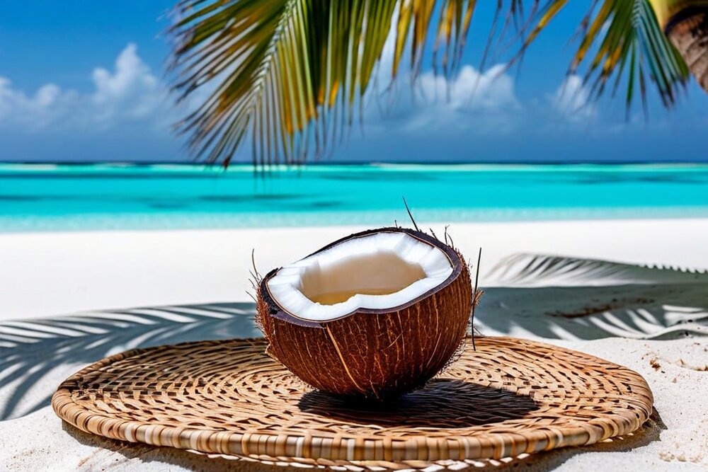
Fish, in enormous quantity and variety, mostly reef fish and tuna, eaten raw, grilled over coals, boiled in coconut cream or dried in the sun. Coconut in every form. Pandanus, preserved as te tuae — the pulp cooked, spread thin and sun-dried into hard sheets that keep for years, the classic voyaging and famine food. Breadfruit, roasted whole in the coals. And te babai, giant swamp taro, grown in pits for years and reserved for feasts, where the size of the corm is a matter of family pride.
Te ika
Raw fish is the everyday dish: fresh tuna or reef fish cubed and dressed with lime or coconut cream, sometimes with onion when there is onion. The Kiribati version of what the wider Pacific knows as ika mata or poisson cru. Fish is also salted and dried on lines and roofs across every village, which is what makes an outer island smell the way it does.
Te bua toro ni baukin
The dish that says the most about modern Kiribati: corned beef, imported in tins, cooked with onion and coconut cream and served with rice. Tinned meat, rice, flour and sugar now form a very large share of the diet, they are cheaper and easier than fish and babai, and the resulting rates of diabetes and obesity are among the highest in the world. It tastes good, everybody eats it, and it is a public health disaster.
Feasting
A botaki — a feast in the maneaba for a birth, a first birthday, a wedding, a funeral, a visitor — is the centre of social life. Food is laid out on pandanus mats, the largest babai and the best fish are displayed, speeches are made, and everyone dances. Guests are served first and enormously. Food is also formally distributed to every family present to take home, so nothing is wasted and everyone's contribution is publicly acknowledged.
What you will actually eat
On South Tarawa: rice with fish or corned beef, chicken and chips at the handful of restaurants and hotels, Chinese food at a couple of places in Bairiki, and whatever the shops have that week. Fresh vegetables are scarce and expensive. On an outer island: fish, rice, coconut, breadfruit, and whatever your hosts have. Bring your own supplement if you have dietary requirements, because there will be no alternative.
Vegetarians
Difficult but not impossible. Coconut, rice, breadfruit, babai, pandanus and imported noodles will keep you alive. Fish is regarded as the default rather than as meat, and declining it in a household that has caught something for you is genuinely awkward — say so early, warmly, and in advance rather than at the mat.
👨🍳 Two Recipes
Both of these are honest atoll cooking: a handful of ingredients, no oven, and coconut doing most of the work. Neither needs anything you cannot buy in Prague, though the substitutions are noted where they matter.
Te Ika — Raw Fish in Coconut Cream
Kiribati · serves 4 as a starter · 20 minutes plus 20 minutes curing · a sharp knife and a bowl
Ingredients: 500 g very fresh firm ocean fish — tuna, bonito, snapper or mackerel; sashimi-grade or frozen-then-thawed if you cannot verify the source · juice of 4–6 limes · 200 ml thick coconut cream (the first pressing, or the solid top of a chilled tin) · 1 small onion, sliced very thin · 1 tomato, deseeded and diced (optional, and not traditional in Kiribati, though common across the Pacific) · sea salt · 1 fresh chilli, chopped, if you like it.
Method: Cut the fish into 1.5 cm cubes, trimming out any bloodline and sinew. Toss with a good pinch of salt and the lime juice, cover and leave in the fridge 15–20 minutes — the surface should go opaque while the centre stays translucent. Drain off most of the lime juice; this is the step people miss, and leaving it in gives you a sour, chalky, over-cured fish. Add the onion, the tomato and chilli if using, then fold in the coconut cream and check the salt. Serve immediately, cold, with rice or breadfruit.
💡 Freshness is the entire dish; there is nothing to hide behind. If you cannot get fish you would eat raw, do not make this — the lime does not make unsafe fish safe. Freezing at −20 °C for at least 24 hours before thawing is the standard parasite precaution and is what any good fishmonger does anyway.
Te Bua Toro ni Baukin — Corned Beef in Coconut Cream
Kiribati · serves 4 · 25 minutes · one frying pan
Ingredients: 1 tin (about 340 g) corned beef · 2 onions, sliced · 2 cloves garlic, chopped · 1 tbsp oil · 200 ml coconut cream · 1 tomato, chopped (optional) · black pepper · rice, to serve. In Kiribati this is often made with fresh grated coconut squeezed with a little warm water rather than tinned cream, and it is noticeably better that way if you have a fresh coconut.
Method: Fry the onion in the oil over medium heat until soft and just golden, about 8 minutes — take the time, because the sweetness of the onion is what balances the salt of the beef. Add the garlic for a minute, then the tomato if using and cook it down. Break up the corned beef with a fork and add it, stirring until it is heated through and beginning to catch in places. Turn the heat down, pour in the coconut cream and simmer gently 5 minutes until it thickens slightly. Do not boil it hard or the cream will split. Plenty of black pepper; no salt, the tin has enough for everyone. Serve over rice.
💡 This is not presented as haute cuisine. It is one of the most-eaten dishes in the Pacific, it is delicious, it is very salty and very fatty, and its dominance over fish and babai is a large part of why Kiribati has one of the highest diabetes rates on Earth. Cook it, eat it, and understand what it represents.
🥥 Toddy, and What There Is to Drink
Te karewe
The sap of the coconut flower, and the closest thing Kiribati has to a national drink. Fresh, it is sweet, cloudy and mildly fizzy, drunk as a soft drink and given to children — it is a significant source of vitamins and sugar. Boiled down it makes kamaimai, a dark molasses used as a sweetener. Left to stand a day or two in the heat it ferments into something alcoholic, and then keeps going into vinegar.
The toddy-cutter
Climbing the same palm twice a day, every day, is a skilled and dangerous job, and the songs sung by toddy-cutters at dawn are a real and much-loved genre. It is also a job that is disappearing as young people leave for South Tarawa and imported drinks arrive, which is a smaller loss than sea-level rise and a loss all the same.
The drinking problem
Fermented toddy — kaokioki — is cheap, home-produced, unregulated and consumed heavily, particularly by young men on South Tarawa, and alcohol-related violence and accidents are a serious social problem that Kiribati discusses openly. Various local councils and outer islands have imposed their own restrictions or bans at different times. Visitors should be aware that a village may be dry by its own decision, and respect it.
Beer and imports
Imported beer — Australian, Fijian, sometimes Chinese — is available in shops and hotels on South Tarawa at prices that reflect having been shipped several thousand kilometres. Spirits likewise. There is no local brewery. On outer islands, assume there is nothing and that turning up with a case of beer is not a neutral act.
Water and coconut
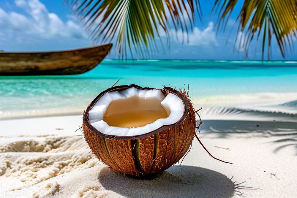
Do not drink the tap water, which on South Tarawa is intermittently supplied and frequently contaminated. Bottled water is available and expensive; rainwater from a household tank is what most people drink and is generally better than the piped supply. Green coconut water — te moimoto — is safe, free, everywhere, and the best thing you will drink in the country.
Tea and the everyday
Sweet black tea with powdered milk, drunk constantly. Instant coffee. Fizzy drinks in enormous quantity, which along with rice and sugar is the other half of the diabetes story. If you are invited into a house you will be given something sweet to drink within about ninety seconds of arriving, and refusing is not really available to you.
💡 Culture, the Maneaba and How to Behave
The maneaba rules
If you are taken into a maneaba — and you should hope to be — there are rules and they matter. Take your shoes off. Do not walk between someone and the person they are addressing. Keep your head lower than the elders', which in practice means stooping as you move and sitting cross-legged on the mat rather than standing. Wait to be shown where to sit; the boti positions are inherited and yours is wherever your host indicates. Do not point your feet at anyone.
Dance
I-Kiribati dance is unlike anything else in the Pacific and is the country's great art form. The te buki and te kaimatoa are performed with the body held rigid and still while the arms make sudden, sharp, bird-like movements and the head snaps — the frigatebird is the model. It is danced standing or seated, to chanted song and a box drum beaten by the singers. Traditionally the best dancers were believed to be assisted by magic, and dance was a serious competitive matter between villages. It still is.
Respect and rank
Age is authority. The unimwane — the old men — decide village matters, and in many outer islands their word is more consequential than the government's. Speak to the eldest person present first. Modesty in dress matters: cover your thighs and shoulders in villages, women should not wear shorts or bikinis outside a resort context, and men going shirtless in a village is not done. Swimwear is for the water only.
Bubuti
A word worth knowing. Bubuti is the customary right to ask a relative for something — money, goods, a favour — which is very hard to refuse. It is a powerful redistribution mechanism that ensures nobody starves and simultaneously makes it nearly impossible to accumulate capital or run a small business, which is one reason the private sector on Tarawa is thin. I-Kiribati discuss its costs and benefits with some ambivalence.
Gifts and reciprocity
Almost every social interaction runs on reciprocity. If you are hosted, fed or guided, you give something back — cash discreetly, or goods that are genuinely useful: rice, sugar, tea, fishing line and hooks, batteries, soap, school supplies. Do not hand out sweets and pens to children in the street. And if you are given something, take it, even if you did not want it, because refusing is the rejection of a relationship.
Photography and privacy
Ask before photographing people, always, and accept no. Do not photograph inside a maneaba during a meeting without explicit permission. And think about what you do with the pictures: South Tarawa is photographed constantly by visiting journalists as a symbol of climate catastrophe, which I-Kiribati find both useful and demeaning — there is real fatigue with being the world's illustration of drowning.
🗣️ Gilbertese
Te taetae ni Kiribati — Gilbertese — is an Austronesian language of the Micronesian branch, spoken by essentially the entire population plus communities in Fiji, Solomon Islands, Nauru, New Zealand and Hawaii. English is the second official language, used in government, secondary schooling and business, and spoken well in South Tarawa and patchily elsewhere.
The sound system
Unusually small: thirteen consonants and five vowels, with a vowel length distinction that changes meaning. There is no s, no l, no g, no h — which is why foreign names get rebuilt so thoroughly on arrival. The orthography, created by Hiram Bingham II in the 1850s, writes the s sound as ti and the ng sound as n plus g. Hence Kiribati, and hence Kiritimati, which is Christmas and is pronounced roughly "kiri-SI-mass".
The structure
Verb-object-subject word order, which is rare worldwide. A rich system of numeral classifiers — you count people, fish, coconuts, days and flat things with different counting words, and using the wrong one is like calling a herd of cows a flock. There is an inclusive/exclusive distinction in "we" that English speakers consistently get wrong and I-Kiribati consistently find funny.
Bingham's Bible
The written language exists essentially because an American missionary on Abaiang spent decades on it from 1857, producing a dictionary, a grammar and a translation of the Bible, and importing a printing press. That is a genuine achievement and it also means the written standard was shaped by a nineteenth-century Protestant American ear, which is why the spelling looks the way it does.
Twelve words
Mauri — hello, and also health and life; the universal greeting. Ko na mauri — hello to you. Ko rabwa — thank you. Eng / tiaki — yes / no. Tiabo — goodbye. Ko uara? — how are you? I marurung — I am well. Te ika — fish. Te ben — coconut. Te ran — water. E raoiroi — it is good. Kam bati n rabwa — thank you all very much, which is what you say at the end of a feast.
English in practice
You will get by on English throughout South Tarawa, with government officials, in hotels and with anyone who has been to secondary school. On the outer islands it thins out fast, especially with older people and women who have not worked away. Younger people generally have some. A few words of Gilbertese, and above all Mauri and Ko rabwa, will change every interaction you have, because visitors who bother are rare enough to be memorable.
The name to get right
Kiribati is "KIRR-i-bass". An I-Kiribati is a person from there — singular and plural, and it is not "a Kiribatian". The language and the people are I-Kiribati; the older colonial term is Gilbertese, which is still used for the language and increasingly not for the people.
✈️ Getting There and Getting Around
Kiribati is one of the hardest countries in the world to reach, and reaching it is a substantial part of the trip. There is no route that is quick, and any itinerary should assume at least one flight will not go.
Flights to Tarawa
Bonriki International (TRW) is served by Fiji Airways from Nadi and Suva, Nauru Airlines on its island-hopping route from Brisbane via Nauru and Tarawa to Majuro, and Solomon Airlines from Honiara. Frequencies are a few flights a week at best and schedules change. Fiji is the standard gateway and the most reliable connection point for a European traveller.
Flights to Kiritimati
Entirely separate. Cassidy International (CXI) on Kiritimati is reached from Honolulu and via Fiji. Getting from Kiritimati to Tarawa within the country is difficult and may mean flying out and back in. If you want both ends of Kiribati, plan them as two trips or accept a great deal of flying.
Domestic flights
Air Kiribati serves most inhabited Gilbert islands with small turboprops. Book on the ground in Tarawa, not from abroad. Baggage allowances are tight, weight matters on a small aircraft, and cancellations are routine. Do not book an outer-island trip with less than three days' slack before an international departure; people miss flights home this way regularly.
Ships
Government and private vessels serve the outer islands and are how most I-Kiribati travel: cheap, slow, crowded, uncomfortable and completely authentic. Schedules are approximate. There is also occasional shipping to Banaba and, very rarely, to the Line and Phoenix Islands. Any trip involving a ship should be treated as open-ended.
On South Tarawa
One road runs the length of the strip and shared minibuses run along it constantly for a flat fare of a dollar or so. Wave one down, pay when you get off. There are a few taxis. Walking is possible but hot, and the road has no footpath. There are no rental cars in any meaningful sense; a few places will hire a vehicle with a driver.
Boats and the lagoon
Local boats cross to North Tarawa from Tanaea and from Buota, and small boats can be hired for reef trips, fishing and diving through hotels and local operators. Safety equipment is often absent — ask about lifejackets and fuel reserve before you set off, and do not go far offshore in a small open boat without a functioning engine and a second one.
📅 When to Visit
The seasons, such as they are
Temperature is around 28–32 °C all year with almost no variation, and Kiribati sits outside the main cyclone belt. The drier, slightly less humid period in the Gilberts runs roughly April to October, and the wetter period from November to March. In practice ENSO matters far more than the calendar.
El Niño and La Niña
El Niño brings heavy rain and higher sea levels to the central and eastern Pacific — good for water tanks in the Line Islands, bad for coral, and associated with the extreme wave events that flood South Tarawa. La Niña brings drought to the Gilberts, sometimes for a year or more, which is a genuine hardship for outer islands relying on rainwater. Check where the cycle is before booking.
Independence Day
12 July, and the best possible time to be in Kiribati. The celebrations run for several days with inter-island dance competitions, canoe racing, sports and feasting in the maneaba, and the dancing in particular is at a level you will not see at any other time. Accommodation on Tarawa is scarce that week; book far ahead.
Fishing seasons on Kiritimati
The bonefishing is year-round and the lodges run continuously, but the flats fish best on the bigger tides and conditions vary with wind. Serious anglers book around moon phases; the lodges will tell you which weeks they prefer. Note that El Niño years bring warmer water and can change the fishing substantially.
What does not vary
Heat, humidity and sun. There is no shade to speak of on an atoll, the reflection off white sand and shallow water is brutal, and sunburn is the single most common thing that goes wrong for visitors. Long sleeves, a wide hat and reef-safe high-factor sunscreen are not optional.
How long to allow
Minimum a week for Tarawa alone, given the flight schedule. Two weeks to include an outer island properly. Kiritimati is a separate trip. Anyone planning to be in Kiribati for three days between other places has not understood the flight schedule and will spend the whole time in the airport at Bonriki.
📋 Practical Information
Entry
Citizens of all EU member states, including the Czech Republic, do not need a visa for a stay of up to one month, with a maximum of 90 days in any twelve-month period. Passport valid six months beyond arrival, plus onward or return ticket and evidence of accommodation. Rules for small states change with little notice and are not always well published — confirm with the Kiribati immigration authorities or a Kiribati mission before booking, and note that visiting the outer islands, Banaba and the Phoenix group may require separate permission arranged locally.
Health
No compulsory vaccinations for arrivals from Europe; yellow fever certificate required if arriving from an endemic area. Recommended: hepatitis A and B, typhoid, tetanus. Kiribati is not malarial, which is a genuine relief — but dengue outbreaks occur and mosquito avoidance matters. The real risks are waterborne illness from contaminated water on South Tarawa, sun and heat, coral cuts that infect readily in tropical water, and ciguatera in certain reef fish — take local advice on what not to eat.
Medical care, honestly
Very limited. Tungaru Central Hospital in Bikenibeu is the main facility for the whole country and is under-resourced; outer islands have small clinics and a nurse. Anything serious means evacuation to Fiji, Australia or New Zealand, which is expensive and takes time to arrange from a country with few flights. Insurance with air-ambulance cover is essential and not a formality, and you should check that your policy will actually cover a location this remote. Bring all your own prescription medication and a proper first-aid kit including antibiotics for skin infections if your doctor will prescribe them.
Money
The currency is the Australian dollar. Kiribati mints its own coins, which circulate alongside Australian ones and are a nice souvenir. There are ATMs on South Tarawa at the ANZ branch and a few other points, and they run out and go offline. Card acceptance is minimal outside a couple of hotels. Bring cash in Australian dollars, in small denominations, and enough for your whole trip plus a margin — on an outer island there is no cash machine and there is no card.
Connectivity
Improving fast and still limited. Mobile coverage on South Tarawa is reasonable; a local SIM from ATHKL is cheap and worth getting. The submarine cable landing has improved bandwidth substantially in recent years, but outer islands rely on satellite and may be effectively offline. Assume you will be out of contact for stretches, and tell people at home that in advance so nobody panics.
Safety
Kiribati is safe by most measures — violent crime against visitors is very rare. The realistic hazards are alcohol-related trouble at night on South Tarawa, particularly around Betio at weekends, road accidents on the single road, dog bites, sun, dehydration, unexploded ordnance on Betio, and the sea: currents in the lagoon passages are strong, there is no coastguard worth the name, and there are no lifeguards anywhere. Register with DROZD and check mzv.gov.cz before you go.
💵 What It Costs
Kiribati is not a cheap country to visit, which surprises people. There is no budget-traveller infrastructure, almost everything is imported, and the flights are the largest single line in any budget by a wide margin.
Getting there
The dominant cost. Return flights from Europe to Tarawa via Fiji or Brisbane run from roughly AUD 2,500–4,500 depending on routing and season, and a Kiritimati trip via Honolulu is comparable. There is no cheap way and no low season worth waiting for. In Czech terms this is typically 40,000–75,000 Kč in airfares alone before you have landed.
Sleeping
Limited stock, so prices hold up. A guesthouse room on South Tarawa AUD 60–110; the better hotels in Bairiki and Bikenibeu AUD 120–200. Eco-lodges on North Tarawa around AUD 80–150 including meals, and worth it. Outer-island guesthouses and homestays AUD 30–70 including food, arranged locally. Kiritimati fishing lodges are sold as all-inclusive packages and run to several thousand dollars a week.
Eating
A meal in a local place on South Tarawa AUD 8–15; a hotel restaurant meal AUD 20–35. Imported goods in shops carry a heavy freight premium — a tin of anything, a packet of biscuits, a bottle of water all cost noticeably more than in Australia. Fresh fish bought from a fisherman is very cheap and is what you should be eating.
Getting about
The South Tarawa minibus is about AUD 1 a ride, which makes it one of the great transport bargains anywhere. A domestic Air Kiribati return to an outer island AUD 150–350 depending on distance. A boat to North Tarawa a few dollars; a chartered boat for a day's fishing or diving AUD 150–400.
A realistic daily budget
On the ground, excluding international flights: AUD 80–130 a day staying in guesthouses and eating locally, AUD 180–300 in the better hotels with boat trips. At roughly 15–16 Kč to the Australian dollar — verify the rate — that is about 1,300–2,000 Kč a day at the lower end. The trip is expensive because of the flights, not because of the days.
Tipping and giving
Tipping is not a Kiribati custom and is not expected in the Western sense. What is expected is reciprocity: contribute food and useful goods when you stay with a family, pay a guide properly and agree it beforehand, and give to the village or church collection if you attend. Cash handed over publicly can be awkward; ask your host how to do it.
🇨🇿 Notes for Czech Travellers
Getting there from Prague
There is no short version. The realistic routings are Prague to Nadi, Fiji via a Gulf hub (Doha, Dubai) and either Singapore, Hong Kong or Sydney, then Fiji Airways to Tarawa; or Prague to Brisbane and Nauru Airlines onward via Nauru. Total elapsed time is typically 35–50 hours each way including a required overnight or two, because the Tarawa connections do not run daily. For Kiritimati, route via Honolulu. Build in a spare day at the Fiji or Brisbane end in both directions.
Visa-free, and what that does not cover
Czech citizens need no visa for up to one month as EU nationals, within a 90-day-per-year limit. That covers entry to the country; it does not cover travel to Banaba, which requires permission from the Banaban authorities and the Kiribati government and is rarely granted, or landing in the Phoenix Islands, which requires a permit. Arrange those months in advance if at all.
Money in Czech terms
The Australian dollar, at roughly 15–16 Kč — check before you go. A guesthouse night is around 900–1,700 Kč, a local meal 120–240 Kč, a minibus ride about 15 Kč, and a domestic flight to an outer island 2,300–5,500 Kč. Change to Australian dollars before you leave Europe or in Fiji — changing Czech crowns in Tarawa is not a thing that can be done.
MZV ČR, DROZD and consular reality
This is where it matters. There is no Czech embassy in Kiribati; the Czech Republic covers it from its embassy in Canberra, several thousand kilometres and a difficult flight away. In an emergency, EU consular cooperation means the nearest reachable help may be an Australian or New Zealand high commission in Tarawa. Register in DROZD before you travel — for a country this remote it is genuinely useful — and read the current mzv.gov.cz advisory. The EHIC does not apply.
Insurance, specifically
Read the policy rather than the summary. You need cover for medical evacuation by air from a remote Pacific island, which is not the same thing as ordinary travel medical cover, and some Czech policies exclude or cap it in ways that would not pay for a real evacuation from Tarawa. If you plan to dive or fish offshore, check those are covered too. This is the single most important piece of preparation for this destination.
Why a Czech traveller would go
Honestly: because almost nobody does. Kiribati receives a few thousand visitors a year, most of them anglers on Kiritimati, aid workers and officials. There is no Czech package, no Czech-speaking guide, and no infrastructure built for you. In exchange you get a country where you will be the only visitor in the room, a culture that has not been packaged, and a first-hand view of the defining environmental question of the century. It is a trip for people who like the difficulty, not despite it.
🏛️ Heritage and What Is Protected
Phoenix Islands Protected Area (2010)
Kiribati's only World Heritage site, and one of the largest ever inscribed: 408,250 km² of ocean around eight atolls and low islands, listed as a natural site for an intact oceanic coral archipelago ecosystem with its full range of species, seamounts and deep-sea habitats. Its status has been complicated by the government's 2021 decision to reopen the area to commercial fishing, and the relationship between the inscription and the country's revenue needs remains unresolved.
The tentative list
Kiribati has proposed further sites, including Butaritari and Makin for their cultural landscape and war heritage, and elements of the Second World War Pacific battlefields. Nothing further has been inscribed. For a country with this much history in it, the heritage register is very thin — which reflects the cost and administrative burden of the process rather than the absence of things worth protecting.
The war heritage nobody lists
Betio is one of the most significant intact Second World War battlefields anywhere, and it is entirely unprotected because tens of thousands of people live on it. The coastal guns, bunkers, wrecks and the remains of the dead are all simply present in a working town. There is no site management, no interpretation to speak of, and no funding, and the tension between preserving it and housing people is not resolvable on 1.5 km².
Intangible heritage
The living things that matter more than the monuments: traditional navigation, the maneaba system and its protocol, te buki and the other dance forms, the songs of the toddy-cutters, canoe building — the Kiribati outrigger, te wa, with its asymmetric hull, is a superb sailing craft — and mat and pandanus weaving. All of it is under pressure from urbanisation and outward migration rather than from any single threat, and the Kiribati cultural centre and the outer-island councils are the ones holding it together.
The museum problem
Much of the finest surviving I-Kiribati material culture — the shark-tooth swords, the coconut-fibre armour and helmets made from porcupine fish skin, the navigational instruments — is in museums in Britain, Germany, Australia and the United States, collected during the colonial period. There is a small museum at Te Umanibong in Bikenibeu. The mismatch is stark and is the subject of ongoing, quiet conversations about return.
What the country is trying to protect now
Not buildings. Kiribati's heritage policy is inseparable from its climate policy: the graveyards being flooded on South Tarawa, the villages that have moved, the pandanus and babai pits lost to saltwater. When the government talks about protecting Kiribati culture, it is talking about whether the culture can survive the place it belongs to becoming uninhabitable — and, as a fallback, whether it can survive being carried elsewhere.
🔬 Curiosities
First light, by decree
Kiribati holds the earliest time zone on Earth, UTC+14, because it moved the international date line east around its own territory on 1 January 1995. When it is midnight Sunday in the Line Islands, it is 2 a.m. Saturday in Honolulu — the same moment, a day and two hours apart. Kiribati is the only country where you can be in two different days at once by flying within it.
All four hemispheres
Kiribati straddles the equator and the 180th meridian, which makes it the only country whose territory lies in the northern, southern, eastern and western hemispheres simultaneously. It is also, by the span of its EEZ, one of the largest countries in the world — and by land area, one of the smallest.
The country with a spare country
In 2014 Kiribati bought about 2,200 hectares of land on Vanua Levu in Fiji, some 2,000 km away, for around AUD 9 million. The official purpose is food security and agriculture; the unofficial one, discussed openly by President Anote Tong at the time, is that a country may need somewhere to go. No other state has done anything quite like it.
The largest atoll and the smallest budget
Kiritimati holds nearly half of Kiribati's entire land area in one island, has around 7,000 people on it, and its villages are called London, Banana and Poland. There was a Paris too; it has been abandoned. The names were given by a Catholic priest and by the plantation managers, and they have outlived both.
An island bought back from the sky
The Guano Islands Act of 1856 let American citizens claim any uninhabited guano island for the United States, and fourteen islands in what is now Kiribati were claimed under it. They were formally handed over in the 1979 Treaty of Tarawa. A nineteenth-century law about bird droppings determined the borders of a twenty-first-century country and, incidentally, the size of its tuna fishery.
The stamps and the domain
Like several micro-states, Kiribati earns real money from collectible postage stamps and from its .ki internet domain. It is a small line in the budget and a completely legitimate one: when your exports are copra and fishing days, selling philatelic issues to collectors in Germany is diversification.
🌿 The Other Environmental Problems
Sea level takes all the attention, and it deserves a lot of it. But several of the things making South Tarawa hard to live on right now would be problems even if the ocean stopped rising tomorrow.
Waste
There is nowhere to put anything. An atoll has no hills, no quarries, no landfill sites and no space, and a modern consumer economy delivers packaging by the shipload. South Tarawa's waste sites are on the lagoon shore and leach into the water. There is no recycling capacity, no incineration that would be acceptable, and shipping waste out costs more than the country can find. Plastic on the beaches of South Tarawa is a permanent feature and it is not washing in from elsewhere — it is local.
Sanitation
Tens of thousands of people living directly above the freshwater lens they drink from, with limited sewerage and widespread use of the beach and the lagoon. The result is contaminated groundwater, high rates of diarrhoeal disease in children, and periodic outbreaks. Large donor projects have built treatment and piped systems for parts of the strip; the coverage does not match the population and the population keeps growing.
Overcrowding
The population of South Tarawa has multiplied many times over since independence, driven by migration from the outer islands toward schools, hospital, jobs and cash. Land is customarily owned and cannot simply be built on, so households crowd onto existing plots. Everything else — water, waste, disease, alcohol, unemployment — is downstream of this, and no government has found a way to make the outer islands attractive enough to reverse it.
Reef damage
Coral mining for building material, sand extraction, sedimentation, sewage nutrients and the causeways that changed the lagoon's water circulation have all degraded the reef around South Tarawa — and a degraded reef makes less sand, which is what the island is made of and what it needs to keep up with sea level. It is a feedback loop: damaging the reef reduces the island's ability to survive the sea.
Food and health
The shift from fish, coconut and babai to rice, flour, sugar, cooking oil and tinned meat has produced obesity and diabetes rates among the highest in the world, with amputations and kidney failure at levels a health system this size cannot cope with. It is a slower emergency than sea level and it is killing more people now.
What is being done
Mangrove replanting, seawalls of variable quality, water and sanitation programmes, rat eradication on outer islands, the fixed-maritime-boundaries campaign, and the long-discussed proposal to raise and reclaim land on Tarawa with dredged material to build a higher, defensible platform. That last one is expensive, technically hard and dependent on outside funding, and it is the only proposal on the table that changes the underlying arithmetic.
⛪ Religion and Social Life
Kiribati is overwhelmingly Christian and unusually church-centred even by Pacific standards. Roughly 55% Catholic and 33% Kiribati Uniting Church (the successor to the Protestant mission), with Mormons, Seventh-day Adventists, Baháʼís and others making up the rest.
The north-south line
The division is geographical and goes back to who got there first. American Protestant missionaries under Hiram Bingham II worked from Abaiang and the northern Gilberts from 1857; French Catholic missionaries of the Sacred Heart arrived later and took the south. The line is still visible on a map of denominations today, and village churches — often the largest and best-built structure in a village — are the physical centre of community life.
What church means here
Far more than Sunday. Churches run schools, organise youth and women's groups, mediate disputes, fund-raise for families, and are a major channel of social organisation alongside the maneaba. Singing is extraordinary — unaccompanied, powerful, close-harmony, and one of the best reasons to attend a service whatever your own position on the metaphysics. Visitors are welcome; dress properly and put something in the collection.
Christianity and the old beliefs
Pre-Christian I-Kiribati belief centred on ancestral spirits, on Nareau the creator in a rich creation cycle, and on places of spiritual power. Much of it was suppressed and much of it persists as a substrate — beliefs about spirits in particular places, about the dead, and about the efficacy of certain traditional practices sit comfortably alongside church attendance for a great many people. Traditional healing and magic are discussed matter-of-factly.
Family and obligation
The extended family, the utu, is the operative social unit rather than the household, and obligations to it — through bubuti, through funerals, through the endless round of contributions — structure most people's finances. Adoption between relatives is common and casual by European standards. The old are cared for at home; there is no other option and no expectation of one.
Gender
Formally, women have equal rights; in practice Kiribati has one of the lower rates of women in parliament in the world and strongly gendered division of labour. It also has, according to successive national studies, some of the highest rates of domestic violence recorded anywhere — a fact the government and civil society have publicly acknowledged and are working on. Visitors should know it exists rather than be surprised by it.
How this affects a visitor
You will be asked what church you belong to, in the same tone as being asked where you are from, and "none" is a perfectly acceptable answer but will be met with polite curiosity. You will be invited to a service. Sunday is genuinely quiet — shops shut, nothing happens, and on some outer islands even swimming and fishing are frowned on. Plan around it rather than against it.
⚖️ Tourism, and Whether You Should Come
Kiribati receives a few thousand visitors a year, a large share of them anglers on Kiritimati, plus consultants, aid workers, officials and researchers. Genuine leisure tourists to Tarawa number in the hundreds. That is the honest baseline for any discussion of this as a destination.
Why it is not a tourist country
Distance and cost, first. Then: almost no accommodation stock, unreliable flights, limited food, water you cannot drink, no beach-resort infrastructure on Tarawa, and a capital that does not look like the brochure. Kiribati has repeatedly tried to develop tourism and the constraints are structural — you cannot build a resort economy on an island with no water and no landfill.
What is genuinely worth coming for
The bonefishing on Kiritimati, which is world class and has real infrastructure. The Battle of Tarawa sites, which are among the most significant and least managed war heritage anywhere. North Tarawa and the outer islands, for a Pacific culture almost untouched by tourism. The diving and fishing. And the fact of the place itself — being in the first time zone, on the equator, in a country most people cannot find.
The disaster-tourism question
A real one. Kiribati has been photographed and filmed relentlessly as the world's illustration of drowning, usually by people who spend three days in Betio, shoot a king tide and leave. I-Kiribati are ambivalent: the attention is useful and the framing is demeaning, and there is fatigue with being a symbol rather than a country. If you go, engage with the place as somewhere people live rather than as a cautionary tale you are visiting before it goes.
Travelling well
Stay in locally owned guesthouses and lodges, of which there are several on North Tarawa and the outer islands. Hire local guides for the war sites, and pay them properly. Bring things that are useful and leave them with people rather than with an institution. Take your waste out with you where you can — batteries and packaging especially, because there is nowhere for them to go. And buy the woven pandanus work, which is superb and is one of very few things a village can sell.
What not to do
Do not remove anything from Betio. Do not stand on coral or buy shells and coral products. Do not photograph people without asking. Do not turn up at an outer island unannounced expecting to be fed — arrange it through contacts on Tarawa, which is easy and is how it is done. And do not treat South Tarawa's difficulties as a spectacle.
Should you go
If you want a beach holiday, no — Fiji, Samoa and the Cooks do that far better and cost less. If you want to see the Pacific outside the resort economy, understand the sharpest edge of the climate question first-hand, fish some of the best flats in the world, or stand on the ground where 1,000 Marines died in three days, then yes, and few places will repay the effort more. Go with time, patience and a very good insurance policy.
🔭 What Happens Next
It is worth ending on the question the whole country is organised around, without pretending to know the answer. Three futures are live, they are not mutually exclusive, and I-Kiribati argue about them as vigorously as anyone.
Adapt and stay
The official position and the one with the most political support: raise and reclaim land on Tarawa, build proper coastal defence, fix water and sanitation, plant mangroves, and make the islands defensible for as long as possible. It is technically feasible for a limited area and it costs far more than Kiribati has, which makes it a question about international climate finance rather than engineering. President Maamau's government has pursued this line, with China as one prospective funder.
Migrate with dignity
President Anote Tong's policy, and the one Kiribati is internationally best known for: accept that some or most of the population may eventually have to leave, and prepare by educating and training people so they arrive as skilled migrants with agency rather than as refugees in camps. It has produced seasonal-work agreements and nursing-training programmes with New Zealand and Australia. It is also politically painful, because a policy that plans for leaving can be read as giving up.
Keep the state without the land
The legal track: entrench the principle that maritime boundaries, once declared, do not move even if coastlines do, and that a state does not cease to exist because its territory becomes uninhabitable. Pacific states have made real progress on this at the UN and in regional declarations. If it holds, Kiribati could in principle continue as a state — with an ocean, a government, an income from fishing licences and a population living somewhere else. There is no precedent.
Who decides
The uncomfortable part: almost none of this is in Kiribati's hands. Emissions are decided elsewhere, climate finance is decided elsewhere, migration quotas are decided elsewhere, and the tuna will move according to physics. A country of 136,000 people has spent thirty years being unusually effective at international advocacy precisely because that is the only lever it has. Both Anote Tong and the current government have been notably good at using it.
What I-Kiribati say
Not one thing. There is real anger at being written off in advance by foreign journalists, real determination to stay, real quiet preparation to leave, strong religious conviction that God will not flood the earth again, and a deep attachment to specific pieces of land held by specific families for many generations. The idea that a nation facing this would have a single view of it is a foreign assumption, and it is wrong.
Why this page treats it carefully
Because the two easy stories — "Kiribati is sinking next year" and "actually the atolls are growing, so it is fine" — are both wrong, both widely circulated, and both let the reader off. The accurate version is harder: the islands may persist as land while ceasing to be habitable, on a timescale of decades, and what happens to the people is a political choice that other countries will make.
📸 The Pictures on This Page — and What Was Rejected
A note in the interest of honesty, and the most severe one this atlas has had to write. The image folder for Kiribati holds three files and the shared recipe folder holds eight. Of those eleven, eight are unusable, and all eight of the rejects are food photographs of dishes that either do not exist in Kiribati or are something else entirely.
Rejected: the "palusami"
kiribati-palusami.jpg shows a bowl of orange-red fried rice with spring onion and coriander. Palusami is taro leaves baked in coconut cream, wrapped in a leaf parcel — dark green, soft, and not rice in any form. It is not even the same colour, texture, ingredient or course.
Rejected: the "te ika mai"
kiribati-te-ika-mai.jpg shows glazed amber cubes in a dark soy-coloured sauce under spring onion and chilli — a cooked braise. The dish it claims to be is raw fish in coconut cream and lime: white, cold, uncooked, and the single most characteristic thing anyone eats in Kiribati. The photograph is a cooked Asian dish with a Gilbertese caption.
Rejected: the "te tuae"
kiribati-te-tuae.jpg shows a bowl of moist, glossy, chopped orange vegetable garnished with coriander. Te tuae is pandanus pulp cooked, spread thin and sun-dried into hard sheets that keep for years — the voyaging and famine food that made long-distance settlement of these atolls survivable. It is dry, brittle and brown. A wet garnished bowl is the opposite of what the food is for.
Rejected: three invented dishes
kiribati-kiribati-flatbread.jpg is a naan or chapati; there is no Kiribati flatbread. kiribati-kiribati-sweet-treat.jpg is an unidentifiable glossy orange lattice-scored dome under a made-up name. kiribati-te-bua-tarawa.jpg is a Western creamy pork dish with broccoli, under a dish name that does not correspond to anything. All three are captions in search of a cuisine.
Rejected: the "traditional Kiribati stew"
kiribati-traditional-kiribati-stew.jpg is the clearest failure in the set: a beef stew with sweetcorn, garden peas, broccoli, carrot, star anise, garlic and paprika. Kiribati has no cattle industry, no soil to grow peas, corn, broccoli or carrots in, and no tradition involving star anise. Every single visible ingredient is wrong for an atoll. The kiribati-pandanus-bread.jpg file is a Western tin loaf, which is closer to plausible modern baking but is not a traditional preparation either.
What is used, and what is missing
Three images, and two of them are near-identical shots of a split coconut. 01-hero.jpg — a lagoon shoreline at sunrise, generic but accurate, at the top of this page; the reality of South Tarawa looks nothing like it, which the Tarawa section covers. kiribati-drink.jpg and toddy-atoll.jpg — the same coconut-on-a-beach idea twice, used once each, the second with a correction about how toddy is actually collected. There is no photograph in this archive of South Tarawa, Betio or its guns, a maneaba, a dance, a canoe under sail, Kiritimati, Banaba, a babai pit, or a single I-Kiribati person. For the country this page has the most to say about, the archive says almost nothing, and it is better to admit that than to illustrate it with a beef stew.
Support This Project 🌍
This World Travel Factbook is a labor of love – free to use for all travelers. If you find it helpful, consider supporting its continued development.